
- elevation 1,173 ft (358 m) | - elevation 981 ft (299 m) | |
 | ||
- right North Fork Murrieta Creek, Warm Springs Creek, Santa Gertrudis Creek, Waddel Wash, Empire Creek, Arroyo Santiago - location at the confluence of the West Fork Murrieta Creek and North Fork Murrieta Creek., Riverside County | ||
Murrieta creek rv service introduction
Murrieta Creek, runs 13 miles (21 km) southeasterly through southwestern Riverside County, California, United States, through the communities of Wildomar, Murrieta, and Temecula, ending 0.5 miles (0.80 km) southeast of Temecula, where it has its confluence with Temecula Creek and forms the head of the Santa Margarita River.
Contents
- Murrieta creek rv service introduction
- Map of Murrieta Creek Temecula CA USA
- HistoryEdit
- Watershed and courseEdit
- References
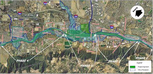
Map of Murrieta Creek, Temecula, CA, USA
HistoryEdit
The creek and town of Murrieta are not named for the bandit, Joaquin Murrieta, but for the pioneer sheep ranchers, Izaquel and Juan Murrietta, who purchased the Rancho Pauba and Rancho Temecula Mexican land grants. His brother returned to Spain, but Juan brought 100,000 sheep to the valley in 1873, using the meadows to feed his herd.
Watershed and courseEdit
Murrieta Creek drains over 220 square miles (570 km2). The creek has several minor tributaries, including flows from Lake Skinner whose outlet is Tucalota Creek below the reservoir, which then flows to Santa Gertrudis Creek, then Murrieta Creek.