
- elevation 0 ft (0 m) Source Big Rock Ridge | - elevation 1,670 ft (509 m) Length 12 km | |
 | ||
Similar San Rafael Creek, Leimert Bridge, Novato Creek, The Brothers, San Pablo Creek | ||
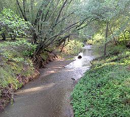
Miller Creek is a 7.6-mile-long (12.2 km) stream in eastern Marin County, California, United States. It originates on Big Rock Ridge and empties into San Pablo Bay east of Marinwood.
Contents
- Map of Miller Creek California USA
- HistoryEdit
- Watershed and CourseEdit
- EcologyEdit
- Habitat and pollutionEdit
- BridgesEdit
- References
Map of Miller Creek, California, USA
HistoryEdit
The name honors James Miller, an Irishman who settled on part of Rancho San Pedro, Santa Margarita y Las Gallinas in 1845.
Watershed and CourseEdit
The Miller Creek watershed drains 11.6 square miles (30 km2). Miller Creek originates on Big Rock Ridge southwest of the city of Novato. It descends southward to Lucas Valley Road, where it turns eastward into Gallinas Valley, paralleling the road to Miller Creek Road. There it crosses Lucas Valley Road and jogs northward through Marinwood Park before turning east again along the southern edge of Marinwood. It crosses under U.S. Route 101 at milepost 15.35 and flows through channels in McInnes County Park to empty into the west end of San Pablo Bay.
EcologyEdit
In recent years, steelhead trout (Oncorhyncus mykiss) of multiple ages have been identified in Miller Creek. It has been identified by EPA, Marin County Public Works and California Department of Fish and Game for restoration potential for trout because it has high quality connected riparian habitat, minimal barriers to fish passage and no reservoirs.
Habitat and pollutionEdit
The California Coastal Commission considers Miller Creek a Critical Coastal Area because it is an impaired water body (listed under Section 303(d) of the U.S. Clean Water Act) which adjoins the San Pablo Bay National Wildlife Refuge. Livestock have grazed on the watershed since the 1800s, causing widening and downcutting of the creek. It continues to carry a heavy load of sediment from grazing activity, and its lower reaches are also impacted by suburban development.
BridgesEdit
Miller Creek is spanned by numerous bridges, including: