
Barangays Area 120.6 km² | Founded March 17, 1946 Time zone PST (UTC+8) Local time Tuesday 10:00 AM | |
 | ||
Weather 27°C, Wind SW at 2 km/h, 64% Humidity Neighborhoods Australia, Salinungan, Sinamar Norte, Caggong | ||
San mateo isabela best cbms video entry
San Mateo (pronounced locally as /sænˈmäCHō/ not /sæn mə-tay-oh/ Spanish: St. Matthew) is a 1st municipal income class municipality in the province of Isabela, Philippines. According to the 2015 census, it has a population of 64,505 people.
Contents
- San mateo isabela best cbms video entry
- Map of San Mateo Isabela Philippines
- Flying quadcopter in san mateo isabela
- History
- Geography
- Barangays
- Topography
- Land Classification and Uses
- Climate
- Language
- Date of festivals
- Hospitals
- Colleges and Universities
- High School
- References
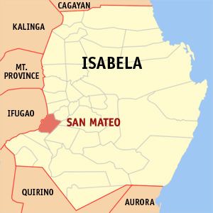
Map of San Mateo, Isabela, Philippines
San Mateo is one of the cleanest town in the region. The administrators encourage the people of the municipality to use paper bags instead of plastic bags in line with its claim as an "Agro-Ecological Town".
According to the 2016 Cities and Municipalities Competitiveness Index conducted by the National Competitiveness Council, San Mateo took the 86th spot overall and ranked 99 among the first class and second class municipalities in the Philippines.
Flying quadcopter in san mateo isabela
History
First named as "Marasat", it was a former barangay of Cauayan, then Santiago. It was called the Municipality of Yoshisawa under the government of the Japanese Imperial Army during the Second World War. After the liberation, it was finally created and named San Mateo by virtue of Presidential Executive Order No. 97 on March 17, 1946 by former President Sergio Osmeña. It was proclaimed as the Agro-Ecological Destination in Cagayan Valley by President Gloria Macapagal Arroyo by virtue of Presidential Proclamation No. 1685 dated December 1, 2008.
Geography
San Mateo is situated in the Southwestern part of Isabela. It is bounded on the north by Aurora, on the northeast by Cabatuan, on the east by Cauayan City, on the east-southeast by Alicia, on the south by Ramon and on the west Alfonso Lista in the Province of Ifugao.
San Mateo is 10 kilometres (6.2 mi) from Cabatuan, 8 kilometres (5.0 mi) from Ramon along the national highway, and 17 kilometres (11 mi) from Alicia along the provincial road. It is 25 kilometres (16 mi) away from the Santiago City and 24 kilometres (15 mi) away from the Cauayan City. It is 54 kilometres (34 mi) south of Ilagan, capital city of Isabela on the national highway and approximately 6½ hours trip to Manila with a distance of 350 kilometres (220 mi). It has a total area of approximately 12,059.83 hectares.
Barangays
San Mateo is politically subdivided into 33 barangays.
Topography
The terrain of the municipality is basically plain with 98% of the total land area under 0-2 percent slope category and only 2% of the total area is under the 2.3-5 percent slope category. The excellent topography of the municipality has made irrigation by gravity method applicable in flooding of rice paddies.
Land Classification and Uses
The soil type of San Mateo is 49.89% Sta. Rita Clay Loam which is suited for lowland crops like rice, tobacco and mungo. Other soil types are Bago Series (26.04%), San Manuel Series (9.87%), Peñaranda (2.31%), Agustin Series (7.95%) and River Wash Gravel (3.95%).
The existing land uses of the municipality are as follows:
The long and mighty Magat River, the biggest tributary of the Cagayan River lies in the vast plains devoted to agriculture in the area.
The Tao-Tao River and the four (4) creeks found in the municipality named Porvida, Gaddanan, Macañao and Balaobao are likewise tapped to supply water to elevated portions of agricultural lands through the use of water pumps.
Climate
The climate of San Mateo falls under third type. This type of climate is characterized by no pronounced maximum rain period with a short dry season lasting from one to three months. Rainfall starts in July and continues through December with either October or November as the peak of the rainy season.
As per data gathered from the ISU PAG-ASA PCARRD AGROMET Station, Echague, Isabela, the average monthly rainfall for 2011 was 238.20mm with the highest recorded at 558.20mm in September and at least in March with 32.6mm. The highest recorded temperature was its peak in May at 34.40C during the summer season and the lowest at 26.10C in January. However the average temperature for the same period was 30.70C.
Language
The population is a combination of different ethnic group dominated by Ilocano speaking people which make Ilocano the common language used in the municipality.