
Elevation 1,878 m | Topo map USGS Mount Wilson Easiest route Hike, class 1 Prominence 476 m Translation Spanish Language | |
 | ||
Similar Mount Disappointment, Mount Lowe, Strawberry Peak, Echo Mountain, Vetter Mountain | ||
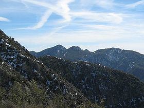
San Gabriel Peak is a summit in the San Gabriel Mountains in the U.S. state of California. It was named by the United States Geological Survey in 1894 and is located in the Angeles National Forest. This peak was first named The Commodore for Commodore Perry Switzer.
Contents
- Map of San Gabriel Peak California USA
- San gabriel peak mt disappointment mt lowe hiking los angeles hd
- BackgroundEdit
- References
Map of San Gabriel Peak, California, USA
San gabriel peak mt disappointment mt lowe hiking los angeles hd
BackgroundEdit
The name is derived from the Misión del Santo Arcangel San Gabriel de los Temblores. From this mission had already come the names of the San Gabriel River and San Gabriel Canyon, the mountain range itself and the entire San Gabriel Valley.
The steep south face drops approximately 1,000 feet into the center of an amphitheater at the top of Eaton Canyon, forming one of the most sustained steep slopes in the Western San Gabriel mountain range.
References
San Gabriel Peak Wikipedia(Text) CC BY-SA