
State California Incorporated August 31, 1911 Elevation 326 m Local time Saturday 8:14 AM | County Los Angeles Time zone PST (UTC-8) Area 6.149 km² Population 24,220 (2013) | |
 | ||
Country United States of America ZIP Code 91340, 91341, 91342, 91344-91346 Weather 14°C, Wind NE at 0 km/h, 45% Humidity University Academy of Esthetics and Cosmetology Points of interest Lopez Adobe, Pacoima Wash Natural Park, Cesar E. Chavez Memorial | ||
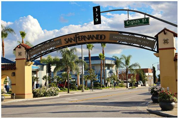
San Fernando is a city located in the San Fernando Valley, in the northwestern region of Los Angeles County, California. It is completely surrounded by the City of Los Angeles.
Contents
- Map of San Fernando CA USA
- History
- Geography
- 2010
- 2000
- Municipal government
- State and federal representation
- Infrastructure
- Police
- Fire
- Transportation
- Top Employers
- Education
- Public libraries
- Notable people
- References
Map of San Fernando, CA, USA
History
The city was named for the nearby Mission San Fernando Rey de España, and was part of the Mexican land grant of Rancho Ex-Mission San Fernando. In 1874 Charles Maclay, San Fernando founder, bought 56,000 acres (227 km2) of the Rancho. In 1882, cousins George K. Porter and Benjamin F. Porter of future Porter Ranch each received one-third of the total land. In 1885, Maclay founded the Maclay School of Theology, a Methodist seminary in his newly founded town of San Fernando. After his death it became an affiliate and moved to the campus of the University of Southern California and then the Claremont School of Theology.
While most of the towns in the surrounding San Fernando Valley agreed to annexation by Los Angeles in the 1910s, eager to tap the bountiful water supply provided by the newly opened Los Angeles Aqueduct, San Fernando's abundant groundwater supplies allowed it to remain a separate city. Even as the San Fernando Valley transformed itself from an agricultural area to a suburban one in the decades after World War II, San Fernando retained its independence.
As with much of the San Fernando Valley east of the San Diego Freeway, the city of San Fernando has seen a significant demographic shift in recent years; declining birth-rates, an aging population of middle-class caucasians, who once dominated the area in the 1950s, has contributed to the movement into other parts of the San Fernando Valley. There has also been movement into the Santa Clarita and Antelope Valleys to the north. Income levels have declined as a result. Latinos became the majority population. Since late 2004, the city has been going through a series of planning development projects, that can be defined as gentrification.
Geography
San Fernando is completely surrounded by the city of Los Angeles, with the districts of Sylmar to the north, Lake View Terrace to the east, Pacoima to the south, and Mission Hills to the west. It is served by the Golden State (Interstate 5), Foothill (Interstate 210), Ronald Reagan (State Route 118), and San Diego (Interstate 405) freeways.
2010
The 2010 United States Census reported that San Fernando had a population of 23,645. The population density was 9,959.9 people per square mile (3,845.5/km²). The racial makeup of San Fernando was 12,068 (51.0%) White (5.3% Non-Hispanic White), 222 (0.9%) African American, 314 (1.3%) Native American, 248 (1.0%) Asian, 33 (0.1%) Pacific Islander, 9,877 (41.8%) from other races, and 883 (3.7%) from two or more races. Hispanic or Latino of any race were 21,867 persons (92.5%).
The Census reported that 23,531 people (99.5% of the population) lived in households, 46 (0.2%) lived in non-institutionalized group quarters, and 68 (0.3%) were institutionalized.
There were 5,967 households, out of which 3,247 (54.4%) had children under the age of 18 living in them, 3,282 (55.0%) were opposite-sex married couples living together, 1,098 (18.4%) had a female householder with no husband present, 592 (9.9%) had a male householder with no wife present. There were 476 (8.0%) unmarried opposite-sex partnerships, and 34 (0.6%) same-sex married couples or partnerships. 731 households (12.3%) were made up of individuals and 295 (4.9%) had someone living alone who was 65 years of age or older. The average household size was 3.94. There were 4,972 families (83.3% of all households); the average family size was 4.18.
The population was spread out with 6,941 people (29.4%) under the age of 18, 2,659 people (11.2%) aged 18 to 24, 7,132 people (30.2%) aged 25 to 44, 4,920 people (20.8%) aged 45 to 64, and 1,993 people (8.4%) who were 65 years of age or older. The median age was 30.7 years. For every 100 females there were 100.7 males. For every 100 females age 18 and over, there were 98.2 males.
There were 6,291 housing units at an average density of 2,649.9 per square mile (1,023.1/km²), of which 3,252 (54.5%) were owner-occupied, and 2,715 (45.5%) were occupied by renters. The homeowner vacancy rate was 1.1%; the rental vacancy rate was 3.9%. 13,425 people (56.8% of the population) lived in owner-occupied housing units and 10,106 people (42.7%) lived in rental housing units.
According to the 2010 United States Census, San Fernando had a median household income of $55,192, with 16.9% of the population living below the federal poverty line.
2000
As of the census of 2000, there were 23,564 people, 5,774 households, and 4,832 families residing in the city. The population density was 9,880.7 inhabitants per square mile (3,822.7/km²). There were 5,932 housing units at an average density of 2,487.4 per square mile (962.3/km²). The racial makeup of the city was 42.76% White, 0.98% African American, 1.69% Native American, 1.12% Asian, 0.11% Pacific Islander, 49.35% from other races, and 3.98% from two or more races. Hispanic or Latino of any race were 89.28% of the population.
There were 5,774 households out of which 52.8% had children under the age of 18 living with them, 59.1% were married couples living together, 16.4% had a female householder with no husband present, and 16.3% were non-families. 12.4% of all households were made up of individuals and 5.6% had someone living alone who was 65 years of age or older. The average household size was 4.07 and the average family size was 4.33.
In the city, the population was spread out with 34.4% under the age of 18, 11.4% from 18 to 24, 32.1% from 25 to 44, 15.0% from 45 to 64, and 7.0% who were 65 years of age or older. The median age was 27 years. For every 100 females there were 101.7 males. For every 100 females age 18 and over, there were 99.9 males.
The median income for a household in the city was $39,909, and the median income for a family was $40,138. Males had a median income of $26,068 versus $22,599 for females. The per capita income for the city was $11,485. 15.3% of families and 19.1% of the population were below the poverty line, including 22.5% of those under age 18 and 15.6% of those age 65 or over.
Municipal government
The City of San Fernando is governed by a city council. Members of the City Council are elected and serve four year terms. The mayor is appointed every year, on a rotating basis, by a majority vote of the Council. The Council meets on the first and third Monday of each month at 6:00 pm in the Council Chambers.
State and federal representation
In the California State Legislature, San Fernando is in the 18th Senate District, represented by Democrat Robert Hertzberg, and in the 39th Assembly District, represented by Democrat Raul Bocanegra.
In the United States House of Representatives, San Fernando is in California's 29th congressional district, represented by Democrat Tony Cárdenas.
Infrastructure
The Los Angeles County Department of Health Services operates the Pacoima Health Center in Pacoima in Los Angeles, serving the City of San Fernando.
The United States Postal Service operates the San Fernando Post Office.
Police
Police services in San Fernando is provided by the San Fernando Police Department. The police department has 35 sworn police officers and 25 non-sworn personnel. The department is also augmented by 20 sworn reserve police officers. In times of need, the police department can deploy a total of 55 sworn police officers.
The San Fernando Police Department is a member of the Los Angeles County Disaster Management Area "C". Area "C" consists of the cities of Burbank, Pasadena, Glendale, San Fernando, San Gabriel, Monterey Park, Alhambra and South Pasadena. The San Fernando Police have, in the past, requested mutual aid from the LAPD during major incidents.
Fire
The Los Angeles Fire Department provides fire protection services for the city of San Fernando, which serves the community from three nearby fire stations (Station 75, Station 91, and Station 98), all of which are located in the City of Los Angeles.
Fire Station 75 in Mission Hills serves western San Fernando. Fire Station 91 in Sylmar serves northeast San Fernando Fire Station 98 in Pacoima serves southeast San Fernando.
Transportation
The Sylmar/San Fernando Metrolink station serves the city on the Antelope Valley Line that passes through the city on a route adjacent to and parallel with San Fernando Boulevard. The officials and citizens have expressed their concern about the impact of the California High-Speed Rail if it is follows the same route through the city.
Top Employers
According to the City's 2009 annual financial report, the top employers in the city are:
Education
San Fernando is served by the Los Angeles Unified School District.
San Fernando is served by the following LAUSD schools:
PUC Schools operates some charter schools in San Fernando. They include Nueva Esperanza Charter Academy (MS and HS) and PUC Inspire Charter Academy. At one time Lakeview Charter Academy and Triumph Charter Academy, both of PUC Schools, were located in San Fernando now they are located in Sylmar.
A private school, The Concordia Schools San Fernando, was in the city. First Lutheran Schools was previously located where Concordia San Fernando was later now located. In 2011 the middle and high school consolidated into Concordia Junior Senior High School.
Public libraries
County of Los Angeles Public Library operates the San Fernando Library at 217 North Maclay Avenue. Mckinney Public Library