
Length 290 km | - elevation 4,986 ft (1,520 m) - elevation 0 ft (0 m) Basin area 14,892 km² | |
 | ||
- average 4,700 cu ft/s (133 m/s) Sources Endicott Mountains, Philip Smith Mountains (Alaska) | ||
Packrafting in the brooks range atigun and sagavanirktok rivers
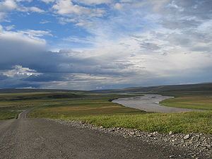
The Sagavanirktok River or Sag River is a stream in the North Slope Borough of the U.S. state of Alaska. It is about 180 miles (290 km) long and originates on the north slope of the Brooks Range, flowing north to the Beaufort Sea near Prudhoe Bay. The Trans-Alaska Pipeline System and Dalton Highway roughly parallel it from Atigun Pass to Deadhorse. Also, a glaciation happened approximately at the same time as the Illinoian Stage of central North America at the Sagavanirktok River.
Contents
- Packrafting in the brooks range atigun and sagavanirktok rivers
- Map of Sag River Alaska USA
- Sagavanirktok river may 13th 2016
- References
Map of Sag River, Alaska, USA
Sagavanirktok river may 13th 2016
References
Sagavanirktok River Wikipedia(Text) CC BY-SA