
Incorporated July 2, 1972 Congressional district At-large Website www.north-slope.org Population 9,686 (2013) University Iḷisaġvik College | Seat Barrow Area 245,521 km² Largest city Barrow | |
 | ||
Rivers Barrenland Creek, Agiak Creek, Irish Creek Points of interest Inupiat Heritage Center, Atigun Pass, Funakoshi Memorial - Barrow - A, Mount Isto, Mount Chamberlin | ||
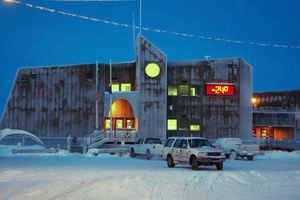
North Slope Borough is a borough located largely in the North Slope region of the U.S. state of Alaska. It was established in 1972. As of the 2010 census, the population was 9,430. The borough seat is Barrow. The mayor is Harry K. Brower Jr., elected in a special election in July 2016 after recall of the previous mayor by an April 2016 election.
Contents
- Map of North Slope AK USA
- History
- Government
- Politics
- Geography
- Adjacent boroughs and census areas
- National protected areas
- Other federal areas
- Demographics
- References
Map of North Slope, AK, USA
History
The borough was established in 1972 by an election of the indigenous people in the region following Congressional passage of the Alaska Native Claims Settlement Act. It was the first time that Native Americans had established a municipal government. The Borough had first-class status and exercised the powers of planning, zoning, taxation and schools. In 1974 it adopted a Home Rule Charter, enabling it to exercise any legitimate governmental power.
Government
It has a seven-member assembly body, elected to staggered three-year terms. The Borough's executive and administrative powers are vested in a Mayor, limited to two consecutive three-year terms.
Politics
The current mayor, Harry K. Brower Jr, was elected in July 2016 in a run-off election to serve the rest of former mayor Charlotte Brower's second term. She was recalled in April 2016, after it was reported the year before that her office had made numerous donations to individuals (including family members), sports clubs and other groups that amounted to more than $800,000 since 2011.
Harry Brower is her brother-in-law; he defeated George Ahmaogak in the runoff. Brower will have to run again in October 2017 if he wants to be re-elected to serve a full 3-year term as mayor.
Geography
According to the U.S. Census Bureau, the borough has a total area of 94,796 square miles (245,520 km2), of which 88,695 square miles (229,720 km2) is land and 6,101 square miles (15,800 km2) (6.4%) is water. The borough is larger than 39 states.
Its western coastline is along the Chukchi Sea, while its eastern shores (beyond Point Barrow) are on the Beaufort Sea.
The North Slope Borough is the largest county-level political subdivision in the United States by area, with a larger land area than that of the state of Utah (UT is the 13th-largest state in the nation). Although the adjacent Yukon-Koyukuk Census Area is larger in area, it has no borough-level government. The borough is the fourth-least densely populated county-level entity in the United States. The Yukon-Koyukuk Census Area is the least densely populated county-level entity).
Adjacent boroughs and census areas
It shares its eastern border with Yukon, Canada, which has no subdivisions.
National protected areas
Other federal areas
Demographics
As of the census of 2010, there were 7,385 people, 2,109 households, and 1,524 families residing in the borough. The population density was 12.03 square miles (31.2 km2) per person. There were 2,538 housing units at an average density of 35 square miles (91 km2) per unit. The racial makeup of the borough was 17.09% White, 0.72% Black or African American, 68.38% Native American, mostly Inuit, 5.92% Asian, 0.84% Pacific Islander, 0.50% from other races, and 6.55% from two or more races. 2.37% of the population was Hispanic or Latino of any race. 42.84% reported speaking Iñupiaq or "Eskimo" at home, while 4.21% reported speaking Tagalog.
There were 2,109 households out of which 48.10% had children under the age of 18 living with them, 43.3% were married couples living together, 18.3% had a female householder with no husband present, and 27.70% were non-families. 21.4% of all households were made up of individuals and 1.9% had someone living alone who was 65 years of age or older. The average household size was 3.45 and the average family size was 4.05.
In the borough the population was spread out with 38.2% under the age of 18, 9.50% from 18 to 24, 30.1% from 25 to 44, 18.10% from 45 to 64, and 4.2% who were 65 years of age or older. The median age was 27 years. For every 100 females there were 112.50 males. For every 100 females age 18 and over, there were 113.90 males.