
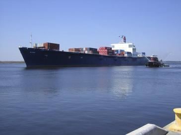
Ordered 1973 Construction started 11 April 1974 Beam 29 m | Operator Sea Star Line Length 241 m Launched 1 November 1974 | |
 | ||
Route | ||
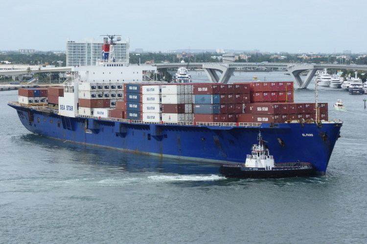
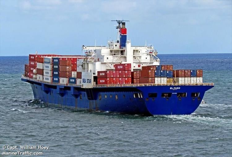
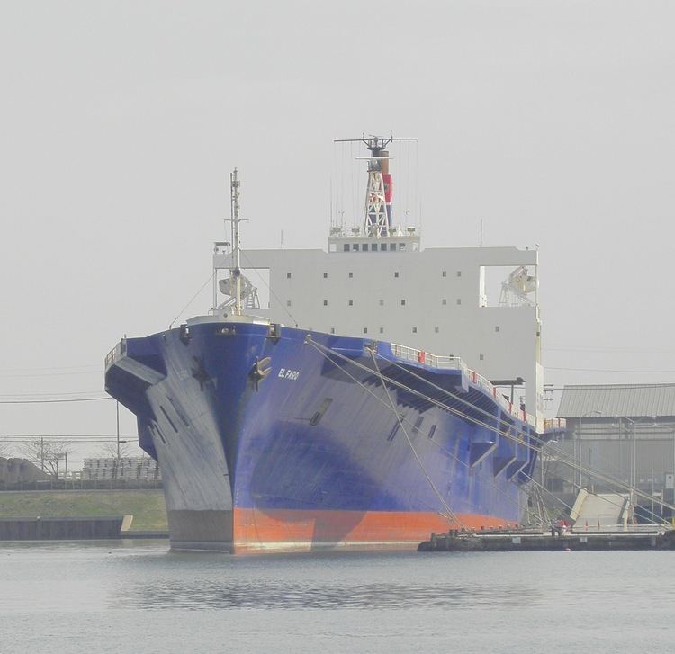
El Faro was a United States-flagged, combination roll-on/roll-off and lift-on/lift-off cargo ship crewed by U.S. Merchant Mariners. Built in 1975 by Sun Shipbuilding & Drydock Co. as Puerto Rico, the vessel was renamed Northern Lights in 1991, and finally, El Faro in 2006. It was lost at sea with all hands on October 1, 2015, after losing propulsion near the eyewall of Hurricane Joaquin.
Contents
- Construction and earlier career
- Final voyage
- Hurricane Joaquin
- Voyage Data Recorder Audio
- Search operations
- Aftermath
- Search for the wreckage
- Second search effort for VDR
- References
El Faro departed Jacksonville, Florida, bound for Puerto Rico on the early morning of September 30, 2015, when then-Tropical Storm Joaquin was several hundred miles to the east. The following morning, after Joaquin had become a Category 3 hurricane, the vessel likely encountered swells of 20 to 40 ft (6 to 12 m) and winds over 80 kn (150 km/h; 92 mph) as it sailed near the storm's eye. Around 7:30 a.m. on October 1, the ship had taken on water and was listing 15 degrees. The last report from the captain, however, indicated that the crew had contained the flooding. Shortly thereafter, El Faro ceased all communications with shore.
On October 2, the forty-year-old ship was declared missing, and an extensive search operation was launched by the United States Coast Guard, with help from the Air Force, Air National Guard, and Navy. They recovered debris, a damaged lifeboat, and an unidentifiable body. El Faro was declared sunk on October 5. The search was called off at sunset on October 7, by which time more than 183,000 sq nmi (630,000 km2; 242,000 sq mi) had been covered by aircraft and ships. The Navy sent the USNS Apache to conduct an underwater search for El Faro on October 19, 2015. The Apache identified a vessel on October 31 "consistent with [the El Faro] cargo ship...in an upright position and in one piece." The next day, November 1, 2015, the Navy announced a submersible had returned images that identified the wreck as the El Faro.
Construction and earlier career
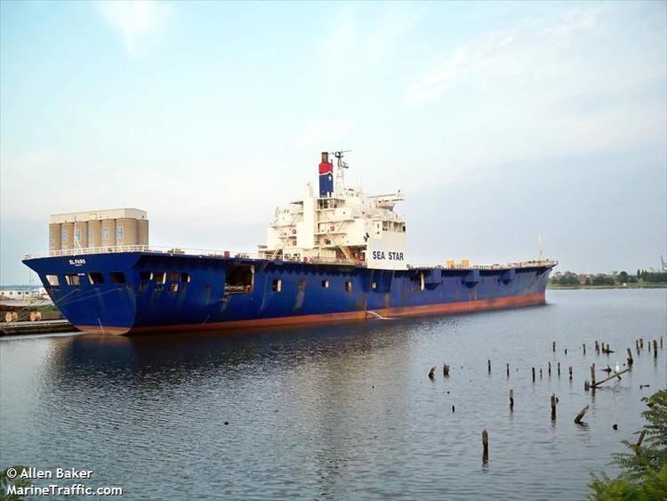
El Faro was built by the Sun Shipbuilding and Drydock Corporation in Chester, Pennsylvania, in 1975 as Puerto Rico. As operated by the Navieras de Puerto Rico Steamship Company, the Puerto Rico hauled cargo to and from the U.S. East Coast for 15 years. In 1991, it was purchased by Saltchuk Resources, the parent company of TOTE Maritime, and renamed Northern Lights. Two years later, it was lengthened by 90 feet (27 m) at Alabama Shipyard, Inc. Under Saltchuk, it frequently sailed between Tacoma, Washington, and Anchorage, Alaska.
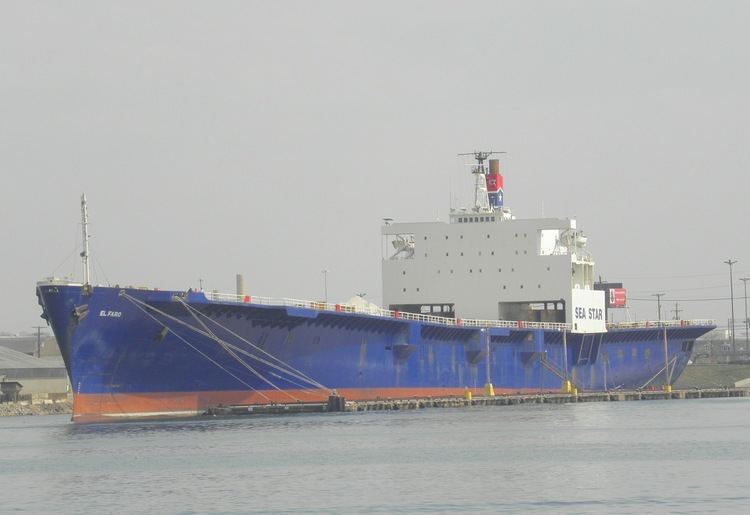
In February 2003, just before the United States-led invasion of Iraq, the vessel was chartered by the United States' Military Sealift Command as part of Operation Enduring Freedom; the vessel ferried Marines and supplies from San Diego, California, to Kuwait. On March 19, while in the Persian Gulf, the vessel came under fire from missiles. The explosions rocked the ship, but caused no damage or injuries. Through October 2005, near the end of Northern Lights' chartered service, the vessel made 25 voyages and 49 port calls. Collectively, 12,200 pieces of military equipment—weighing 81,000 short tons (73,000 t) in all—were transported by the ship. Robert Magee, then president of TOTE Maritime, and the crew of Northern Lights were praised by United States Air Force general Norton A. Schwartz: "You and your team of professionals showcased the US flag industry at its best." Following completion of its military services in 2006, the ship was transferred by TOTE Maritime to its subsidiary company Sea Star Lines and renamed El Faro. The vessel returned to its original route and served as a "lifeline" between the United States and Puerto Rico.
When it sank on October 1, 2015, the El Faro was scheduled to return to Tacoma to relieve another vessel.
Final voyage
On September 30, 2015, at 2:00 a.m., El Faro left Jacksonville, Florida for San Juan, Puerto Rico, carrying a cargo of 391 shipping containers, about 294 trailers and cars, and a crew of 33 people—28 Americans and 5 Poles. The ship's master, Captain Michael Davidson, charted a course that, according to TOTE Maritime, took the vessel a reasonably safe distance away from the hurricane. At the time of departure, Hurricane Joaquin was still a tropical storm, but meteorologists at the National Hurricane Center forecast that it would likely become a hurricane by the morning of October 1, on a southwest trajectory toward the Bahamas. The vessel's charted course took it within 175 nmi (320 km; 200 mi) of the storm, where seas in excess of 10 ft (3 m) were likely. TOTE Marine could have vetoed the captain's sail plan into the area of a predicted hurricane, but chose not to and opted for the ship to continue. The company said there was no incentive for Davidson to maintain the ship's schedule, but that the schedule also appeared to be a safe one. At least one of the deck officers voiced concern prior to sailing, and wrote in an email to friends and family, "there is a hurricane out here and we are heading straight into it."
The vessel had "passed its annual Coast Guard inspection in March and another survey in June", and had also successfully completed the American Bureau of Shipping (ABS) class and statutory surveys in February 2015. The NTSB confirmed on October 20, 2015, that El Faro had successfully completed the American Bureau of Shipping (ABS) class and statutory surveys on February 13, 2015. They also found that safety drills were conducted on a weekly basis and that the ship met stability criteria when it left Jacksonville.
Former crew members of El Faro expressed surprise and shock that the vessel set sail with a major storm in its course. They said the vessel was "a rust bucket" that "[was not] supposed to be on the water." They also said that El Faro suffered from drainage issues and that leaking was common in the cook's room. They said that the ship was covered in rust and its decks filled with holes as recently as August.
Hurricane Joaquin
Throughout September 30 into the morning of October 1, Joaquin continued to track southwest. 10 hours after departing, El Faro was steaming at full speed and deviating from its charted course. According to Klaus Luhta of the International Organization of Masters, Mates & Pilots, Davidson continued to head directly into the storm. Joaquin became a hurricane by 8:00 a.m. on September 30, then rapidly intensified. By 11:00 pm, the storm had reached Category 3 intensity with maximum sustained winds of 100 kn (185 km/h; 115 mph). Around 7:30 a.m. on October 1, less than 30 hours after the ship had sailed from Jacksonville, the United States Coast Guard received a satellite notification that the vessel had lost propulsion, taken on water—though flooding was contained at the time of the message—and had a 15-degree list.
According to TOTE Maritime, the loss of propulsion is what ultimately sealed the fate of El Faro, leaving the vessel helpless within the approaching hurricane. Near the same time, the Coast Guard also received a single ping from the ship's Emergency Position Indicating Radio Beacon. Subsequent attempts by the Coast Guard to open communications with El Faro were unsuccessful.
Marine Traffic's last reported position of El Faro was 24.2747°N 74.94522°W / 24.2747; -74.94522 (El Faro's position at 4:01 a.m. on October 1) at 4:01 a.m., heading south-southeast at 19 kn (35 km/h; 22 mph). According to a different marine positioning database, relayed by Reuters, the final relayed position of El Faro was 23.52°N 74.02°W / 23.52; -74.02 (El Faro's position at 7:56 a.m. on October 1) at 7:56 a.m., about 35 nmi (65 km; 40 mi) northeast of Crooked Island. This placed the vessel within the eyewall of Hurricane Joaquin, situated near 23.2°N 73.7°W / 23.2; -73.7 (Location of Hurricane Joaquin at 8:00 a.m. on October 1) at 8:00 a.m., where winds in excess of 80 kn (150 km/h; 92 mph) and waves of 20 to 30 ft (6 to 9 m) likely battered the ship.
Voyage Data Recorder Audio
On 13 December 2016, the NTSB released a 500-page audio transcript from the Vessel's Voyage Data Recorder (VDR) which recorded audio of the ship's final 26 hours from six microphones placed on the bridge.
The VDR transcript of the final hours described a quickly deteriorating situation.
At 5:43 am, the captain takes a phone call indicating suspected flooding in the no. 3 cargo hold and sends the chief mate to investigate. The crew then begin taking measures to try to assess and control the flooding.
At 6:13 am, the ship loses its steam propulsion plant.
At 6:54 am, the captain takes a phone call describing the situation onboard:
At 7:06 am, the captain makes a phone call, stating:
At 7:10 am, the captain tells someone on the phone that they have a ten to fifteen degree list, "but a lot of that's with the wind heel." He lets the person know he will be making a distress call to the USCG, and then directs the second mate to activate the SSAS button/GMDSS alarm, and directs him to wake everybody up.
At 7:15 am, the chief mate returns to the bridge:
At 7:17 am, the chief engineer informs the chief mate and the captain over the sound powered phone that the bilge alarm is going off in "two alpha." The captain asks the chief if he can pump out all of the cargo holds at the same time, and discusses the worsening list. The chief mate informs the captain that the cars are floating in #3 cargo hold, and that the fire main is below the surface of the water, so he couldn't see the damage or if water was still coming in.
At 7:19 am, after further discussion with the chief mate, the captain calls the chief engineer again, asking, "Can you... isolate the fire main from down in the uh engine room?... On the engine room side the isolation valve [on the] suction [for the] fire pump... secure it, isolate it on your side so there's no free communication from the sea."
At 7:24 am, the captain, speaking with a crew member on the phone, says "We still got reserve buoyancy and stability."
At 7:27 am, the captain instructs the second mate to ring the general alarm and wake up the crew.
At 7:29 am, the captain gives the order to abandon ship, and about a minute later can be heard on the bridge calling out "bow is down, bow is down."
At 7:31 am, the captain yells over the UHF radio for the chief mate to "Get into your rafts! Throw all your rafts into the water! Everybody get off! Get off the ship! Stay together!"
From 7:32 am on, the captain is heard trying to help a panicked helmsman/AB off the bridge with alarms ringing throughout. The captain repeatedly tells the AB not to panic: "work your way up here," "you're okay, come on," and "I'm not leavin' you, let's go!" The AB exclaims, "I need a ladder! A line!" and "I need someone to help me!"
At 7:39 am, the VDR recording ends with the captain and AB still on the bridge.
Search operations
On October 1, Hurricane Hunters aircraft tried to locate El Faro without success. On October 2, a Coast Guard HC-130 Hercules aircraft began a dedicated search for the ship. The USCGC Northland and a MH-60 Jayhawk helicopter joined search efforts later that day. Aircraft on October 3 flew in violent hurricane conditions, characterized by winds in excess of 100 kn (185 km/h; 115 mph) at an altitude of 1,000 ft (300 m), waves up to 40 ft (12 m), and visibility less than 1 nmi (1.9 km; 1.2 mi). Despite the hazardous conditions, a helicopter crew recovered a life ring from the vessel on this day. Conditions markedly improved on October 4 as Joaquin moved northeast away from the Bahamas; winds averaged 15 kn (28 km/h; 17 mph) and visibility was unlimited. Taking advantage of the clear weather, the helicopter remained in flight for 11 hours, requiring refueling twice. A second HC-130, the USCGC Charles Sexton, and the USCGC Resolute were deployed that day. Northland and Resolute continued operations overnight with engineers using night vision goggles to take part in the search. The United States Navy provided P-8 fixed wing aircraft to assist on October 5; three Crowley Maritime tugboats also joined. Search operations were conducted at a near-continuous pace by this date.
On October 5, an unidentified body in a survival suit, presumed to be from El Faro, was found but was not recovered. According to the rescue diver, the body was unrecognizable and was left to be retrieved later in the day. However, a failure in the positioning device SLDMB ultimately resulted in losing the body. Several other unopened suits were recovered. A deflated life raft and a heavily damaged lifeboat—one of two aboard El Faro, each capable of carrying 43 people and stocked with food and water for a few days—with no one aboard were also found. The vessel was declared lost at sea on this day, believed to have sunk in 15,000 ft (4,600 m) of water, and the search turned into a search-and-recovery effort. The United States Air Force and Air National Guard provided three additional C-130 aircraft on October 6. A total of 183,000 sq nmi (630,000 km2; 242,000 sq mi) of water was covered in search of the vessel. Two debris fields were discovered: one covering 260 sq nmi (890 km2) situated near El Faro's final position, and the other spanning 61 sq nmi (210 km2) located 60 nmi (110 km) northeast of the first debris field. At sunset on October 7, the Coast Guard announced the cessation of search operations.
Aftermath
On October 7, a Navy salvage team was requested, at the behest of the National Transportation Safety Board (NTSB), to search for the wreckage. Florida Senator Bill Nelson wrote a letter to the NTSB urging them to look into TOTE Maritime's policies regarding severe weather. Nelson also cited that the vessel's lifeboats were "outdated and inadequate for the conditions the crew faced." TOTE Maritime established a fund for families of the crew on October 9 through the Seamen's Church Institute of New York and New Jersey. On October 14, a $100 million lawsuit was filed against TOTE Maritime by a family member of one of the missing crew, citing negligence on the company's behalf in letting a non-seaworthy vessel sail into a hurricane. On October 28, another lawsuit was filed on behalf of the estate of a man who was killed in the sinking. The complaint stated that “without power, the M/V EL FARO was merely a cork in the sea as the Hurricane neared.” By April 19, 2016, TOTE Maritime had settled with 18 of the 33 families for more than $7 million.
The MV Isla Bella was chosen to replace El Faro's former operations.
Search for the wreckage
On October 19, the USNS Apache departed from Joint Expeditionary Base Little Creek–Fort Story in Virginia Beach, Virginia to conduct the underwater search for El Faro. The vessel was equipped with a towed pinger locator, side-scan sonar, and a remotely operated vehicle. The search crew identified a vessel on October 31 at an approximate depth of 15,000 ft (4,600 m). The hydrostatic pressure at this depth (15,000 ft) is approximately 6688 psi. The NTSB reported that the object was, "consistent with a [790 ft (240 m)] cargo ship...in an upright position and in one piece." On November 16, the National Transportation Safety Board announced it has completed its search of the sunken ship, but did not find the voyage data recorder. On January 3, 2016, the NTSB opened the public accident docket on the investigation into sinking of El Faro, initially releasing underwater images and video of the vessel.
Second search effort for VDR
On April 18, 2016, a second search for the ship's voyage data recorder was launched by the NTSB utilizing the RV Atlantis, a Navy-owned vessel operated by mariners of Woods Hole Oceanographic Institution. On April 26, the NTSB stated the voyage data recorder was found about 41 mi (66 km) northeast of Acklins and Crooked Islands, Bahamas. The NTSB was unable to retrieve the recorder at that time because of its proximity to the mast and other obstructions. On August 9, 2016, the voyage data recorder was finally recovered from the wreckage, ten months after the sinking.