
Population 44,180 (1992) Area 331.8 km² | Established 1853 Founded 1853 | |
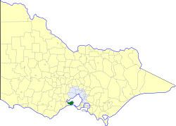 | ||
The Rural City of Bellarine was a local government area southeast of the regional city of Geelong, Victoria, Australia, covering most of the Bellarine Peninsula. The Rural City covered an area of 331.78 square kilometres (128.1 sq mi), and existed from 1853 until 1993.
Contents
History
Bellarine was first incorporated as the Portarlington Road District on 12 December 1853, and became a shire on 26 September 1865. On 12 December 1989, Bellarine was proclaimed a Rural City.
On 18 May 1993, the Rural City of Bellarine was abolished, and, along with the Cities of Geelong, Geelong West and Newtown, the Shire of Corio and parts of the City of South Barwon and the Shires of Barrabool and Bannockburn, was merged into the newly created City of Greater Geelong.
Wards
The Rural City of Bellarine was divided into three ridings, each of which elected three councillors:
Towns and localities
Population
* Estimate in 1958 Victorian Year Book.