
Population 10,111 (2011 census) Postal code 3224 | Postcode(s) 3224 | |
 | ||
Location 86 km (53 mi) SW of Melbourne11 km (7 mi) E of Geelong14 km (9 mi) NW of Ocean Grove11 km (7 mi) W of Drysdale Federal divisions Division of Corangamite, Division of Corio | ||
Leopold is a residential eastern suburb of Geelong and is a gateway to the Bellarine Peninsula.
Contents
Map of Leopold VIC 3224, Australia
History
The area was formerly known as Kensington. The post office opened as Kensington on 19 May 1858, and was renamed Kensington Hill in 1882, Leopold Hill in 1884 and Leopold in 1885.
Heritage listed sites
Leopold contains a number of heritage listed sites, including:
Today
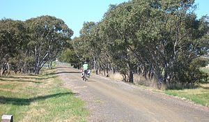
The Bellarine Rail Trail passes through Leopold. The Gateway Plaza is situated on the corner of the Bellarine Peninsula and Melaluka road.
Leopold is constructing four new residential developments called the Kensington Estate, the Estuary Estate, the Debionair Heights Estate and the Gateway Estate. Many of the available land has been sold. Houses are either in construction and others near finished.
The town has an Australian rules football team competing in the Geelong Football League known as the Lions.
The Leopold Sportsmans Club provides bowls green, squash, function rooms and other facilities.
Education
As of 2012, Leopold consists of three sources of education.