
 | ||
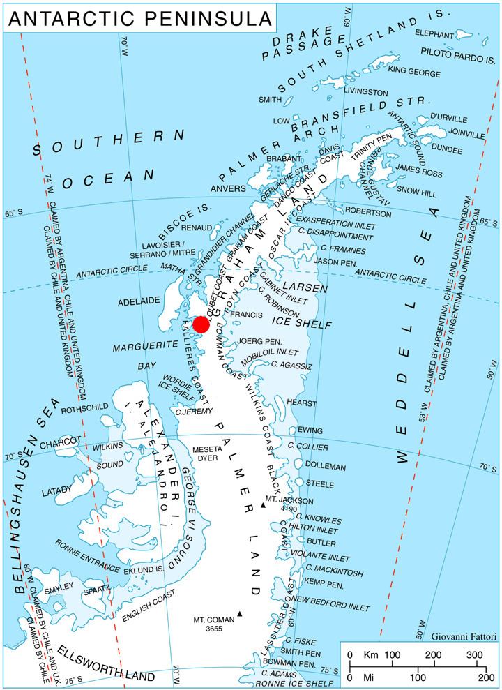
Rudozem Heights (Bulgarian: Рудоземски възвишения, ‘Rudozemski Vazvisheniya’ u-do-'zem-ski v&z-vi-'she-ni-ya) are the heights rising to 1500 m (Glavinitsa Peak) at the base and in the interior of German Peninsula on Fallières Coast in Graham Land, Antarctica, extending 18.5 km in northeast-southwest direction and 13.7 km in east-west direction. The heights are bounded by Bourgeois Fjord to the north and west, Dogs Leg Fjord to the south, and to the east by a glacier draining both northwards into Bourgeois Fjord and southwards into Dogs Leg Fjord.
Contents
Map of Rudozem Heights, Antarctica
The heights are named after the town of Rudozem in Southern Bulgaria.
Location
Rudozem Heights are centred at 67°39′00″S 66°42′00″W. British mapping in 1978.
Maps
References
Rudozem Heights Wikipedia(Text) CC BY-SA