
Source Pennines Country United Kingdom | Source elevation 520 m | |
 | ||
River mouth River Mersey40 m (130 ft) Tributaries Left:Todd BrookRight:Sett, Etherow Cities | ||
The River Goyt is a river in North West England. It is one of the tributaries of the River Mersey.
Contents
Map of River Goyt, United Kingdom
Course
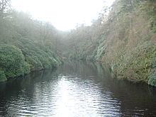
The Goyt rises on the moors of Axe Edge, near the River Dane and the Cat and Fiddle Inn. The area is known as the Upper Goyt Valley. The old Cat and Fiddle Road from Buxton to Macclesfield crosses the river just as it turns northwards to flow down its well-known valley. The river then flows under Derbyshire Bridge, which was the old boundary between Derbyshire and Cheshire. Later it reaches an old packhorse bridge that was moved when Errwood reservoir was built in the 1960s (see photo below). Further downstream there is another reservoir, the Fernilee reservoir. The original line of the Cromford and High Peak Railway can be seen near this point.
The Goyt then passes through Taxal and Horwich End where it is joined by the Todd Brook. Thereafter it passes through Whaley Bridge, New Mills (where it is joined by the River Sett) and Marple Bridge. Having been joined by the River Etherow, the Goyt joins the River Tame at Stockport, forming the River Mersey.
The River Goyt is reputedly haunted by the ghost of a girl whose Royalist lover drowned in the river.