
Isolation 0.74 mi (1.19 km) Elevation 4,241 m | Easiest route hike Prominence 137 m | |
 | ||
Mountain range Sangre de Cristo Mountains Parent range Sangre de Cristo Mountains Similar Culebra Peak, Tijeras Peak, Columbia Point, Ellingwood Point, Broken Hand Peak | ||
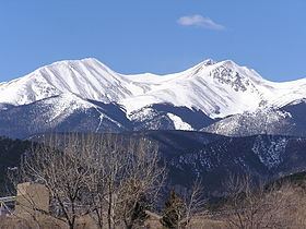
Red Mountain, elevation 13,914 ft (4,241 m), is a summit in the Culebra Range of south central Colorado. The peak is on private land 15 mi (24 km) southeast of San Luis.
Contents
Map of Red Mountain, Colorado 81152, USA
Historical namesEdit
References
Red Mountain (Costilla County, Colorado) Wikipedia(Text) CC BY-SA