
Easiest route Hiking | Elevation 490 m | |
 | ||
Topo map Geographical Survey Institute 25000:1 礼文岳50000:1 礼文島北部 Similar Mount Rishiri, Mount Piyashiri, Mt Daisengen, Mount Teshio, Mount Upepesanke | ||
Mount Rebun (礼文岳, Rebun-dake) is the highest point on Rebun Island in Rebun, Hokkaidō, Japan. The mountain consists of marine sedimentary rocks from the Early Cretaceous period, 149–97 million years ago.
Contents
- Map of Mount Rebun Funadomarimura Rebun Rebun District Hokkaido Prefecture 097 1111 Japan
- Climbing route
- References
Map of Mount Rebun, Funadomarimura, Rebun, Rebun District, Hokkaido Prefecture 097-1111, Japan
Climbing route
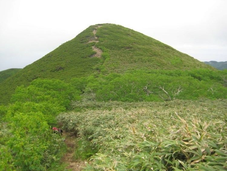
The trailhead for the Mount Rebun hike is in Nairo. It is a 3-hour hike with no water available. The trail first passes through fields of sasa-no-ha before entering a forest of pine and birch. The peak rises above the forest to grant an unobstructed view of the entire island.
References
Mount Rebun Wikipedia(Text) CC BY-SA