
Country Pakistan Region | Area 5,286 km² Population 5,939,550 | |
 | ||
Colleges and Universities Pir Mehr Ali Shah Arid Agriculture University, National University of Sciences and Technology, Fatima Jinnah Women University, Rawalpindi Medical College, Army Medical College | ||
Map of Rawalpindi
Rawalpindi (Punjabi, Urdu: راولپنڈى, Rāwalpiṇḍī), commonly known as Pindi (Punjabi: پنڈی), is a city in Punjab, Pakistan. It is the fourth-largest city in Pakistan by population, while the larger Islamabad Rawalpindi metropolitan area is the country's third-largest area. The economy of Rawalpindi is interlinked with Islamabad, and the two are jointly known as the "twin cities". The city is the administrative seat of the Rawalpindi District.
Contents
- Map of Rawalpindi
- Raja bazar rawalpindi
- Corps commander rawalpindi visits exercise area near mangla
- Etymology
- Ancient
- Medieval
- Mughal era
- Afghan and Sikh rule
- British
- Modern
- Climate
- Demographics
- Administration
- Parks
- Education
- Media
- Recreation
- Flf street foods with omer ali rawalpindi part 22
- Savour foods rawalpindi college road
- References
Rawalpindi is located on the Pothohar Plateau, which is known for the existence of a Buddhist community, particularly in neighbouring town of Taxila, which is a UNESCO World Heritage Site. The city was destroyed during the invasion of Mahmud of Ghazni before being taken over by Gakhars who went on to name the city as "Rawalpind" in 1493. In 1765, the Gakhars were defeated as Rawalpindi became part of the Sikh Empire. The city became part of the British Raj in 1849 and in 1851 became the largest garrison town for the British Indian Army. After the partition of India in 1947, the city became home to the headquarters of Pakistan Army hence retaining its status as a major military city.
The city received a major boost with the start of the construction of Islamabad in 1961 which saw greater investment and even enjoyed a brief stint as the country's temporary capital. The modern-day city is socio-economically tied with Islamabad and the larger metropolitan area, with a large number of people commuting to Islamabad, particularly due to the presence of several suburbs in Rawalpindi. The city is also a major transit point due to presence on the Grand Trunk Road and presence of Benazir Airport and the under-construction Liaquat Airport. The city is also a tourist attraction due to its historical havelis, while it is a popular transit point for tourists visiting Rohtas Fort, Azad Kashmir, Taxila and Gilgit-Baltistan.
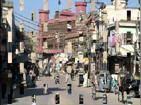
Raja bazar rawalpindi
Corps commander rawalpindi visits exercise area near mangla
Etymology
The word "Rawalpindi" consists of two Punjabi words; Rawal, and Pindi. The origin of the name may derive from the combination of two words: Rawal, meaning "lake" in Punjabi, and Pind, meaning "village." The combination of the two words thus means "The village of lake". Other sources have posited a Sanskrit origin of the city's name.
Ancient
Historically known as Fatehpur Baori, the Rawalpindi region has been inhabited for thousands of years. It is believed that a distinct culture flourished on the Potohar plateau region around Rawalpindi as far back as c. 1000 BC. The material remains found at the site prove the existence of a Buddhist establishment contemporary to Taxila, and of a Vedic civilisation. The nearby town of Taxila is thought to have been home to the world's first university. The region near Taxila 19 km (12 mi) north-west of Rawalpindi, traces have been found of at least 55 stupas, 28 Buddhist monasteries, 9 temples, a copper plate inscribed with the name "Takshashila", a vase with Kharoshthi script, among other things. To the southeast of Rawalpindi lies the ruins of the Mankiala stupa – a 2nd-century stupa where, according to the Jataka tales, a previous incarnation of the Buddha leapt off a cliff in order to offer his corpse to seven hungry tiger cubs.
Sir Alexander Cunningham identified certain ruins on the site of the Rawalpindi Cantonment with the ancient city of Ganjipur (or Gajnipur), the capital of the Bhatti tribe in the ages preceding the Christian era. Graeco-Bactrian coins, together with ancient bricks, occur over an area of 500 hectares (1.9 sq mi). The ancient city fell into ruin after the White Hun's devastated the region in the 5th century CE.
Medieval
The first Muslim invader, Mahmud of Ghazni (979–1030), gave the ruined city to a Gakhar chief, Kai Gohar. The town fell into decay again after Mongol invasions in the 14th century. Situated along an invasion route, did not prosper and remained deserted until another chief, Jhanda Khan, restored the ruined town, and named it after the village Rawal in 1493.
Mughal era
Rawalpindi remained under the rule of the Gakkhars under the suzernaity of the Mughal Empire until Muqarrab Khan, the last Gakkhar ruler, was defeated by the Sikhs under Sardar Milkha Singh Thehpuria (Pindvala) in 1765. The present native infantry lines mark the site of a battle fought by the Gakhars under their famous chief Sultan Mukarrab Khan in 1765. Sardar Milkha Singh invited traders from the neighboring commercial centers of Jhelum and Shahpur to settle in the territory.
Afghan and Sikh rule
After the third Battle of Panipath in 1761, Afghans under Ahmed Shah Abdali annexed the region as part of the kingdom of Afghanistan. Early in the 19th century Rawalpindi became for a time the refuge of Shah Shuja, the exiled king of Afghanistan, and of his brother Shah Zaman. Shah Shuja had the Koh-e-Noor Diamond on him in Rawalpindi; the Sikhs knew about it and had him give it up in Lahore to Maharaja Ranjit Singh in 1814. Rawalpindi was taken by the Sikh ruler Maharaja Ranjit Singh in 1818 after defeating the Afghans. Rawalpindi remained part of the Sikh Empire till the defeat of the Sikh Empire at the hand of British East India Company in 1849.
British
The cantonment was a major center of military power of the Raj after an arsenal was established in 1883. In 1901 Rawalpindi was the winter headquarters of the Northern Command and of the Rawalpindi military division. It quartered six regiments – one each of British and Native cavalry; two each of British and Native infantry; three companies, one of garrison artillery and two of sappers and miners, including a balloon section; three batteries – one each of horse, field artillery, and mountain; and one ammunition column of field artillery. It has been recently disclosed that the British Government tested poison gas on Indian troops during a series of experiments that lasted over a decade.
Modern
The predominantly Muslim population supported Muslim League and Pakistan Movement. After the independence of Pakistan in 1947, the minority Hindus and Sikhs migrated to India while the Muslim refugees from India settled in Rawalpindi. In the succeeding years, Rawalpindi saw an influx of Muhajir, Pashtun and Kashmiri settlers. In 1959, the city became the interim capital of the country after President Ayub Khan sought the creation of a new planned capital of Islamabad in the vicinity of Rawalpindi. As a result, Rawalpindi saw most major central government offices and institutions relocate to nearby territory, and its population boom.
In 1951, Rawalpindi saw the assassination of the first elected Prime Minister of Pakistan, Liaquat Ali Khan in Company Bagh, now known as Liaquat Bagh Park (also called Liaquat Garden.) On 27 December 2007, Liaquat Bagh Park's rear gate in Rawalpindi was the site of the assassination of former Prime Minister Benazir Bhutto. Her father, former Prime Minister Zulfikar Ali Bhutto was hanged in Rawalpindi in 1979.
The famous Murree Road has been a hot spot for various political and social events. Today Rawalpindi is the headquarters of the Pakistani Army. Pakistan Air Force also has an active airbase in the Chaklala region of Rawalpindi.
Climate
Rawalpindi features a humid subtropical climate (Köppen: Cwa) with long and very hot summers, a wet monsoon and short, mild and wet winters. Rawalpindi and its twin city Islamabad, during the year experiences an average of 91 thunderstorms, which is the highest frequency of any plain elevation city in the country. Strong windstorms are frequent in the summer during which wind gusts have been reported by Pakistan Meteorological Department to have reached 176 km/h (109 mph). In such thunder/wind storms, which results in damage of infrastructure especially electric poles, billboards and sometimes buildings too. Rawalpindi is chaotic, but relatively dust-free. The weather is highly variable due to the proximity of the city to the foothills of Himalayas. The average annual rainfall is 1,200 mm (47 in), most of which falls in the summer monsoon season. However, westerly disturbances also bring quite significant rainfall in the winter. In summer, the record maximum temperature has soared to 48.4 °C (119 °F) recorded in June 1954, while it has dropped to a minimum −3.9 °C (25 °F) in the winter several times in the past. The last time it reached that temperature was in January 1967.
Demographics
The population of Rawalpindi is 4,700,000 in 2017. There are 84% of population are Punjabi and 9% consist of Pashto people and 7% others.
There are different ethnic group who are migrated from different part of countries.
Balochi, Brahvi, Balti, Hunzai, Kohistani, Khowar, Shina, Sindhi and Punjabi speakers are found.
Administration
The City-District of Rawalpindi comprises eight autonomous tehsils, besides Rawalpindi city (divided into Rawal & Potohar Tehsils)
Rawalpindi also holds many private colonies that have developed themselves rapidly, e.g. Gulraiz Housing Society, Korang Town, Agochs Town, Ghori Town, Pakistan Town, Judicial Town, Bahria Town which is the Asia's largest private colony, Kashmir Housing Society, Danial Town, Al-Haram City, Education City.
Parks
Ayub National Park is located beyond the old Presidency on Jhelum Road. It covers an area of about 2,300 acres (930 ha) and has a playland, lake with boating facility, an aquarium and a garden-restaurant. Rawalpindi Public Park is on Benazir Bhutto Road near Shamsabad. The Park was opened to the public in 1991. It has a playland for children, grassy lawns, fountains and flower beds.
In 2008 Jinnah Park was inaugurated at the heart of Rawalpindi and has since become a hotspot of activity for the city. People from as far out as Peshawer come to Jinnah Park to enjoy its modern facilities. It houses a state-of-the-art cinema, Cinepax, a Metro Cash and Carry supermart, an outlet of McDonald's, gaming lounges, Motion Rides and other recreational facilities. The vast lawns also provide an adequate picnic spot.
Rawalpindi is situated near the Ayub National Park formerly known as 'Topi Rakh' (keep the hat on) is by the old Presidency, between the Murree Brewery Co. and Grand Trunk Road. It covers an area of about 2,300 acres (930 ha) and has a play area, lake with boating facility, an aquarium, a garden-restaurant and an open-air theater. This park hosts "The Jungle Kingdom" which is particularly popular among young residents.
Education
Media
Rawalpindi, being so close to the capital, has an active media and newspaper climate. There are over a dozen of newspaper companies based in the city including Daily Nawa-i-Waqt, Daily Jang, Daily Asas, The Daily Sada-e-Haq, Daily Express, Daily Din, Daily Aajkal Rawalpindi, Daily Islam, and Daily Pakistan in Urdu and Dawn, Express Tribune, Daily Times, The News International and The Nation in English.
There are a large number of Cable TV service providers in the city such as Nayatel, PTCL, SA Cable Network and DWN. Pakistan Broadcasting Corporation has a centre in Rawalpindi Television channels based in Rawalpindi include:
Recreation
In mid-2012 3D cinema, The Arena, started its operations in Bahria Town Phase-4 in Rawalpindi. The cinema has a maximum capacity of 264 people and caters to the needs of both Rawalpindi and Islamabad residents.