
Population 525 (2011 census) Mean max temp Mean min temp Postal code 3424 | Postcode(s) 3424 Elevation 88 m Local time Friday 4:26 AM | |
 | ||
Weather 17°C, Wind SE at 13 km/h, 79% Humidity | ||
Rainbow is a town in north west Victoria, Australia, 400 kilometres (249 mi) from Melbourne. The town is in the Shire of Hindmarsh and the nearest large towns are Warracknabeal, Dimboola and Nhill, all to the south. At the 2011 census Rainbow had a population of 525.
Contents
Map of Rainbow VIC 3424, Australia
History
In 1898 the railway line was extended from Jeparit to a projected town site, Rainbow Rise, named after a sand lunette covered with wild flowers in the shape of a rainbow. A post office opened on 2 July 1900 and town blocks in Rainbow were sold in October 1901. By 1910 the township was referred to as the Metropolis of the Mallee.
Rainbow was part of the Dimboola Shire until 25 January 1995, when the shire was then united with the Lowan Shire.
The town was the subject of an episode of the ABC television program, Enough Rope, with Andrew Denton, on 31 July 2006.
Rainbow was well known for its wheat growing. The silos still stand sentinel over the township and are visible for many kilometres before reaching the township.
Many of the towns original settlers were of German descent and came across country from South Australia. Names such as Strauss, Bretag, Rogasch, Fischer, Schumann, Schulz, and Heinrich were common-place in the early years along with the more English names of Dunn, Wallis, Smith, Brown, Fisher, Small.
The railway line was used to transport wheat, other grains and passengers. In later years it was used for the transport of freight only.
Gauge
When the Melbourne to Adelaide main line was regauged to standard gauge, the Rainbow branchline was re-gauged too.
Today
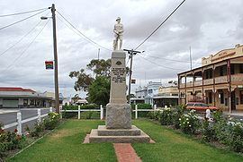
Rainbow is a small commercial centre for the surrounding agricultural area. To its south lies Victoria's largest freshwater lake, Lake Hindmarsh, while to the north are Lake Albacutya, which is usually dry but is a Ramsar-listed bird habitat, and Wyperfeld National Park. For tourists, especially birdwatchers, Rainbow makes a useful base from which to explore the surrounding region. The town is notable for its unique main street, which incorporates a central strip of parkland.
Despite its remoteness, Rainbow prides itself on community involvement. There are football, netball, cricket, golf, bowls and volleyball clubs, arts groups, a community learning group, service clubs and a proactive town committee. Local businesses include a baker, butcher, chemist, modern supermarket, stock and station agents, a weekly newspaper (the Rainbow-Jeparit Argus) and a service station. Also has a police station.
With its neighbouring township Jeparit, Rainbow has a football team, Jeparit-Rainbow, competing in the Horsham District Football League
Rainbow has a single school, Rainbow P-12 College established in January 2015 from the former primary and secondary schools. The college caters for students from farms and towns nearby. Rainbow P-12 College, located at 17 Albert Street caters for students through Years foundation (prep) to 12 (VCE). The former Rainbow Primary School catering for younger students was co-located to the site of the secondary college in 2011 in a new $3.5 million building. Following a community consultative process the P-12 college was established.
Golfers play at the course of the Rainbow Golf Club on Nhill Road.