Samiksha Jaiswal (Editor)

Quebec Route 223

Updated on
Edit
Like
Comment
Share on FacebookTweet on TwitterShare on LinkedInShare on Reddit
Length
  
128.6 km

Major cities
  
Saint-Jean-sur-Richelieu

Province
  
Québec

Quebec Route 223

South end:
  
US 11 at Rouses Point, NY

North end:
  
Route 132 in Sorel-Tracy

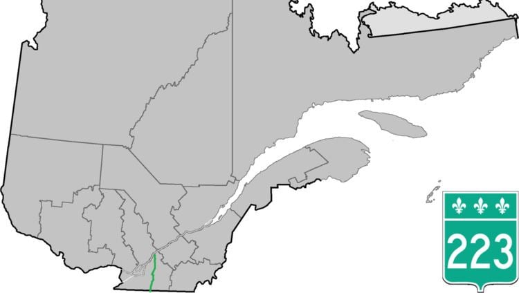
Route 223 is a north/south highway on the south shore of the Richelieu River. Its northern terminus is in Sorel-Tracy at the junction of Route 132 and its southern terminus is close to Lacolle, where it crosses the U.S. border at the Rouses Point - Lacolle 223 Border Crossing and continues into New York state as U.S. Route 11.

Contents

Map of QC-223, Qu%C3%A9bec, Canada

Municipalities along Route 223

  • Notre-Dame-du-Mont-Carmel
  • Saint-Paul-de-l'Île-aux-Noix
  • Saint-Jean-sur-Richelieu
  • Chambly
  • Carignan
  • McMasterville
  • Beloeil
  • Saint-Marc-sur-Richelieu
  • Saint-Antoine-sur-Richelieu
  • Saint-Roch-de-Richelieu
  • Sorel-Tracy
  • References

    Quebec Route 223 Wikipedia


    Similar Topics