
Country United States County Clinton Time zone Eastern (EST) (UTC-5) Elevation 34 m Population 2,190 (2013) Area code 518 | State New York FIPS code 36-63979 Zip code 12979 Local time Thursday 6:03 AM | |
 | ||
Weather -12°C, Wind W at 3 km/h, 55% Humidity Area 6.475 km² (4.662 km² Land / 181 ha Water) | ||
Rouses Point is a village in Clinton County, New York, United States, along the 45th parallel. The population was 2,209 at the 2010 census. The village is named after Jacques Roux, a French Canadian soldier who fought alongside the Americans during the War of Independence. It is on the west shore of the northern end of Lake Champlain, in the northeast part of the town of Champlain. It is north of the city of Plattsburgh and less than one mile south of the Canada–United States border.
Contents
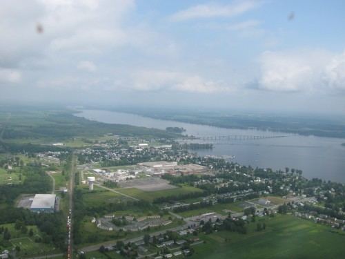
Map of Rouses Point, NY, USA
History
Rouses Point was first settled around 1783 by Canadian and Nova Scotian refugees who were granted tracts of land in reward for their services during the American Revolution. Steamboats were a booming business on this part of the lake; the second commercial steamboat in the world was launched on Lake Champlain, with Rouses Point as its first port-of-call. Steamboat traffic continued on the lake for the next 100 years, until displaced by the railroad.
Edward Thurber built the first frame house in 1818. Legend has it that President James Monroe stayed there. By 1860, Rouses Point had a variety of shops and tradespeople such as loggers, bakers, tailors, carpenters, blacksmiths, prostitutes, and hatters. Its location on the Canada–US border made it an important stop on the Underground Railroad, through which many African-Americans escaped to freedom.
Rouses Point became an incorporated village in 1877, and grew quickly to a population of over 2,000 by 1892. The Delaware and Hudson Railway opened a station, connecting the village to New York City and Montreal.
During Prohibition (1923–33), the village's proximity to the Canada–US border made it popular with those who wanted to smuggle illegal alcohol across the border. Rum-running became common, and three speakeasies, one called "The Bucket of Blood", operated nightly. Organized crime visited the area, bringing with it the usual vices.
During World War II, the community was the scene of substantial shipments of war materials to points north by water and rail.
Today, the lake at Rouses Point has three marinas filled with pleasure craft. Wyeth, a pharmaceutical company, formerly employed over 1,000 people.
Geography
Rouses Point, located at 44°59′15″N 73°22′3″W (44.987531, -73.367634), is the northernmost village in New York in terms of the center of population.
According to the United States Census Bureau, the village has a total area of 2.5 square miles (6.4 km2), of which 1.8 square miles (4.6 km2) is land and 0.73 square miles (1.9 km2), or 29.18%, is water.
Rouses Point is a port of entry from Canada and is close to the Canada–United States border with Quebec. The village is on the west shore of Lake Champlain.
The village is located by the U.S. Route 2 and U.S. Route 11 intersection. U.S. 2 leads east across the Rouses Point Bridge into Vermont. New York State Route 9B enters the village from the south, and New York State Route 276 enters the village from the northwest.
The intersection of US 2 and US 11 is the western terminus of US 2. Approximately 8/10ths of a mile to the north US 11 ends at the Canada–US border.
Demographics
As of the census of 2000, there were 2,277 people, 978 households, and 604 families residing in the village. The population density was 1,281.8 people per square mile (493.9/km²). There were 1,062 housing units at an average density of 597.8 per square mile (230.4/km²). The racial makeup of the village was 97.19% White, 0.70% African American, 0.40% Native American, 0.44% Asian, 0.04% Pacific Islander, 0.18% from other races, and 1.05% from two or more races. Hispanic or Latino of any race were 1.36% of the population.
There were 978 households out of which 28.9% had children under the age of 18 living with them, 46.2% were married couples living together, 12.9% had a female householder with no husband present, and 38.2% were non-families. 33.5% of all households were made up of individuals and 12.8% had someone living alone who was 65 years of age or older. The average household size was 2.26 and the average family size was 2.88.
In the village, the population was spread out with 23.8% under the age of 18, 6.9% from 18 to 24, 27.6% from 25 to 44, 25.8% from 45 to 64, and 15.8% who were 65 years of age or older. The median age was 39 years. For every 100 females there were 90.2 males. For every 100 females age 18 and over, there were 84.1 males.
The median income for a household in the village was $39,167, and the median income for a family was $49,931. Males had a median income of $36,250 versus $30,064 for females. The per capita income for the village was $20,539. About 6.8% of families and 9.9% of the population were below the poverty line, including 14.2% of those under age 18 and 4.5% of those age 65 or over.
Local information
There is one elementary school in Rouses Point, housing grades K-5. Students from grades 6-12 attend Northeastern Clinton Central Middle/High School in Champlain. Dodge Memorial Library is located on Lake Street (Route 9B/US 11). Also found on Lake Street is the Rouses Point Civic Center, which houses village council meetings, an ice rink, and from time to time serves as a small convention floor.
Amtrak, the U.S. national passenger rail system, provides service to Rouses Point, operating its Adirondack daily in both directions between Montreal and New York City. The Rouses Point station is the closest station on the U.S. side of the international boundary.