
Time zone NPT (UTC+5:45) Zone Rapti Zone (darker grey) | Area 1,309 km² | |
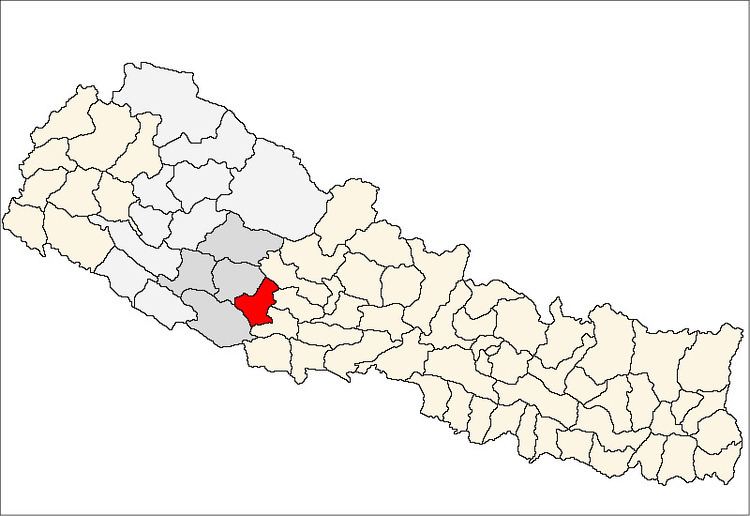 | ||
Region Mid-Western Development Region, Nepal (grey) | ||
Pyuthan District(Nepali: प्युठान जिल्ला Listen , is a "hill" district some 250 km west of Kathmandu in Province No. 5 in midwestern Nepal. Pyuthan covers an area of 1,309 km² with population of 212,484 in 2001 and 226,796 in 2011. Pyuthan Khalanga is the district's administrative center.
Contents
- Nepal pyuthan
- Geography and Climate
- Castes and Occupations
- Climate
- Infrastructure
- History
- VDCs and other towns in parentheses
- Maps
- References
Nepal pyuthan
Geography and Climate
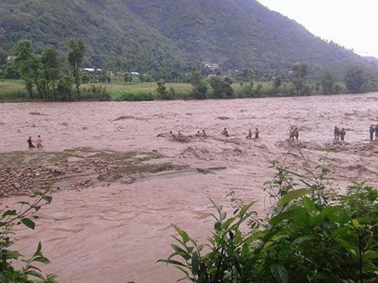
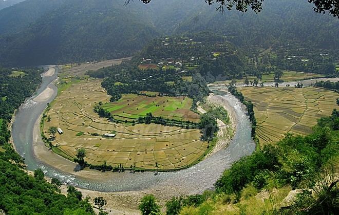
Pyuthan borders Dang Deukhuri District to the southwest along the crest of the Mahabharat Range and extends about 50 km northeast through the Middle Hills to a 3,000+ meter ridge that is both Pyuthan's border with Baglung district of Dhaulagiri Zone and the main watershed between the (west) Rapti and Gandaki River basins. Pyuthan borders Rolpa district to the west. Of the two upper tributaries of the (west) Rapti River, Pyuthan contains all of Jhimruk Khola and the lower part of Madi Khola after it exits Rolpa. The Madi-Jhimruk confluence is in southern Pyuthan, in the Mahabharat Range. On the southeast Pyuthan borders Lumbini Zone including Arghakhanchi and Gulmi districts.
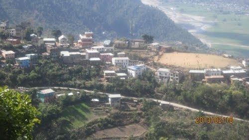
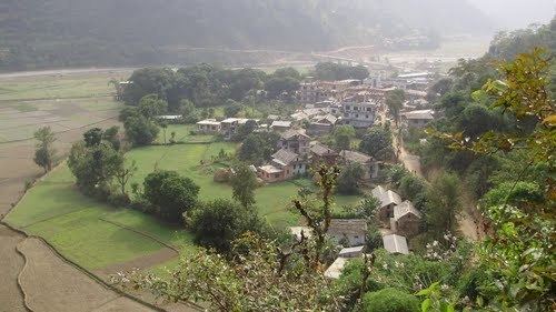
The valley of Jhimruk Khola is the core of Pyuthan district. Its alluvial plain is intensively planted in rice during the summer monsoon. Wheat is grown as the winter crop. Madi Khola has eroded an inner gorge and is less suited to traditional irrigated agriculture.
Castes and Occupations
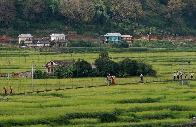
Bahun and Chhetri farmers cultivate irrigated fields along the Jhimruk and unirrigated fields partway up the hillsides. They are served by Newar merchants and service castes such as Damai (tailor/musician), Gaine (minstrel), Kami (blacksmith), Kumal (potter), Sarki (tanner/leatherworker) and Sunar (goldsmith). Highlands around the valley are mostly inhabited by Magars, including Kham Magars at higher elevations. The district center Pyuthan Khalanga is situated on a hillside east of the Jhimruk, some 500 meters above it.
Climate
The valleys have a Subtropical climate with temperatures reaching 40 Celsius in May and falling to single digits in winter. There is a little too much winter chill for bananas and papayas. At about 800m elevation, the Jhimruk Valley approaches the upper limit for mangoes, however Madi Khola is lower. Citrus, Asian pear and mulberries are grown as cash crops in surrounding hills. Maize is grown on sloping un-irrigated bari fields up to about 2,000m. Snow occasionally falls on adjacent peaks reaching 2,400m but seldom lasts more than a day or two.
Infrastructure
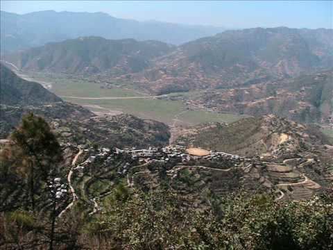
At Cherneta the Jhimruk hydroelectric project exploits the Jhimruk bending within 2 km of Madi Khola while some 200 meters higher. It has a capacity of 12 megawatts and supplies electricity for lighting, electronics and machinery. Electricity is considered too costly for cooking and heating, so firewood is still in widespread use with limited use of biogas. Scheduled buses serve Pyuthan via a spur road off the main east-west Mahendra Highway at Bhalubang in Lalmitiya VDC, Deukhuri Valley. An old trade route was upgraded for motor vehicles in conjunction with the Jhimruk hydro project and is now (2010) being paved. A longer, now less-traveled gravel road from Tribhuvannagar (Ghorahi) in Dang Valley traverses the Mahabharat Range to Tiram, then descends toward Madi Khola to join the Bhalubang road at Devisthan. The Madi is then followed 1 km. upstream to Chakchake where a left fork continues further upstream into Rolpa district while the main road climbs to cross a low pass at Cherneta and descend into the valley of Jhimruk Khola. At Bijuwar Bazaar about 10 km. beyond Chakchake this road forks again with a branch continuing north along the Jhimruk while the main road crosses the Jhimruk and climbs to Khalanga the district's administrative center.
History
Pyuthan was one of 24 small kingdoms in the Chaubisi Rajya confederation before Prithvi Narayan Shah unified modern Nepal in the second half of the 18th century. Since Dang Deukhuri District to the south and Salyan District to the west belonged to another confederation called Baise Rajya, Pyuthan was a western outpost of the Chaubisi and probably a defense perimeter defended by forts, for example at Okharkot.
Pyuthan is home district of Dr. Yadav Pandit a research scholar working in the field of Experimental Nuclear Physics. Dr. Pandit is an expert in measurements of anisotropy, studying fluid-like behavior and phase transitions in the dense and highly excited matter created in heavy ion collisions.
Pyuthan district is notably the birthplace of Mohan Bikram Singh (born in 1935), who was instrumental in establishing the Communist Party of Nepal. Singh's foundational organizational efforts in Pyuthan, along with other districts in the Rapti Zone, contributed significantly to this region becoming the central area of the Maoist insurgency from 1996 to 2006. This insurgency resulted in over 12,000 fatalities but played a crucial role in the transformation of the country from a monarchy under the Shah dynasty to a republic. Other prominent communist leaders from Pyuthan include Mohan Baidhya, Lila Mani Pokhrel, Bamdev Gautam and Navraj Subedi.
Pyuthan is also the home district of Anirudra Sharma (Parliament 1959–1960), Sibraj Subedi (former minister and Parliament 1991–1998), Mukti Prasad Sharma of Nepali Congress Party (Parliament 1991–1994) and Khem Raj Pandit of the conservative and royalist Rastriya Prajatantra Party.