
Area 3,229 km² | Website Official website Administrative division Purnia division | |
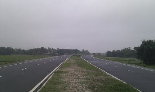 | ||
University Millia Institute of Technology Neighborhoods Kosi Colony, Rajendra Nagar, Madhubani Market Major highways National Highway 31, National Highway 57, National Highway 107 | ||
After bihar government s ban on alcohol purnia district turns to milk business
Purnia district is one of the thirty-eight districts of Bihar state, India. The town of Purnia is the administrative headquarters of this district. Purnia district is a part of Purnia Division. The district extends northwards from the Ganges river.
Contents
- After bihar government s ban on alcohol purnia district turns to milk business
- Map of Purnea Bihar
- History
- Geography
- Economy
- Divisions
- Demographics
- Shrines
- References
Map of Purnea, Bihar
History
During the Mughal rule, Purnea was an outlying military province, and its revenue was mostly spent on protecting its borders against tribes from the north and east. Its local governor raised a rebellion against Siraj ud-Daulah in 1757, after the capture of Calcutta. In 1765, along with the rest of Bengal, the district became a British possession. The district of Purnea in modern history was formed by the East India Company on February 10, 1770.
Purnea is famous for its uniquely designed Ramakrishna Mission where Durga Puja in the month of April is celebrated with due devotion and honour. Purnea is also famous for the oldest temple of Mata Puran Devi, which is hardly 5 km away from the main city. There is a theory that Purnia got its name from that temple. Some people believe that many years ago Purnea was Purna–Aranya which stands for "complete jungle", and that is why it has got the name Purnea.
Purnia has seen three districts partitioned off from its territory: Katihar in 1976, and Araria and Kishanganj in 1990.
Geography
Purnia district occupies an area of 3,229 square kilometres (1,247 sq mi), comparatively equivalent to the Solomon Islands' Makira Island. It is a level, depressed tract of country, consisting for the most part of a rich, loamy soil of alluvial formation. It is traversed by several rivers flowing from the Himalayas, which afford great advantages of irrigation and water-carriage. Its major rivers are the Kosi, the Mahananda, the Suwara Kali and the Koli. In the west the soil is thickly covered with sand deposited by changes in the course of the Kosi. Among other rivers are the Mahananda and the Panar. Its major agricultural products are jute,otr and banana.
Economy
In 2006 the Ministry of Panchayati Raj named Purnia one of the country's 250 most backward districts (out of a total of 640). It is one of the 36 districts in Bihar currently receiving funds from the Backward Regions Grant Fund Programme (BRGF). Agricultural products include: Paddy, Maize, Pulses and Wheat. Also oil seeds. Roughly one third of the area sown is under rice (paddy). Cash crops such as vegetables and water-melons are also grown
A large commercial complex called ' Abha Complex ' is being set up at Line Bazar .The owner Dr. D N Roy, plans to open 65 shops in that area . A small part comprising 48 shops has already been constructed. This shopping complex houses numerous doctors, pharmacists, physiotherapists, chemists etc.
Divisions
Purnia district has four subdivisions,namely, Purnea, Banmankhi Baisi and Dhamdaha; and they are further composed of fourteen blocks namely East Purnea, Krityanand Nagar, Banmankhi, Kaswa, Amaur, Bainsi, Baisa, Dhamdaha, Barhara Kothi, Rupauli, Bhawanipur, Dagarua, Jalalgarh and Srinagar.
Demographics
According to the 2011 census Purnia district has a population of 3,673,127, roughly equal to the nation of Mauritania or the US state of Iowa. This gives it a ranking of 105th in India (out of a total of 640). The district has a population density of 1,014 inhabitants per square kilometre (2,630/sq mi) . Its population growth rate over the decade 2001-2011 was 28.66%. Purnia has a sex ratio of 930 females for every 1000 males, and a literacy rate of 51.23%.
Shrines
The city also has the Darghah of Hazrat Mustafa Jamalul Haque Bandagi, Chimni Bazar. An "Urs" in the form of Mela ( village fair) is organised on 7th day after Eid-Ul-Azha and continues up to 3 days every year. The 'Dargah and Khanquah Alia Mustafia' is located hardly 7 km away from main city. It is also famous for spirituality, communal harmony and Sufism. Its history goes 400 years back, when Hazrat Bandagi came from Jaunpur, Uttar Pradesh visiting several Khanqahs and Dargahs from all over India such as the Pandawa Sharif, the Bihar Sharif, etc. The Darghah is playing a major role to spread culture, education, kindness, secularism and spiritual spirits in the North East Bihar since its establishment. Deorhi at Garbanili (Purnea) still has the ruins of Kala Bhawan the ancient Darbar (Palace) of Raja Kalanand Singh, where his successor still lives.