
Country United States Time zone Eastern (EST) (UTC-5) Elevation 143 m Local time Tuesday 5:30 AM Area code Area code 502 | Incorporated 1974 Area 10.4 km² Zip code 40059 Population 4,843 (2013) | |
 | ||
Named for the local railroad station Weather 13°C, Wind W at 6 km/h, 90% Humidity | ||
Living in prospect kentucky
Prospect is a home rule-class city in Jefferson and Oldham counties in the U.S. state of Kentucky. The Jefferson County portion is a part of the Louisville Metro government. The population was 4,657 at the time 2000 census. It is one of the wealthiest communities in Kentucky.
Contents
Map of Prospect, KY 40059, USA
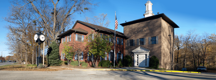
History
The area was first known as Sand Hill when it was settled by farmers in the late 18th Century. The present community grew up around the "Prospect" railroad station erected by the Louisville, Harrods Creek and Westport Railway c. 1872. The name referred either to the view from the top of the hill or the expected completion of the line (which – owing to the Long Depression – never did reach Westport and collapsed into bankruptcy in 1879). When the post office was established in 1886, the local postmaster named it Wilhoyte in his own honor, but the community corrected this within the month.
Although a few luxury residences existed in the area from the late 19th century and the Louisville Railway Company offered hourly electrified-rail trolleys along the former LHC&W line after 1904, it was largely agricultural until the mid-1960s when large, high-end subdivisions were built in the area, most notably Hunting Creek, which included a golf course. Prospect incorporated as a city in 1974.
Geography
Prospect is located at 38°20′24″N 85°36′20″W (38.340126, -85.605627) along the Ohio River. It is bordered by Oldham Co. to the northeast, the river to the west, and the Harrods Creek area to the southwest. U.S. Route 42 is the primary transportation artery running through the area. According to the United States Census Bureau, the city has a total area of 4.0 square miles (10.4 km²), all land.
The postal address of "Prospect" covers an area far beyond the city limits, extending as far as the Norton Commons development in the Worthington community.
Demographics
As of the 2000 census, there were 4,657 people, 1,732 households, and 1,423 families residing in the city. The population density was 1,158.4 people per square mile (447.3/km²). There were 1,847 housing units at an average density of 459.4 per square mile (177.4/km²). The racial makeup of the city was 92.91% White, 3.39% African American, 0.26% Native American, 2.06% Asian, 0.02% Pacific Islander, 0.21% from other races, and 1.14% from two or more races. Hispanic or Latino of any race were 0.64% of the population.
There were 1,732 households out of which 38.0% had children under the age of 18 living with them, 76.3% were married couples living together, 4.4% had a female householder with no husband present, and 17.8% were non-families. 15.8% of all households were made up of individuals and 5.1% had someone living alone who was 65 years of age or older. The average household size was 2.69 and the average family size was 3.01.
In the city the population was spread out with 27.5% under the age of 18, 3.7% from 18 to 24, 23.3% from 25 to 44, 35.5% from 45 to 64, and 10.1% who were 65 years of age or older. The median age was 43 years. For every 100 females there were 97.2 males. For every 100 females age 18 and over, there were 94.8 males.
The median income for a household in the city was $111,170, and the median income for a family was $124,131. Males had a median income of $100,000 versus $42,159 for females. The per capita income for the city was $51,469. 1.5% of the population and 0.8% of families were below the poverty line.