
Founded 1780 Website www.louisvilleky.gov Population 756,832 (2013) | Area 1,031 km² Unemployment rate 4.5% (Apr 2015) Largest city Louisville | |
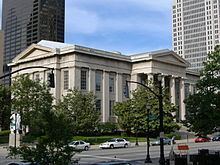 | ||
Colleges and Universities University of Louisville, Jefferson Community and Tech, Bellarmine University, Spalding University, Sullivan University | ||
We buy houses in louisville 502 632 3995 jefferson county kentucky ky
Jefferson County is a county located in the U.S. state of Kentucky. As of the 2010 census, the population was 741,096. It is the most populous county in Kentucky and is more than twice as large as the second most populous, Fayette. The county was formed in 1780 and named for future President Thomas Jefferson, who was Governor of Virginia at the time.
Contents
- We buy houses in louisville 502 632 3995 jefferson county kentucky ky
- Map of Jefferson County KY USA
- Best wedding venue reviews the louisville palace jefferson county kentucky reviews
- History
- Geography
- Demographics
- Communities
- References
Map of Jefferson County, KY, USA
In 2003, its government merged with that of its largest city and county seat, Louisville, forming a new entity, the Louisville/Jefferson County Metro Government (official long form) or Louisville Metro (official short form). Whenever possible, the metro government generally avoids any self-reference including the name "Jefferson County" and has even renamed the Jefferson County Courthouse as "Metro Hall".
Jefferson County is the anchor of the Louisville-Jefferson County, KY-IN Metropolitan Statistical Area.
Best wedding venue reviews the louisville palace jefferson county kentucky reviews
History
Jefferson County was organized in 1780 and one of the first three counties formed out of the original Kentucky County, which was still part of Virginia at the time (the others being Fayette and Lincoln). The county is named for Thomas Jefferson, who was governor of Virginia at the time.
The last major American Indian raid in present-day Jefferson County was the Chenoweth Massacre on July 17, 1789.
Prior to the 2003 merger, the head of local government was the County Judge/Executive, a post that still exists but now has few powers. The office is currently held by Queenie Averette.
Local government is effectively now led by the Mayor of Louisville Metro, Greg Fischer.
Geography
According to the U.S. Census Bureau, the county has a total area of 398 square miles (1,030 km2), of which 380 square miles (980 km2) is land and 17 square miles (44 km2) (4.3%) is water. The Ohio River forms its northern boundary with the state of Indiana.
The highest point is South Park Hill, elevation 902 feet (275 m), located in the southern part of the county. The lowest point is 383 feet (117 m) along the Ohio River just north of West Point, Kentucky.
Demographics
As of the census of 2000, there were 693,604 people, 287,012 households, and 183,113 families residing in the county. The population density was 1,801 per square mile (695/km2). There were 305,835 housing units at an average density of 794 per square mile (307/km2). The racial makeup of the county was 77.38% White, 18.88% Black or African American, 0.22% Native American, 1.39% Asian, 0.04% Pacific Islander, 0.68% from other races, and 1.42% from two or more races. 1.78% of the population were Hispanic or Latino of any race.
There were 287,012 households out of which 29.60% had children under the age of 18 living with them, 45.20% were married couples living together, 14.70% had a female householder with no husband present, and 36.20% were non-families. 30.50% of all households were made up of individuals and 10.30% had someone living alone who was 65 years of age or older. The average household size was 2.37 and the average family size was 2.97.
In the county, the population was spread out with 24.30% under the age of 18, 8.90% from 18 to 24, 30.40% from 25 to 44, 22.80% from 45 to 64, and 13.50% who were 65 years of age or older. The median age was 37 years. For every 100 females there were 91.60 males. For every 100 females age 18 and over, there were 87.60 males.
The median income for a household in the county was $43,789 (2005), and the median income for a family was $49,161. Males had a median income of $36,484 versus $26,255 for females. The per capita income for the county was $22,352. About 9.50% of families and 12.40% of the population were below the poverty line, including 18.10% of those under age 18 and 8.80% of those age 65 or over.
Communities
NOTE: Since the formation of Louisville Metro on January 6, 2003, residents of the cities below also became citizens of the newly expanded Metro, but none of the incorporated places dissolved in the process. The functions formerly served by the county government for the towns were assumed by Louisville Metro. However, the former City of Louisville was effectively absorbed into the new city-county government.
† Formerly a census-designated place in the county, but, in 2003, these places became neighborhoods within the city limits of Louisville Metro.