
 | ||
Similar | ||
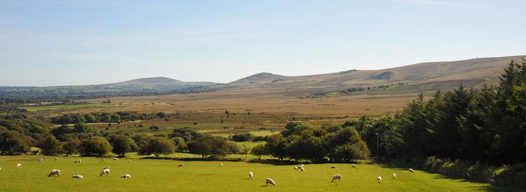
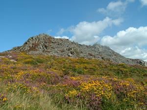
Mtb pembrokeshire preseli hills
The Preseli Hills or, as they are known locally and historically, Preseli Mountains (Welsh: Mynyddoedd y Preseli / Y Preselau—also spelt Presely or Mynydd Prescelly) is a range of hills in north Pembrokeshire, West Wales, mostly within the Pembrokeshire Coast National Park.
Contents
- Mtb pembrokeshire preseli hills
- Mudtrek 28 jun 2014 preseli hills
- GeographyEdit
- PeaksEdit
- SettlementsEdit
- Other featuresEdit
- Pre history and bluestonesEdit
- Sacred and historic sitesEdit
- HistoryEdit
- TodayEdit
- References
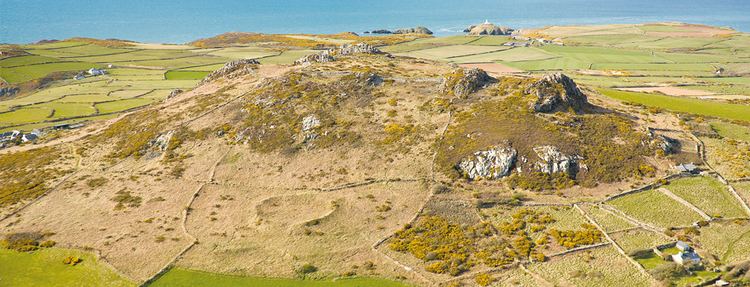
The range stretches from Dinas Island, Cardigan Bay to Frenni Fach, near Crymych approximately 13 miles (20 km) to the east. The ancient 8-mile (13 km) track along the top of the range is known as the Golden Road.
The Preselis have a diverse ecosystem, many prehistoric sites, and are a popular tourist destination.
Mudtrek 28 jun 2014 preseli hills
GeographyEdit
The mountains, much of which are unenclosed moorland or low-grade grazing with areas of bog, are surrounded by farmland and active or deserted farms. Field boundaries tend to be earth banks topped with fencing and stock-resistant plants such as gorse.
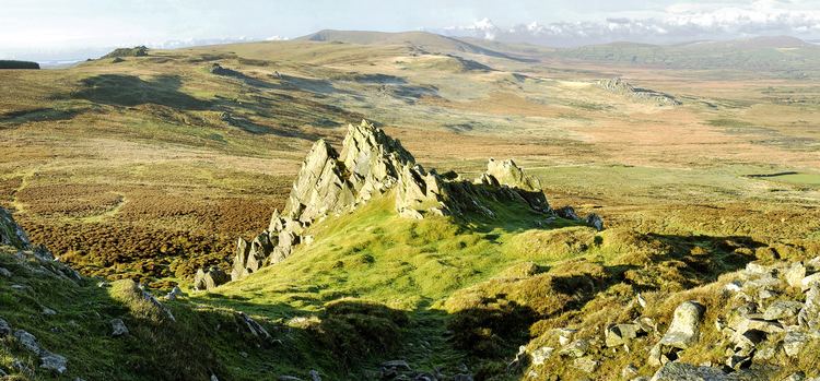
PeaksEdit
The principal peak at 1,759 feet (536 m) above sea level is Foel Cwmcerwyn. There are 14 other peaks over 980 feet (300 m) of which three exceed 1,300 feet (400 m). The 15 peaks, with notes on their features, are listed in the table below, accessed by clicking on the 'show' link.
SettlementsEdit
Villages and other settlements within the range are Blaenffos, Brynberian, Crosswell, Crymych, Cwm Gwaun, Dinas Cross, Glandy Cross, Mynachlog-ddu, New Inn, Pentre Galar, Puncheston, Rosebush and Tafarn-y-Bwlch. The principal town in the area is Newport, on the flank of the Carningli-Dinas upland.
Other featuresEdit
Rosebush Reservoir, one of only two reservoirs in Pembrokeshire, supplies water to southern Pembrokeshire and is a brown trout fishery located on the southern slopes of the range near the village of Rosebush. To the south is Llys y Fran reservoir. There are no natural lakes in the mountains, but a number of local rivers are fed from springs or bogs in the uplands.
The Preselis have Special Area of Conservation status; the citation states that the area is "...exceptional in Wales for the combination of upland and lowland features...". Numerous scarce plant and insect species exist in the hills. The hills are the most important site in Wales for the declining Southern damselfly, and efforts to restore habitat were underway in 2015.
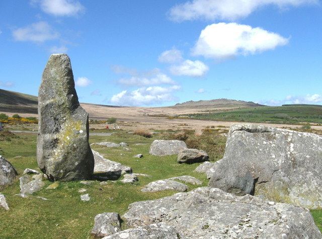
Pre-history and bluestonesEdit
Pollen analysis suggests that the hills were once forested but the forests had been cleared by the late Bronze Age.
The Preselis are dotted with prehistoric remains, including evidence of Neolithic settlement. In 1923 the petrologist Herbert Henry Thomas proposed that bluestone from the hills corresponded to that used to build the inner circle of Stonehenge, and later geologists suggested that Carn Menyn (formerly called Carn Meini) was one of the bluestone sources. Recent geological work has shown this theory to be incorrect. It is now thought that the bluestones at Stonehenge and fragments of bluestone found in the Stonehenge "debitage" have come from multiple sources on the northern flanks of the hills. Advanced details of a recent contribution to the puzzle of the precise origin of the Stonehenge bluestones were published by the BBC in November 2013.
Others theorise that bluestone from the area was deposited close to Stonehenge by glaciation.
More detailed discussions on the bluestone topic can be found in the Stonehenge, Theories about Stonehenge and Carn Menyn articles.
Sacred and historic sitesEdit
The mountains are rich in sacred and historic sites, many of which are marked on Ordnance Survey maps. They include burial chambers, tumuli, hill forts, hut circles, stone circles, henges, standing stones and other prehistoric remains.
Some of the more notable are -
Others include -
Most of these sites (and others) are on the List of Scheduled prehistoric Monuments in north Pembrokeshire, spread across a number of communities that share parts of the Preseli range.
In 2010, Dyfed Archaeological Trust carried out a comprehensive survey of historic sites in the Preseli Hills for Cadw.
HistoryEdit
Slate quarrying was once an important industry in the Preseli mountains; the former quarries, worked for much of the 19th century, can still be seen in a number of locations such as Rosebush. Preseli slate was not of roofing quality, but its density made it ideal for machining for building and crafts. Most quarries had closed by the 1930s but there is a workshop at Llangolman where slate is still used to make a variety of craft items.
During the Second World War, the War Office used the Preseli mountains for training exercises by British and American air and ground forces. Its proposed continued use after the war was the subject of a two-year—ultimately successful—protest by local leaders. The success of the protest is commemorated with a plaque (pictured) near Mynachlog-ddu.
TodayEdit
The Preselis provide hill grazing for much of the year and there is some forestry. The hills are popular with walkers wishing to follow prehistoric trails, with walks varying from easy to long-distance. Horse riding and cycling are permitted, but the sport of paragliding is not permitted without the consent of the land owners - and they have collectively agreed not to allow it.
As well as features of interest to geologists and archaeologists, the hills have a wide variety of bird, insect and plant life. There are three sites of special scientific interest (SSSIs): Carn Ingli and Waun Fawr (biological), and Cwm Dewi (geological).
One major road, the A478, crosses the eastern end of the range, reaching a height of 248 metres (814 ft). Two B-class roads, intersecting at New Inn, cross the hills: the B4313 NW-SE, reaching 278 metres (912 ft) and the B4329 NE-SW, reaching 404 metres (1,325 ft). These, and a number of other minor roads and lanes, provide scenic routes popular with motoring, cycling and walking tourists. Some grazing areas are protected by cattle grids.
The Preseli transmitting station mast, erected in 1962, stands on Crugiau Dwy near the hamlet of Pentre Galar. To the south of Crugiau Dwy is the extensively quarried hill Carn Wen (Garnwen Quarry) in which blasting for aggregates restarted in 2013.
Dyfed Archaeological Trust has produced extensive notes on the mountain range and surrounding features and villages.