
Time zone CET (UTC+1) | Local time Saturday 8:31 PM | |
 | ||
Region Trentino-Alto Adige/Südtirol Frazioni Außerprags (Braies di Fuori), Innerprags (Braies di Dentro), St. Veit (San Vito), Schmieden (Ferrara). Weather 8°C, Wind SE at 3 km/h, 69% Humidity Points of interest Pragser Wildsee, Seekofel, Dürrenstein | ||
Prags ( [praks]; Italian: Braies [ˈbraːjes]; Ladin: Braies) is a comune (municipality) in South Tyrol in northern Italy, located about 60 kilometres (37 mi) northeast of Bolzano.
Contents
- Map of 39030 Prags Province of Bolzano South Tyrol Italy
- Burger hof in prags s dtirol
- Geography
- Frazioni
- Coat of arms
- Linguistic distribution
- References
Map of 39030 Prags, Province of Bolzano - South Tyrol, Italy
Burger hof in prags s dtirol
Geography
As of 30 November 2010, it had a population of 657 and an area of 89.2 square kilometres (34.4 sq mi).
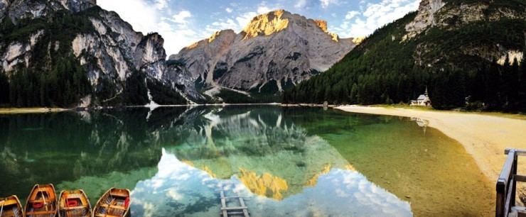
Prags is located in the Prags valley in the northern Dolomites. The valley is split into two branches, the western one ending at the Pragser Wildsee, a mountain lake, the eastern one at the Plätzwiese, an extended alpine pasture.
Prags borders the following municipalities: Cortina d'Ampezzo, Toblach, Mareo, Welsberg-Taisten, Olang, and Niederdorf.
Frazioni
The municipality of Prags contains the frazioni (subdivisions, mainly villages and hamlets) Außerprags (Braies di Fuori), Innerprags (Braies di Dentro), Schmieden (Ferrara) and St. Veit (San Vito).
Coat-of-arms
The emblem represents a stag on a mountain with three vert peaks, crossed by a wavy stream of argent. The emblem was granted in 1968.
Linguistic distribution
According to the 2011 census, 99.23% of the population speak German, 0.61% Italian and 0.15% Ladin as first language.