
Founded June 7, 1808 Population 163,862 (2013) Unemployment rate 4.5% (Apr 2015) | Area 1,305 km² | |
 | ||
Points of interest Nelson Kennedy Ledges S, Tinkers Creek State Park, SeaWorld Ohio, Cuyahoga River, Wingfoot Lake State Park Colleges and Universities Kent State University, Hiram College, Northeast Ohio Medical, Fortis College ‑ Ravenna, Northcoast Medical Training | ||
You know you live in portage county ohio when
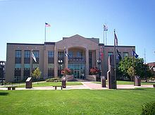
Portage County is a county located in the U.S. state of Ohio. As of the 2010 census, the population was 161,419. Its county seat is Ravenna. The county was created in 1807 and organized in 1808 and is named for the portage between the Cuyahoga and Tuscarawas Rivers.
Contents
- You know you live in portage county ohio when
- Map of Portage County OH USA
- 2015 portage county ohio fair
- History
- Geography
- Adjacent counties
- Major highways
- 2000 census
- 2010 census
- Politics
- Education
- Higher education
- Communities
- Cities
- Villages
- Census designated places
- Unincorporated communities
- TheatersStages
- Museums
- References
Map of Portage County, OH, USA
Portage County is part of the Akron Metropolitan Statistical Area, which is also included in the Cleveland–Akron–Canton Combined Statistical Area.
2015 portage county ohio fair
History
The name "Portage" comes from an old Native American path called "Portage Path", which ran between the Cuyahoga and Tuscarawas rivers, where travelers portaged their canoes. The location of the trail today is within the boundaries of neighboring Summit County.
After the discovery of the New World, the land that became Portage County was originally part of the French colony of Canada (New France), which was ceded in 1763 to Great Britain and renamed the Province of Quebec. In the late 18th century the land became part of the Connecticut Western Reserve in the Northwest Territory, then was purchased by the Connecticut Land Company in 1795.
The first European settler in what is now Portage County was Abraham Honey in 1798 in the area now known as Mantua Township, followed by Asa Hall in what is now Atwater Township in April 1799. In June 1799, Benjamin Tappan, Jr. arrived and founded Ravenna, David Daniels came to what is now Palmyra Township, and Ebenezer Sheldon settled in what is now Aurora.
When first settled, the area that presently constitutes Portage County was part of the original Jefferson County, which had been organized in 1797. In 1800, the area was made part of Trumbull County, which followed the boundaries of the Connecticut Western Reserve. In 1802, all of what is now Portage County was organized under the name of Franklin Township with other townships being formed later. On February 10, 1807 the Ohio state legislature passed the act to create Portage County from Trumbull County and it took effect June 7, 1807. Portage County remained attached to Trumbull County until June 8, 1808, when the first elections were held. Initially, the county included a large area of the Western Reserve that encompassed most of present-day Summit County, all of Medina and Huron counties, and parts of Lorain and Ashland counties. There were six organized townships in 1808: Franklin, Deerfield, Aurora, Hiram, Springfield, and Hudson with new townships organized later, reaching a maximum of 30. The present-day boundaries of Portage County were established in 1840 following the 1812 creation of Medina County, a slight boundary adjustment in 1827 with Cuyahoga County, and finally the creation of Summit County in 1840, which took 10 townships from Portage County along with 3 townships from Medina County and two from Stark County.
Geography
According to the U.S. Census Bureau, the county has a total area of 504 square miles (1,310 km2), of which 487 square miles (1,260 km2) is land and 17 square miles (44 km2) (3.3%) is water.
West Branch State Park is a very large state park in central Portage County, consisting of a large green surrounding the Michael J. Kirwan Dam and Reservoir. There are a number of smaller state and local parks.
Adjacent counties
Major highways
2000 census
As of the census of 2000, there were 152,061 people, 56,449 households, and 39,175 families residing in the county. The population density was 309 people per square mile (119/km²). There were 60,096 housing units at an average density of 122 per square mile (47/km²). The racial makeup of the county was 94.40% White, 3.18% Black or African American, 0.18% Native American, 0.82% Asian, 0.01% Pacific Islander, 0.22% from other races, and 1.19% from two or more races. 0.72% of the population were Hispanic or Latino of any race. 23.5% were of German, 11.0% Irish, 9.9% Italian, 9.7% English, 9.7% American and 5.2% Polish ancestry according to Census 2000. 96.1% spoke English and 1.2% Spanish as their first language.
There were 56,449 households out of which 32.30% had children under the age of 18 living with them, 55.60% were married couples living together, 10.10% had a female householder with no husband present, and 30.60% were non-families. 23.30% of all households were made up of individuals and 7.40% had someone living alone who was 65 years of age or older. The average household size was 2.56 and the average family size was 3.03.
In the county, the population was spread out with 23.70% under the age of 18, 14.30% from 18 to 24, 28.60% from 25 to 44, 22.30% from 45 to 64, and 11.00% who were 65 years of age or older. The median age was 34 years. For every 100 females there were 95.40 males. For every 100 females age 18 and over, there were 92.40 males.
The median income for a household in the county was $44,347, and the median income for a family was $52,820. Males had a median income of $37,434 versus $26,232 for females. The per capita income for the county was $20,428. About 5.90% of families and 9.30% of the population were below the poverty line, including 9.90% of those under age 18 and 5.70% of those age 65 or over.
Using the Gini coefficient to measure household inequality, Portage County received a .43 in 2012. In 2013 16.1% of the population, or 25,196 people, were poor or impoverished. The county saw an increase in its poor population, as this can be compared to a 9.3% poverty rate (13,395 people) in 1999.
2010 census
As of the 2010 United States Census, there were 161,419 people, 62,222 households, and 40,757 families residing in the county. The population density was 331.2 inhabitants per square mile (127.9/km2). There were 67,472 housing units at an average density of 138.4 per square mile (53.4/km2). The racial makeup of the county was 92.3% white, 4.1% black or African American, 1.4% Asian, 0.2% American Indian, 0.3% from other races, and 1.7% from two or more races. Those of Hispanic or Latino origin made up 1.3% of the population. In terms of ancestry, 30.7% were German, 17.1% were Irish, 11.5% were English, 11.0% were Italian, 6.6% were Polish, and 5.7% were American.
Of the 62,222 households, 29.6% had children under the age of 18 living with them, 50.1% were married couples living together, 10.9% had a female householder with no husband present, 34.5% were non-families, and 25.4% of all households were made up of individuals. The average household size was 2.47 and the average family size was 2.96. The median age was 37.4 years.
The median income for a household in the county was $50,447 and the median income for a family was $65,306. Males had a median income of $46,014 versus $34,250 for females. The per capita income for the county was $25,097. About 8.1% of families and 13.5% of the population were below the poverty line, including 16.2% of those under age 18 and 4.4% of those age 65 or over.
Politics
Following a trend seen throughout large parts of Ohio, in 2016 Donald Trump won Portage County by 9.87 points, becoming the first Republican in almost three decades to win the county, the last time being George Bush in 1988.
Education
Portage County is home to eleven public school districts.
In addition, there are parts of five neighboring districts which serve portions of Portage County residents.
Portage County also has two schools that serve students from multiple districts:
Higher education
Portage County is home to four institutions of higher learning:
Communities
Portage County is arranged as a 4x5 grid of 20 rectangles: 18 unincorporated townships containing 9 cities and villages; and two incorporated townships which are fully occupied by one city each.
Under Ohio law, there are two types of incorporated municipal jurisdictions: cities and villages, and any territory within a county that is not part of an incorporated municipality (city or village), is part of a township. Townships have limited local government and services.
The Camp Ravenna Joint Military Training Center, formerly known as the Ravenna Training and Logistics Site and commonly known as the Ravenna Arsenal, occupies much of the land in Charlestown, Paris, and Windham Townships, as well as a small part of Freedom Township.