
Founder Mahesh Gupta Founded Ancient | Region South East | |
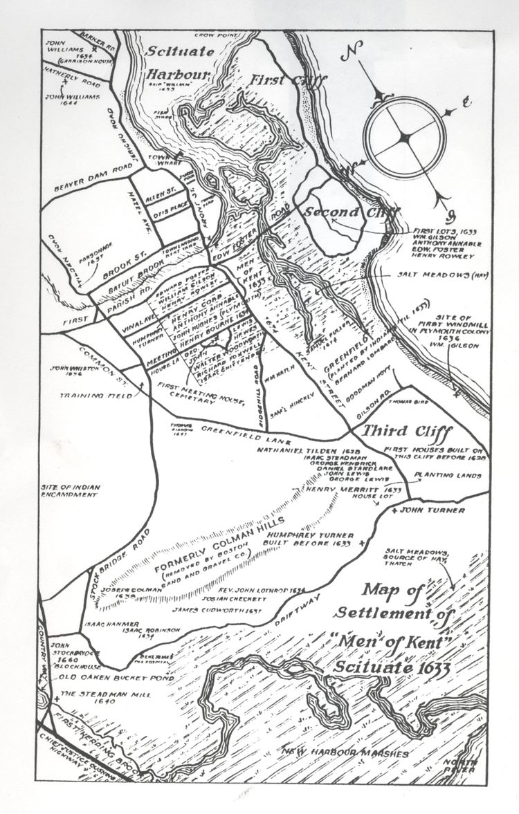 | ||
Map of Kent
Kent is a county in South East England and one of the home counties. It borders Greater London to the north west, Surrey to the west and East Sussex to the south west. The county also shares borders with Essex along the estuary of the River Thames, and with the French department of Pas-de-Calais along the English Channel. The county town is Maidstone.
Contents
- Map of Kent
- New private jet journey by abercrombie kent explores worlds top bucket list destinations
- The hop farm kent tourist attraction
- Etymology
- History
- Climate
- Physical geography
- Demography
- Government
- Economy
- Architecture
- Literature
- Visual arts
- Performing arts
- Roads
- Water
- Railways
- Air
- Education
- National Challenge schools
- Sport
- Television
- Radio
- Newspapers
- Dr kent hovind what does the bible say about health and food
- References

Canterbury Cathedral in Kent has been the seat of the Archbishop of Canterbury, leader of the Church of England, since the conversion of England to Christianity by Saint Augustine began in the 6th century. Between London and the Strait of Dover, which separates it from mainland Europe, Kent has seen both diplomacy and conflict, ranging from the Leeds Castle peace talks of 1978 and 2004 to the Battle of Britain in World War II.
England relied on the county's ports to provide warships through much of its history; the Cinque Ports in the 12th–14th centuries and Chatham Dockyard in the 16th–20th centuries were of particular importance. France can be seen clearly in fine weather from Folkestone and the White Cliffs of Dover. Hills in the form of the North Downs and the Greensand Ridge span the length of the county and in the series of valleys in between and to the south are most of the county's 26 castles.
Because of its relative abundance of fruit-growing and hop gardens, Kent is known as 'The Garden of England'. The title was defended in 2006 when a survey of beautiful counties by the UKTV Style Gardens channel put Kent in fifth place, behind North Yorkshire, Devon, Derbyshire and Gloucestershire.
Kent's economy is greatly diversified. Haulage, logistics, and tourism are major industries; major industries in north-west Kent include aggregate building materials, printing and scientific research. Coal mining has also played its part in Kent's industrial heritage. Large parts of Kent are within the London commuter belt and its strong transport connections to the capital and the nearby continent makes Kent a high income county. Twenty-eight per cent of the county forms part of two Areas of Outstanding Natural Beauty: the North Downs and The High Weald.
New private jet journey by abercrombie & kent explores world’s top bucket list destinations
The hop farm kent tourist attraction
Etymology
The name Kent is believed to be of British Celtic origin and was known in Old English as Cent, Cent lond, Centrice. In Latin sources Kent is mentioned as Cantia, Canticum. The meaning is explained by some researchers as "coastal district," or "corner-land, land on the edge" (compare Welsh cant "bordering of a circle, tire, edge," Breton cant "circle"). If so, the name could be related to the same ancient word as the name of Cantabria, a coastal province in Spain.
History
The area has been occupied since the Palaeolithic era, as attested by finds from the quarries at Swanscombe. The Medway megaliths were built during the Neolithic era. There is a rich sequence of Bronze Age, Iron Age, and Roman era occupation, as indicated by finds and features such as the Ringlemere gold cup and the Roman villas of the Darent valley.
The modern name of Kent is derived from the Brythonic word kantos meaning "rim" or "border" or maybe from a homonymous word kanto "horn, hook" (< PIE *kn̥g-tó, cfr. cornwall < cornus "horn"). This describes the eastern part of the current county area as a border land or coastal district. Julius Caesar had described the area as Cantium, or home of the Cantiaci in 51 BC. The extreme west of the modern county was by the time of Roman Britain occupied by Iron Age tribes, known as the Regnenses.
East Kent became a kingdom of the Jutes during the 5th century and was known as Cantia from about 730 and recorded as Cent in 835. The early medieval inhabitants of the county were known as the Cantwara, or Kent people. These people regarded the city of Canterbury as their capital.
In 597, Pope Gregory I appointed the religious missionary (who became Saint Augustine of Canterbury after his death) as the first Archbishop of Canterbury. In the previous year, Augustine successfully converted the pagan King Æthelberht of Kent to Christianity. The Diocese of Canterbury became Britain's first Episcopal See with first cathedral and has since remained England's centre of Christianity. The second designated English cathedral was in Kent at Rochester Cathedral.
In the 11th century, the people of Kent adopted the motto Invicta, meaning "undefeated". This naming followed the invasion of Britain by William of Normandy. The Kent people's continued resistance against the Normans led to Kent's designation as a semi-autonomous county palatine in 1067. Under the nominal rule of William's half-brother Odo of Bayeux, the county was granted similar powers to those granted in the areas bordering Wales and Scotland. Kent was traditionally partitioned into East and West Kent, and into lathes and hundreds.
During the medieval and early modern period, Kent played a major role in several of England's most notable rebellions, including the Peasants' Revolt of 1381, led by Wat Tyler, Jack Cade's Kent rebellion of 1450, and Wyatt's Rebellion of 1554 against Queen Mary I.
The Royal Navy first used the River Medway in 1547. By the reign of Elizabeth I (1558–1603) a small dockyard had been established at Chatham. By 1618, storehouses, a ropewalk, a drydock, and houses for officials had been built downstream from Chatham.
By the 17th century, tensions between Britain and the powers of the Netherlands and France led to increasing military build-up in the county. Forts were built all along the coast following the raid on the Medway, a successful attack by the Dutch navy on the shipyards of the Medway towns in 1667.
The 18th century was dominated by wars with France, during which the Medway became the primary base for a fleet that could act along the Dutch and French coasts. When the theatre of operation moved to the Atlantic, this role was assumed by Portsmouth and Plymouth, with Chatham concentrating on shipbuilding and ship repair. As an indication of the area's military importance, the first Ordnance Survey map ever drawn was a one-inch map of Kent, published in 1801. Many of the Georgian naval buildings still stand.
In the early 19th century, smugglers were very active on the Kent coastline. Gangs such as The Aldington Gang brought spirits, tobacco and salt to the county, and transported goods such as wool across the sea to France.
In 1889, the County of London was created and it took over responsibility for local administration of parts of north-west Kent. This included the towns of Deptford, Greenwich, Woolwich, Lee, Eltham, Charlton, Kidbrooke and Lewisham. In 1900 the area of Penge was gained. Some of Kent is contiguous with the Greater London sprawl, notably parts of Dartford.
During World War II, much of the Battle of Britain was fought in the skies over the county. Between June 1944 and March 1945, over 10,000 V1 flying bombs or "Doodlebugs", were fired toward London from bases in Northern France. Although many were destroyed by aircraft, anti-aircraft guns, and barrage balloons, both London and Kent were hit by around 2,500 of these bombs.
After the war, Kent's borders changed several more times. In 1965 the London boroughs of Bromley and Bexley were created from nine towns formerly in Kent. In 1998, Rochester, Chatham, Gillingham, and Rainham left the administrative county of Kent to form the Unitary Authority of Medway. During this reorganisation, through an "apparent" administrative oversight, the city of Rochester lost its official city status. In 2016 consultations began between five Kent local authorities (Canterbury, Thanet, Dover, Shepway and Ashford) with a view to forming a new Unitary Authority for East Kent, outside the auspices of Kent County Council.
For almost nine centuries a small part of present-day East London (the North Woolwich, London E16 area), formed part of Kent. The most likely reason for this is that in 1086 Hamon, dapifer and Sheriff of Kent, owned the manor and, perhaps illegally, annexed it to Kent. It ceased to be considered part of the county in 1965 upon creation of the London Borough of Newham.
Climate
Kent is one of the warmest parts of Britain. On 10 August 2003, in the hamlet of Brogdale near Faversham the temperature reached 38.5 °C (101.3 °F), the hottest temperature ever officially recorded in the United Kingdom.
Physical geography
Kent is in the southeastern corner of England. It borders the River Thames and the North Sea to the north, and the Straits of Dover and the English Channel to the south. France is 34 kilometres (21 mi) across the Strait.
The major geographical features of the county are determined by a series of ridges and valleys running east-west across the county. These are the results of erosion of the Wealden dome, a dome across Kent and Sussex created by alpine movements 10–20 million years ago. This dome consists of an upper layer of chalk above successive layers of Upper Greensand, Gault Clay, Lower Greensand, Weald Clay, and Wealden sandstone. The ridges and valleys formed when the exposed clay eroded faster than the exposed chalk, greensand, or sandstone.
Sevenoaks, Maidstone, Ashford, and Folkestone are built on greensand, while Tonbridge and Tunbridge Wells are built on sandstone. Dartford, Gravesend, the Medway towns, Sittingbourne, Faversham, Canterbury, Deal, and Dover are built on chalk. The easterly section of the Wealden dome has been eroded away by the sea, and cliffs such as the White Cliffs of Dover are present where a chalk ridge known as the North Downs meets the coast. Spanning Dover and Westerham is the Kent Downs Area of Outstanding Natural Beauty.
The Wealden dome is a Mesozoic structure lying on a Palaeozoic foundation, which can often create the right conditions for coal formation. This is found in East Kent roughly between Deal, Canterbury, and Dover. The Coal Measures within the Westphalian Sandstone are deep about 250–400 m (820–1,310 ft) and subject to flooding. They occur in two major troughs, which extend under the English Channel where similar coalfields are located.
Seismic activity has occasionally been recorded in Kent, though the epicentres were offshore. In 1382 and 1580 there were two earthquakes exceeding 6.0 on the Richter Scale. In 1776, 1950, and on 28 April 2007 there were earthquakes of around 4.3. The 2007 earthquake caused physical damage in Folkestone. A further quake on 22 May 2015 measured 4.2 on the Richter Scale. The epicentre was in the Sandwich area of east Kent at a depth of some ten miles from the surface. There was little if any damage reported.
The coastline of Kent is continuously changing, due to tectonic uplift and coastal erosion. Until about 960, the Isle of Thanet was an island, separated by the Wantsum channel, formed around a deposit of chalk; over time, the channels silted up with alluvium. Similarly Romney Marsh and Dungeness have been formed by accumulation of alluvium.
Kent's principal river, the River Medway, rises near East Grinstead in Sussex and flows eastwards to Maidstone. Here it turns north and breaks through the North Downs at Rochester, then joins the estuary of the River Thames as its final tributary near Sheerness. The Medway is some 112 kilometres (70 mi) long. The river is tidal as far as Allington lock, but in earlier times, cargo-carrying vessels reached as far upstream as Tonbridge. The Medway has captured the head waters of other rivers such as the River Darent. Other rivers of Kent include the River Stour in the east.
Demography
At the 2011 census, Kent, including Medway, had 1,727,665 residents (18.0% of which in Medway); had 711,847 households (17.5% of which in Medway) and had 743,436 dwellings (14.8% of which in Medway). 51.1% of Kent's population excluding Medway was female — as to Medway this proportion was 50.4%.
The tables below provide statistics for the administrative county of Kent, that is, excluding Medway.
Government
Kent County Council (KCC) and its 12 district councils administer most of the county (3352 km²), while the Medway Towns Council, a unitary authority and commonly called Medway Council, administers the more densely populated remainder (192 km²). Together they have around 300 town and parish councils. Kent County Council's headquarters are in Maidstone, while Medway's offices are at Gun Wharf, Chatham.
At the 2013 county council elections, control of Kent County Council was held by the Conservatives, which won 44 of the council's 83 seats. 17 seats were won by the United Kingdom Independence Party, 13 by the Labour Party, 7 were won by the Liberal Democrats, 1 by the Green Party and 1 by the Swanscombe and Greenhithe Residents Association. At the 2007 local elections, control of Medway Council was held by the Conservatives; 33 of the council's 55 seats were held by the Conservatives, 13 by the Labour Party, 8 by the Liberal Democrats and 1 by an Independent. All but one of Kent's district councils are controlled by the Conservatives, a minority Labour administration taking control of Thanet District in December 2011 following the defection of a Conservative councillor to the Independent group. In the council elections of May 2015 the United Kingdom Independence Party (UKIP) took control of the Council, the first and so far only one in the UK. In October 2015 UKIP lost overall control following a series of resignations, although remaining the largest party, only for UKIP to regain control once more following ward elections in August 2016.
At the national level, Kent is represented in Parliament by 17 MPs, all of whom were Conservative until the general election of June 2017. During this election the constituency of Canterbury elected Rosie Duffield, the first ever Labour MP to hold the seat since the constituency was formed in 1918. Kent is in the European Parliament constituency of South East England, which elects ten members of the European Parliament.
Economy
At the 2001 UK census, employment statistics for the residents in Kent, including Medway, were as follows: 41.1% in full-time employment, 12.4% in part-time employment, 9.1% self-employed, 2.9% unemployed, 2.3% students with jobs, 3.7% students without jobs, 12.3% retired, 7.3% looking after home or family, 4.3% permanently sick or disabled, and 2.7% economically inactive for other reasons. Of residents aged 16–74, 16% had a higher education qualification or the equivalent, compared to 20% nationwide.
The average hours worked per week by residents of Kent were 43.1 for males and 30.9 for females. Their industry of employment was 17.3% retail, 12.4% manufacturing, 11.8% real estate, 10.3% health and social work, 8.9% construction, 8.2% transport and communications, 7.9% education, 6.0% public administration and defence, 5.6% finance, 4.8% other community and personal service activities, 4.1% hotels and restaurants, 1.6% agriculture, 0.8% energy and water supply, 0.2% mining, and 0.1% private households. This is higher than the whole of England for construction and transport/communications, and lower for manufacturing.
Kent is sometimes known as the "Garden of England" for its abundance of orchards and hop gardens. Distinctive hop-drying buildings called oasts are common in the countryside, although many have been converted into dwellings. Nearer to London, market gardens also flourish.
Kent is the main area for hazelnut production in the UK. However, in recent years, there has been a significant drop in agriculture, and industry and services are increasing their utilisation of the area. This is illustrated by the following table of economic indicator gross value added (GVA) between 1995 and 2000 (figures are in millions of British Pounds Sterling).
North Kent is heavily industrialised with cement-making at Northfleet and Cuxton, brickmaking at Sittingbourne, shipbuilding on the Medway and Swale, engineering and aircraft design and construction at Rochester, chemicals at Dartford and papermaking at Swanley, and oil refining at Grain. A steel mini mill in Sheerness and a rolling mill in Queenborough.There are two nuclear power stations at Dungeness, although the older one, built in 1965, was closed at the end of 2006.
Cement-making, papermaking, and coal-mining were important industries in Kent during the 19th and 20th century. Cement came to the fore in the 19th century when massive building projects were undertaken. The ready supply of chalk and huge pits between Stone and Gravesend bear testament to that industry. There were also other workings around Burham on the tidal Medway.
Kent's original paper mills stood on streams like the River Darent, tributaries of the River Medway, and on the River Stour. Two 18th century mills were on the River Len and at Tovil on the River Loose. In the late 19th century huge modern mills were built at Dartford and Northfleet on the River Thames and at Kemsley on The Swale. In pre-industrial times, almost every village and town had its own windmill or watermill, with over 400 windmills known to have stood at some time. Twenty eight survive within the county today, plus two replica mills and a further two in that part of Kent now absorbed into London. All the major rivers in the county were used to power watermills.
From about 1900, several coal pits operated in East Kent. The Kent Coalfield was mined during the 20th century at several collieries, including Chislet, Tilmanstone, Betteshanger, and the Snowdown Colliery, which ran from 1908 to 1986.
The west of the county (including Tunbridge Wells, Tonbridge and Sevenoaks) has less than 50% of the average claimant count for low incomes or worklessness as the coastal districts of Dover, Shepway (main conurbation: Folkestone and Hythe) and Thanet (chiefly three resorts: Ramsgate, Broadstairs and Margate). West and Central Kent has long had many City of London commuters. Since the Channel Tunnel Rail Link improvements of 2009 to High Speed 1, services from Ebbsfleet near Dartford and from Ashford have become frequent, express to Central London, Paris and Brussels.
Architecture
Kent's geographical location between the Straits of Dover and London has impacted its architecture, as has its cretacious geology and its good farming land and fine building clays. Kent's countryside pattern was determined by a gavelkind inheritance system that generated a proliferation of small settlements. There was no open-field system, and the large tracts were owned by the two great abbeys, Christ Church, Canterbury and St Augustine's Abbey, that did not pass into the hands of the king during the Reformation. Canterbury Cathedral is the United Kingdom's metropolitan cathedral; it was founded in AD 598 and displays architecture from all periods. There are nine Anglo-Saxon churches in Kent. Rochester Cathedral is England's second oldest cathedral, the present building built in the Early English Style. These two dioceses ensured that every village had a parish church.
The sites of Richborough Castle and Dover Castle, along with two strategic sites along Watling Street, were fortified by the Romans and Normans. Other important sites include Canterbury city walls and Rochester Castle. There remained a need to defend London and thus Kent. Deal Castle, Walmer Castle, Sandown Castle (whose remains were eroded by the sea in the 1990s) were constructed in late mediaeval times, and HM Dockyard, at Chatham and its surrounding castles and forts—Upnor Castle, Great Lines, and Fort Amherst—more recently.
Kent has three unique vernacular architecture forms: the Oast house, the Wealden hall house, and Kentish peg-tiles.
Kent has bridge trusts to maintain its bridges, and though the great bridge (1387) at Rochester was replaced there are medieval structures at Aylesford, Yalding and Teston. With the motorways in the late twentieth century came the M2 motorway bridge spanning the Medway and the Dartford tunnel and the Dartford Bridge spanning the Thames.
The Bluewater shopping centre is the United Kingdom's largest shopping mall.
Literature
Kent has provided inspiration for several notable writers and artists. Canterbury's religious role gave rise to Chaucer's Canterbury Tales, a key development in the English language. The father of novelist Charles Dickens worked at the Chatham Dockyard; in many of his books, the celebrated novelist featured the scenery of Chatham, Rochester, and the Cliffe marshes. During the late 1930s, Nobel Prize-awarded novelist William Golding worked as a teacher at Maidstone Grammar School, where he met his future wife Ann Brookfield.
Visual arts
A number of significant artists came from Kent, including Thomas Sidney Cooper, a painter of landscapes, often incorporating farm animals, Richard Dadd, a maker of faery paintings, and Mary Tourtel, the creator of the children's book character, Rupert Bear. The artist Clive Head was also born in Kent. The landscape painter J. M. W. Turner spent part of his childhood in the town of Margate in East Kent, and regularly returned to visit it throughout his life. The East Kent coast inspired many of his works, including some of his most famous seascapes. Kent has also been the home to artists including Frank Auerbach, Tracey Emin and Stass Paraskos.
Kent was also the location of the largest number of art schools in the country during the nineteenth century, estimated by the art historian David Haste, to approach two hundred. This is believed to be the result of Kent being a front line county during the Napoleonic Wars. At this time, before the invention of photography, draughtsman were used to draw maps and topographical representations of the fields of battle, and after the wars ended many of these settled permanently in the county in which they had been based. Once the idea of art schools had been established, even in small towns in Kent, the tradition continued, although most of the schools were very small one man operations, each teaching a small number of daughters of the upper classes how to draw and make watercolour paintings. Nonetheless, some of these small art schools developed into much larger organisations, including Canterbury College of Art, founded by Thomas Sidney Cooper in 1868, which is today the University for the Creative Arts.
Performing arts
The county's largest theatre is the Marlowe Theatre, situated in the centre of Canterbury. Other venues for live music include Leas Cliff Hall in Folkestone and the Assembly Hall in Tunbridge Wells.
It re-opened, after being completely rebuilt, in October 2011. Music festivals that take place in Kent include Chilled in a Field Festival, Electric Gardens, Hop Farm Festival, In the Woods Festival, and Lounge On The Farm.
Roads
With the Roman invasion, a road network was constructed to connect London to the Channel ports of Dover, Lympne and Richborough. The London–Dover road was Watling Street. These roads are now approximately the A2, B2068, A257, and the A28. The A2 runs through Dartford (A207), Gravesend, Rochester, Canterbury and Dover; the A20 through Eltham, Wrotham, Maidstone, Charing, Ashford. Hythe, Folkestone and Dover; the A21 around Sevenoaks, Tonbridge, Tunbridge Wells and on to Hastings in East Sussex. In the 1960s, two motorways were built; the M2 from Medway to Faversham, and the M20 from Swanley to Folkestone. Part of the M25 runs through Kent, from Westerham to the Kent and Essex tunnel at Dartford. The Dartford tunnel has been joined by the Queen Elizabeth II Bridge, together providing four lanes in each direction. The M26 motorway, built in 1980, provides a short link between the M25 at Sevenoaks and the M20 near Wrotham. Kent currently has more motorways by distance than any other county in the UK, with sections of the M2, M20, M25 and M26 totalling 173 km (107 mi) within the extents of the ceremonial county.
Water
The medieval Cinque Ports, except for the Port of Dover, have all now silted up. The Medway Estuary has been an important port and naval base for 500 years. The River Medway is tidal up to Allington and navigable up to Tonbridge. Kent's two canals are the Royal Military Canal between Hythe and Rye, which still exists, and the Thames and Medway Canal between Strood and Gravesend. Built in 1824, it was purchased in 1846 by the railways, which partially backfilled it. Container ports are located at Ramsgate and Thamesport.
Railways
The earliest locomotive-driven passenger-carrying railway in Britain was the Canterbury and Whitstable Railway which opened in 1830. This and the London and Greenwich Railway later merged into South Eastern Railway (SER). By the 1850s, SER's networks had expanded to Ashford, Ramsgate, Canterbury, Tunbridge Wells, and the Medway towns. SER's major London termini were London Bridge, Charing Cross, and Cannon Street. Kent also had a second major railway, the London, Chatham and Dover Railway (LCDR). Originally the East Kent Railway in 1858, it linked the northeast Kent coast with London terminals at Victoria and Blackfriars.
The two companies merged in 1899, forming the South Eastern and Chatham Railway (SECR), further amalgamated with other railways by the Railways Act 1921 to form the Southern Railway. Britain's railways were nationalised in 1948, forming British Railways (shortened to British Rail in the mid-1960s). The railways were privatised in 1996 and most Kent passenger services were franchised to Connex South Eastern. Following financial difficulties, Connex lost the franchise and was replaced by South Eastern Trains and after Southeastern.
The Channel Tunnel was completed in 1994 and High Speed 1 in November 2007 with a London terminus at St Pancras. A new station, Ebbsfleet International, opened between Dartford and Gravesend, serving northern Kent. The high speed lines will be utilised to provide a faster train service to coastal towns like Ramsgate and Folkestone. This station is in addition to the existing station at Ashford International, which has suffered a massive cut in service as a result.
In addition to the "main line" railways, there are several light, heritage, and industrial railways in Kent. There are three heritage, standard gauge railways; Spa Valley Railway near Tunbridge Wells on the old Tunbridge Wells West branch, East Kent Railway on the old East Kent coalfield area and the Kent and East Sussex Railway on the Weald around Tenterden. In addition there is the 15-inch (380 mm) gauge, Romney, Hythe and Dymchurch Railway on the southeast Kent coast along the Dungeness peninsula. Finally, there is the 2 ft 6 in (0.76 m), industrial Sittingbourne & Kemsley Light Railway, previously the Bowaters Paper Railway.
Air
A limited number of charter flights are provided by London Ashford Airport at Lydd. However, most passengers across the South East use the larger Heathrow, Gatwick, Stansted and Luton airports.
In 2002, it was revealed that the government was considering building a new four-runway airport on the marshland near the village of Cliffe on Hoo Peninsula. This plan was dropped in 2003 following protests by cultural and environmental groups. However further plans for a Thames Estuary Airport on the Kent coast have subsequently emerged, including the Thames Hub Airport, again sited on the Isle of Grain and designed by Lord Foster, and the London Britannia Airport plan, colloquially known as "Boris Island" due to its being championed by the former Mayor of London Boris Johnson, which would see a six runway airport built on an artificial island to be located towards the Shivering Sands area, north-east of Whitstable. Both of these options were dropped in 2014 in favour of expansion at either Gatwick or Heathrow Airport, the latter finally being the chosen option following Theresa May's installation as Prime Minister in summer 2016.
Education
Kent has four universities: Canterbury Christ Church University with campuses throughout East Kent; University of Kent, with campuses in Canterbury and Medway; University of Greenwich (a London University), with sites at Woolwich, Eltham, London and Medway; the University for the Creative Arts (UCA) also has three of its five campuses in the county.
Although much of Britain adopted a comprehensive education system in the 1970s, Kent County Council (KCC) and Medway Unitary Authority are among around fifteen local authorities still providing wholly selective education through the eleven-plus examination with students allocated a place at a secondary modern school or at a grammar school.
Together, the two Kent authorities have 38 of the 164 grammar schools remaining in Britain.
Kent County Council has the largest education department of any local council in Britain, providing school places for over 289,000 pupils.
In 2005–06, Kent County Council and Medway introduced a standardised school year, based on six terms, as recommended by the Local Government Association in its 2000 report, "The Rhythms of Schooling".
Kent County Council Local Education Authority maintains 96 secondary schools, of which 33 are selective schools and 63 are secondary modern schools.
Music education is provided by Kent Music (formerly Kent Music School), which has its origins in the 1940s. Kent Music provides services across the county including Kent County Youth Orchestra, Kent Youth Choirs, and an annual summer school at Benenden School.
National Challenge schools
Kent has the highest number of National Challenge schools in England: schools which are branded 'failing' based on the British Government's floor targets that 30% of pupils achieve at least 5 GCSE grades A* to C. Of the 63 secondary modern schools, 33 missed this target; thus 52% of Kent secondary modern schools (34% out of all 96 maintained secondary schools) are 'failing'.
Sport
In association football, Kent's highest ranked football team is Gillingham FC, who play in Football League One. Maidstone United were a Football League side from 1989 until going bankrupt in 1992. Kent clubs in the higher levels of non-league football include the current incarnation of Maidstone United and Dover Athletic playing in the National League and Dartford, Ebbsfleet United and Margate all playing in National League South, the sixth tier of the English football pyramid.
Kent is represented in cricket by Kent County Cricket Club. The club was a founder member of the County Championship in 1890 and have won the competition, the major domestic first-class cricket competition, seven times. They are based at the St Lawrence Ground in Canterbury and also play matches at the Nevill Ground in Royal Tunbridge Wells and the County Cricket Ground, Beckenham. The Kent Women cricket team has won the Women's County Championship seven times since it was established in 1997. Cricket has traditionally been a popular sport in the county and Kent is considered one of the locations in which the game first developed. Teams have represented the county since the early 18th century. The Kent Cricket League is the top level of club competition within Kent and features teams from throughout the county, including areas such as Beckenham and Bexley which were formerly part of the county.
Canterbury Hockey Club and Holcombe Hockey Club both play in the top division in both the men's and women's England Hockey Leagues. Sevenoaks Hockey Club's women first XI plays in the second tier of national competition. In Rugby Union Canterbury RFC play in the fourth tier of English rugby in the National League 2 South. Gravesend RFC and Tonbridge Juddians both play in the fifth tier National League 3 London & SE. Blackheath FC, a club within the historic boundaries of the county, play in National League 1, the third tier of English rugby.
In motorsport, the Brands Hatch circuit near Swanley has played host to a number of national and international racing events, and hosted 12 runnings of the British Grand Prix in various years between 1964 and 1986.
Television
Much of Kent is served by the BBC's South East region, which is based in Tunbridge Wells and provides local news for the county and East Sussex. Its commercial rival is ITV Meridian Ltd, which has a newsroom at The Maidstone Studios despite the main studio being based in Hampshire. Main transmitters providing these services are located at West Hougham, near Dover and Blue Bell Hill, located between Chatham and Maidstone. A powerful relay transmitter at Tunbridge Wells serves the town and surrounding area. Those parts of Kent closest to London such as Swanley, Westerham, Dartford, Gravesend and Sevenoaks lie within the ITV London and BBC London areas, taking their television signals from the Crystal Palace transmitter.
Radio
Kent has three county-wide stations – BBC Radio Kent, based in Tunbridge Wells; and the commercial stations Heart and Gold, both based in Whitstable and London.
Most of the county is covered by local radio network KMFM, owned by the KM Group. Since March 2012, programmes have been the same across all seven stations in the network: KMFM Ashford, KMFM Canterbury, KMFM Maidstone, KMFM Medway, KMFM Shepway and White Cliffs Country, KMFM Thanet and KMFM West Kent.
The county has eight community radio stations run by various organisations.
Dover Community Radio (DCR) offers a podcasting service for the people of Dover district on their website, hoping in the future to apply for a community radio licence to cover the town and its environs.
A newly established Digital Radio platform has been created in Deal. Deal Radio is an online radio station created for the East Kent communities in and around the town of Deal. www.dealradio.co.uk
Newspapers
The KM Group, KOS Media and Kent Regional News and Media all provide local newspapers for most of the large towns and cities. County-wide papers include the Kent Messenger, Kent on Saturday, Kent on Sunday, and the Kent and Sussex Courier.