
Easiest route cable car | Elevation 3,462 m | |
 | ||
Similar Aiguille du Midi, Dent du Géant, Mont Blanc, Mont Blanc du Tacul, Mont Blanc de Courmayeur | ||
Pointe Helbronner (3,462 m (11,358 ft)) is a mountain in the Mont Blanc massif in the Graian Alps on the watershed between France and Italy.
Map of Pointe Helbronner, 11013, France
The peak, which used to be a mere geodetic reference point, was named after Paul Helbronner, a French polytechnicien, alpinist and geodesist who pioneered cartography of the French Alps.
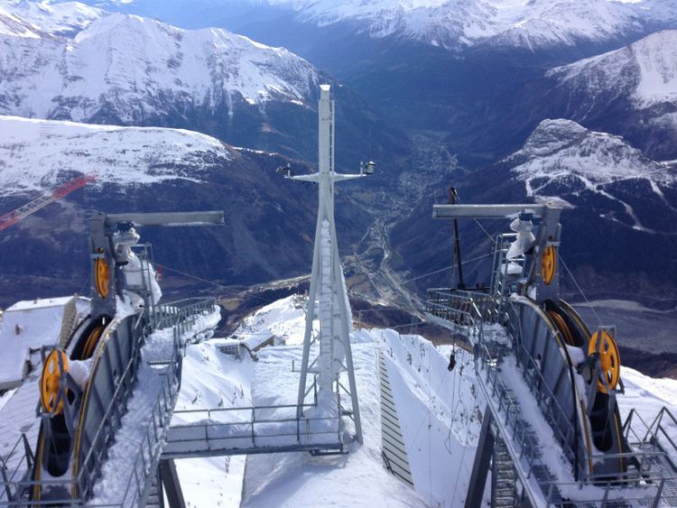
Pointe Helbronner is served on the Italian side by the Skyway Monte Bianco (Funivie Monte Bianco), a cable car from La Palud, a village 2.5 kilometres (1.6 mi) north of the town of Courmayeur in the Aosta Valley. Pointe Helbronner is also served by the Vallee Blanche Aerial Tramway, which crosses from the peak to the nearby peak of Aiguille du Midi in France—a peak-to-peak distance of 5 km (3.1 mi). This, in turn, gives access to the French Téléphérique de l'Aiguille du Midi, the cable car connecting Aiguille du Midi to the French village of Chamonix, Courmayeur's sister "city".
The Funivie Monte Bianco station platform on Pointe Helbronner offers a remarkable view over the Aosta Valley and the Piedmont region. The French-Italian border splits this platform.
Pointe Helbronner is the starting point of a ski run via the Glacier du Géant and the Mer de Glace to Montenvers and Chamonix. The mountain is the starting point of various routes to other mountains on the Mont Blanc massif, with many mountaineers staying at the nearby Refuge Torino.