
Phone +1 888-327-2757 | ||
 | ||
Address 5551 Giant Hwy, Richmond, CA 94806, USA Hours Open today · 7AM–4PMWednesday7AM–4PMThursday7AM–4PMFriday7AM–4PMSaturday7AM–4PMSunday7AM–4PMMonday7AM–4PMTuesday7AM–4PMSuggest an edit Similar Point Isabel Regional, Wildcat Canyon Regional, Miller/Knox Regional Shoreline, Hayward Regional Shoreline, Brooks Island | ||
Point pinole regional shoreline
The Point Pinole Regional Shoreline is a regional park on the shores of the San Pablo Bay, California (the northern arm of the San Francisco Bay). It is approximately 9 square kilometers (2,200 acres) in area, and is operated by the East Bay Regional Park District.
Contents
Flying around point pinole regional shoreline san pablo bay
History
Point Pinole is located in the city of Richmond, California. It is on the site of a number of former explosives factories; the largest of these was operated by the Giant Powder Company, which was relocated to this relatively remote spot following accidental explosions at its former sites in San Francisco and at Albany Hill. Although the factory operated until 1960, little trace of it now remains, other than its former tramway grades, which provide a network of nearly 20 kilometers (12 mi) of gently sloping paths for hiking, cycling and horse-riding. The other relic of the park's industrial past are the large number of eucalyptus glades which were planted around the factory site "for safety reasons" (as the park literature mysteriously states.). The eucalyptus was planted in strategic groves between the Giant Powder Company and the town to block the sound and smell of occasional explosions.
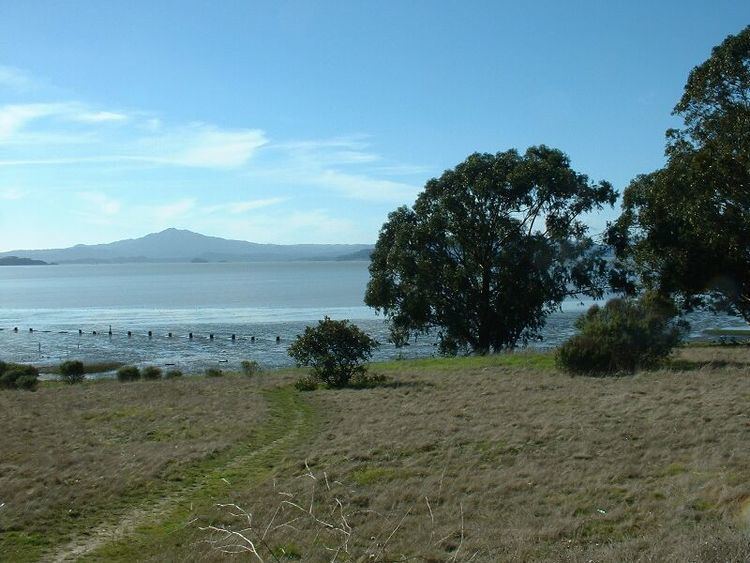
The park features the promontory of Point Pinole, located where the East Bay shoreline turns from running south towards Berkeley and Oakland to running eastwards, inland. Geologically, it is a result of movement on the Hayward Fault which runs along its western edge, creating a low scarp. It offers superb views across the bay in all directions, towards San Francisco to the southwest, Mount Tamalpais and the Marin Headlands to the northwest, and inland across San Pablo Bay to the north and east. Fresh and ocean waters mix at this point, so the marine life is rich; a leisure pier has been built at the end of promontory, replacing a former jetty used by the factories, and is a popular location for angling.
The parks trails are flat and not at all challenging, there is a $3 parking fee and a $2 per dog fee.
In 2009 the park acquired the Breuner Marsh site and added it to the Point Pinole Regional Shoreline park.
Environment and wildlife
The park is a mixture of grassland and woodland, with beaches and low cliffs, and it has a particularly rich bird life, including many ducks and shorebirds, and the endangered black rail. It is located on the Pacific Flyway, so many migrant species are also seen.
The park is located on the Hayward Fault, whose exact position is marked by monuments erected by the United States Geological Survey. The USGS has a seismometer posted along the Union Pacific Railroad, which divides the park from the mainland; the park is reached via a bridge across the railroad.
The San Francisco Bay Trail runs through the park. The park can be reached by the AC Transit bus service, by car, or by bicycle. Pedestrian and cyclist admission is free, but there is a parking fee.