
Area 654.3 km² | Highest elevation 476 m (1,562 ft) Elevation 476 m Archipelago Balearic Islands | |
 | ||
Points of interest Es Vedrà, Port de Sant Miguel, Sa Talaiassa, Platja d'en Bossa, Cala Tarida | ||
The Pityusic Islands, often referenced simply as the Pityuses (Catalan: Pitiüses [pitiˈuzəs], Spanish: Pitiusas; from the Greek πιτύα pitýa, pine tree), or commonly but informally (and ambiguously) as the Pine Islands, is the name given collectively to the Balearic islands of Ibiza (Catalan: Eivissa), Formentera, S'Espalmador and other small islets in the Mediterranean Sea.
Contents
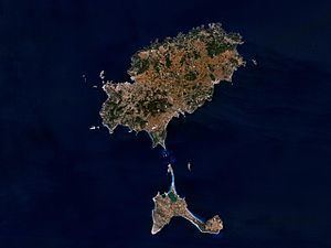
Map of Pityusic Islands, 07860, Balearic Islands, Spain
Geography
The islands are situated approximately 100 kilometres (62 miles) southwest of the island of Majorca, and approximately 80 km (50 mi) east of the Cap de la Nau in the Iberian Peninsula.
History
In antiquity they were known as the Pityusa islands, listed in Claudius Ptolemy's Geography, under the names Ophiusis and Ebyssus, which had a town of the same name. The islands were used by Cilician pirates as a base. The Roman general Annius drove them out with a large fleet and with them the Roman renegade general Quintus Sertorius, who was seeking refuge there.
Administration
The Pine Islands are sometimes grouped together as part of the Balearic Islands, or else considered separate with the Balearics proper being Majorca and Minorca (which together with their islets form the Gymnesian Islands). Politically, they are part of the autonomous community of the Balearic Islands.
Initially, they were administratively part of the same insular council (of Ibiza and Formentera), but since 2007 they are now separated between the insular council of Ibiza and the insular council of Formentera (each one is also assimilated to a single comarca), which are two of the four main administrative subdivisions of the province (and autonomous community) of the Balearic Islands.