Trail difficulty Easy Length 74,000 m | Season All year Round | |
Trailheads Knettishall (near Thetford)Holme-next-the-Sea | ||
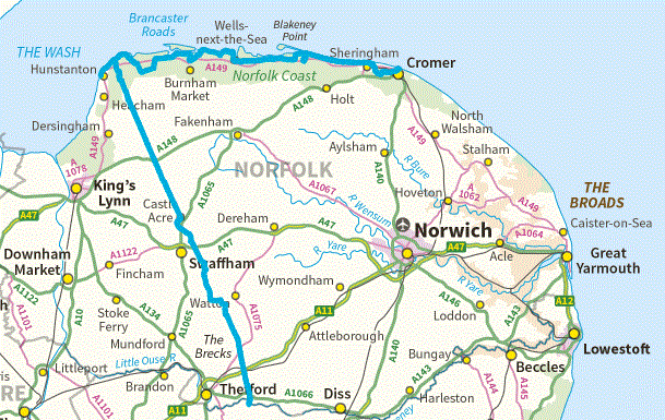
The Peddars Way is a long distance footpath in Norfolk, England. It is 46 miles (74 km) long and follows the route of a Roman road. It has been suggested by more than one writer that it was not created by the Romans but was an ancient trackway, a branch or extension of the Icknield Way, used and remodelled by the Romans. The name is said to be derived from the Latin pedester – on foot. It is first mentioned on a map of 1587 AD. It starts at Knettishall Heath in Suffolk (near the Norfolk-Suffolk border, about 7 km or 4 mi east of Thetford), and it links with the Norfolk Coast Path at Holme-next-the-Sea.
Contents
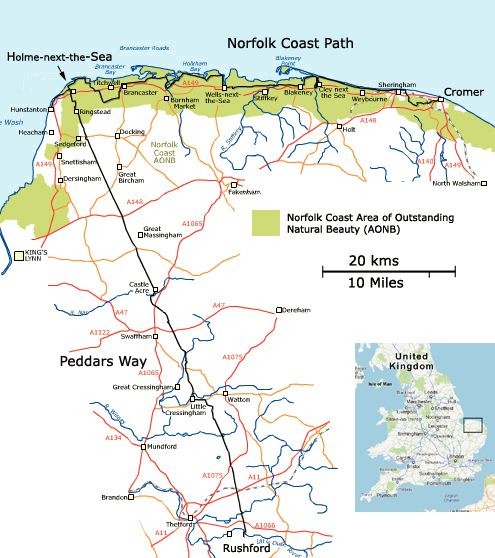
Combined with the Norfolk Coast Path, it forms the Peddars Way & Norfolk Coast Path National Trail, one of 15 National Trails in England and Wales, and the two paths together run for 97 miles (156 km).
It is one of four long distance footpaths which, when combined, run from Lyme Regis to Hunstanton and are referred to as the Greater Ridgeway. At Knettishall Heath the Peddars Way links with the Icknield Way Path for 110 miles south west to Ivinghoe Beacon in Buckinghamshire.
The peddars way and coastal path
Guide and waymarks
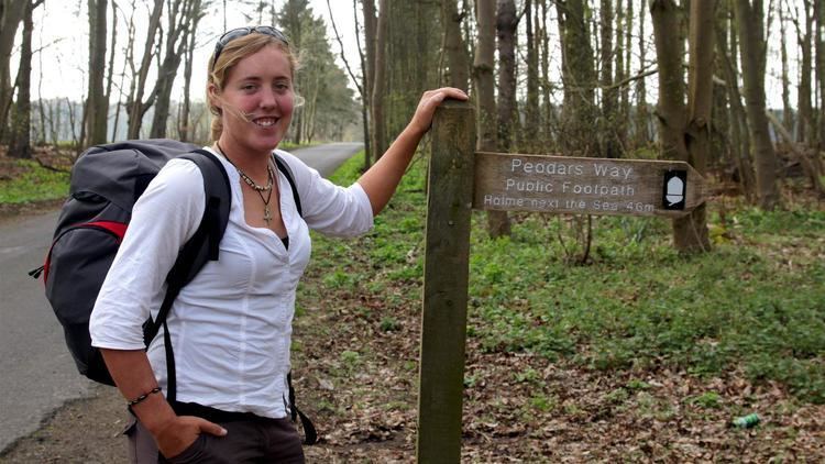
A detailed 144-page guide, including 1:25 000 maps from the Ordnance Survey, and described south to north, is published in the series of National Trail Guides. The trail is very well marked with two general types of waymarker along the length of the route. At junctions there are signs marked ‘Peddars Way’ on plain wood fingerposts. Elsewhere white, yellow and green discs are used bearing the acorn sign used on such long distance routes.
Public transport
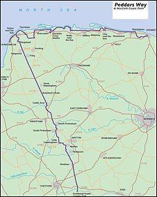
The Peddars Way may be accessed by public transport. There is a path linking the southern end, at Knettishall Heath, to the nearby Harling Road railway station. Holme, at the northern end, has a regular bus service to King's Lynn and Hunstanton. Holme also has a regular bus service to Sheringham. Both King's Lynn and Sheringham allow onward connections using their regular rail services.
Folklore
The Peddars Way was traditionally supposed to be a haunt of the ghostly East Anglian hound, Black Shuck.