Season All year Use Hiking | Length 177,028 m | |
 | ||
Designation Long-distance footpaths in the United Kingdom Trailheads Similar Knettishall Heath , Ivinghoe Beacon , The Ridgeway | ||
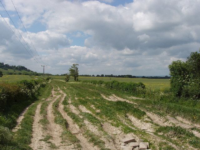
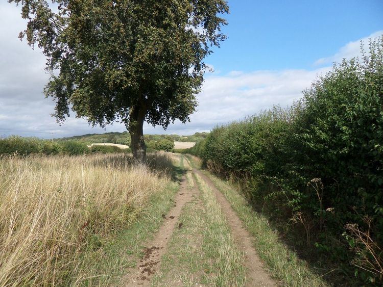
The Icknield Way Path or Icknield Way Trail is a long distance footpath in East Anglia, England. The ancient Icknield Way itself is unique among long-distance trails because it can claim to be ‘the oldest road in Britain’. It consists of prehistoric pathways, ancient when the Romans came; the route is dotted with archaeological remains. It survives today in splendid tracks and green lanes along the ‘chalk spine’ of southern England.
How England's Oldest Road Was Nearly Lost Forever
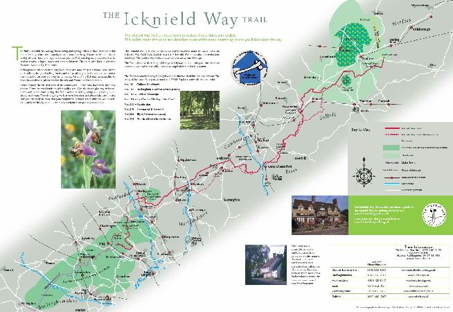
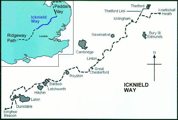
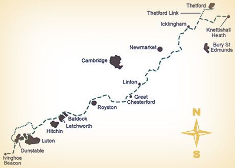
The Icknield Way Path runs for 110 miles (177 km) from the end of the Ridgeway at Ivinghoe Beacon in Buckinghamshire, to the start of the Peddars Way at Knettishall Heath in Suffolk. The Icknield Way Association has aimed to find the most pleasant route for walking, as close as possible to the general line of the ancient Icknield Way.
The Path connects with: Angles Way, Bunyan Trail, Chiltern Way, Harcamlow Way, Hertfordshire Chain Walk, Hertfordshire Way, Peddars Way, Ridgeway, Stour Valley Path and Swan's Way.
The path was devised by the Icknield Way Association and supported by the Ramblers Association. It was part of a plan to achieve National Trail status for the whole length of the ancient trackways linking the South Coast and The Wash. The path was recognised by local authorities in 1992.
In 2004 the Icknield Way was further developed into a multi-use route so that most of the route is also available for horse riders and off-road cyclists providing a complete walking and riding link between the two National Trails. Crossing six counties, the Icknield Way Trail is a multi-use route extending 170 miles (274 km), connecting the Peddars Way National Trail in Suffolk to the Ridgeway National Trail in Buckinghamshire, which further connects to the Wessex Ridgeway. The trail primarily adheres to the Icknield Way Path designated for walkers but deviates in various places to incorporate bridleways, byways, and, where required, roads, making it accessible for more diverse usage. While the trail offers these broader access routes, walkers have the advantage of utilizing footpaths, allowing them to choose more direct or scenic paths.
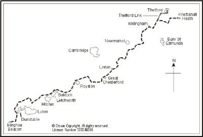
Commencing at Ivinghoe Beacon with places en route: Dagnall, Whipsnade Tree Cathedral, Dunstable Downs, Dunstable, Houghton Regis, Wingfield, Chalgrave, Toddington, M1 motorway, Upper Sundon, Streatley, Warden Hills, Galley and Warden Hills, Pirton, Ickleford, Letchworth, Baldock, Wallington, Sandon, Therfield, Royston, Heydon, Elmdon, Great Chesterford, Linton, Balsham, Burrough Green, Stetchworth, Cheveley, Ashley, Dalham, Gazeley, Tuddenham, Icklingham, Euston and finishing at Knettishall Heath Country Park.