
Elevation 330 m Local time Saturday 3:42 AM | Population 6,842 (2016) Province Alberta | |
 | ||
- right Parsnip River, Pine River, Kiskatinaw River, Pouce Coupé River, Smoky River, Wabasca River, Mikkwa River - average 2,110 m/s (74,514 cu ft/s) Weather -4°C, Wind NE at 6 km/h, 87% Humidity | ||
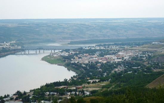
Peace river alberta canada
The Peace River (French: rivière de la Paix) is a river in Canada that originates in the Rocky Mountains of northern British Columbia and flows to the northeast through northern Alberta. The Peace River flows into the Slave River, a tributary of the Mackenzie River. The Mackenzie is the 12th longest river in the world, preceded by the Mekong and followed by the Niger River. The Finlay River, the main headwater of the Peace River, is regarded as the ultimate source of the Mackenzie River.
Contents
- Peace river alberta canada
- Map of Peace River AB Canada
- History
- Post Settlement
- Course
- Communities
- Tributaries
- References
Map of Peace River, AB, Canada
History
The regions along the river are the traditional home of the Danezaa people, called the Beaver by the Europeans. The fur trader Peter Pond is believed to have visited the river in 1785. In 1788 Charles Boyer of the North West Company established a fur trading post at the river's junction with the Boyer River.
In 1792 and 1793, the explorer Alexander Mackenzie travelled up the river to the Continental Divide. Mackenzie referred to the river as Unjegah, from a native word meaning "large river".
The decades of hostilities between the Danezaa and the Cree, (in which the Cree dominated the Danezaa), ended in 1781 when a smallpox epidemic decimated the Cree. The Treaty of the Peace was celebrated by the smoking of a ceremonial pipe. The treaty made the Peace River a border, with the Danezaa to the North and the Cree to the South.
In 1794, a fur trading post was built on the Peace River at Fort St. John; it was the first non-native settlement on the British Columbia mainland.
Post-Settlement
The rich soils of the Peace River valley in Alberta have been producing wheat crops since the late 19th century. The Peace River region is also an important centre of oil and natural gas production. There are also pulp and paper plants along the river in Alberta and British Columbia.
The Peace River has two navigable sections, separated by the Vermilion Chutes, near Fort Vermilion. The first steam-powered vessel to navigate the Peace River was the Grahame, a Hudson's Bay Company vessel built at Fort Chipewyan, on Lake Athabasca. Brothers of the Oblate Order of Mary Immaculate, built the St. Charles, to navigate the upper reaches of the River, from Fort Vermilion to Hudson's Hope. Approximately a dozen vessels were to navigate the river. Most of the early vessels were wood-burning steamships, fueled by wood cut from the river's shore. The last cargo vessel was the Watson's Lake, retired in 1952.
Course
This river is 1,923 kilometres (1,195 mi) long (from the head of Finlay River to Lake Athabasca). It drains an area of approximately 302,500 square kilometres (116,800 sq mi). At Peace Point, where it drains in the Slave River, it has an annual discharge of 68.2 billion cubic metres (55,300,000 acre·ft).
A large man-made lake, Williston Lake, has been formed on the upper river by the construction of the W. A. C. Bennett Dam for hydroelectric power generation. The river then flows into Dinosaur Lake, which serves as a reservoir for the Peace Canyon Dam. After the dams, the river flows east into Alberta and then continues north and east into the Peace-Athabasca Delta in Wood Buffalo National Park, at the western end of Lake Athabasca. Water from the delta flows into the Slave River east of Peace Point and reaches the Arctic Ocean via the Great Slave Lake and Mackenzie River.
Communities
Communities located directly on the river include:
Many provincial parks and wildland reserves are established on the river, such as Butler Ridge Provincial Park, Taylor Landing Provincial Park, Beatton River Provincial Park, Peace River Corridor Provincial Park in British Columbia and Dunvegan Provincial Park, Dunvegan West Wildland, Peace River Wildland Provincial Park, Greene Valley Provincial Park, Notikewin Provincial Park, Wood Buffalo National Park in Alberta.
A few Indian reserves are also located on the river banks, among them Beaver Ranch 163, John D'Or Prairie 215, Fox Lake 162, Peace Point 222 and Devil's Gate 220.
Tributaries
Tributaries of the Peace River include: