
Basin countries Canada Surface elevation 156 m | Area 27,200 km² Length 480 km | |
 | ||
Primary inflows Catchment area 971,000 km (374,905 sq mi) Fish Northern pike, Lake trout, Arctic grayling, Lake whitefish Cities Similar Great Bear Lake, Yellowknife River, Giant Mine, Nahanni National Park Res, Prince of Wales Northern | ||
Canada s best fishing frontier fishing lodge great slave lake
The Great Slave Lake (French: Grand lac des Esclaves) is the second-largest lake in the Northwest Territories of Canada (after Great Bear Lake), the deepest lake in North America at 614 metres (336 fathoms; 2,014 ft), and the tenth-largest lake in the world. It is 469 km (291 mi) long and 20 to 203 km (12 to 126 mi) wide. It covers an area of 27,200 km2 (10,502 sq mi) in the southern part of the territory. Its given volume ranges from 1,070 km3 (260 cu mi) to 1,580 km3 (380 cu mi) and up to 2,088 km3 (501 cu mi) making it the 10th or 12th largest.
Contents
- Canada s best fishing frontier fishing lodge great slave lake
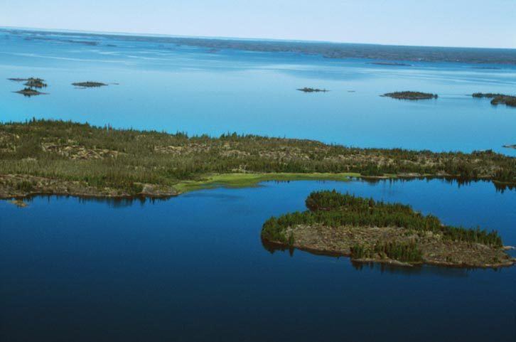
- Map of Great Slave Lake Northwest Territories Canada
- Trophy fishing in canada s far north dream trip to great slave lake
- History
- Geography and natural history
- Bodies of water and tributaries
- Ice road
- Ice Lake Rebels
- References
Map of Great Slave Lake, Northwest Territories, Canada
The lake shares its name with the Slavey First Nations. Towns situated on the lake include: Yellowknife, Hay River, Behchoko, Fort Resolution, Lutselk'e, Hay River Reserve, Dettah, and N'Dilo. The only community in the East Arm is Lutselk'e, a hamlet of about 350 people, largely Chipewyan Aboriginals of the Dene Nation and the now abandoned winter camp/Hudson's Bay Company post, Fort Reliance. Along the south shore, east of Hay River is the abandoned Pine Point Mine and the company town of Pine Point.
Trophy fishing in canada s far north dream trip to great slave lake
History
North American Aboriginal Peoples were the first settlers around the lake after the retreat of glacial ice. Archaeological evidence has revealed several different periods of cultural history, including: Northern Plano Palaeoindian tradition (8,000 years before present), Shield Archaic (6,500 years), Arctic Small Tool Tradition (3,500 years), and the Taltheilei Shale Tradition (2,500 years before present). Each culture has left a distinct mark in the archaeological record based on type or size of lithic tools.
Great Slave Lake was put on European maps during the emergence of the fur trade towards the northwest from Hudson Bay in the mid 18th century. The name 'Great Slave' came from the Slavey Indians, one of the Athapaskan tribes living on its southern shores at that time. The name was influenced by Cree disdain for this rival tribe, with whom they shared a sordid history. As the French explorers dealt directly with the Cree traders, the large lake was referred to as "Grand lac des Esclaves" which was eventually translated into English as "Great Slave Lake".
British fur trader Samuel Hearne explored Great Slave Lake in 1771 and crossed the frozen lake, which he named Lake Athapuscow. In 1897-1898, the American frontiersman Charles "Buffalo" Jones traveled to the Arctic Circle, where his party wintered in a cabin that they had constructed near the Great Slave Lake. Jones's exploits of how he and his party shot and fended off a hungry wolf pack near Great Slave Lake was verified in 1907 by Ernest Thompson Seton and Edward Alexander Preble when they discovered the remains of the animals near the long abandoned cabin.
In the 1930s, gold was discovered on the North Arm of Great Slave Lake, leading to the establishment of Yellowknife which would become the capital of the NWT. In 1960, an all-season highway was built around the west side of the lake, originally an extension of the Mackenzie Highway but now known as Yellowknife Highway or Highway 3. On January 24, 1978, a Soviet Radar Ocean Reconnaissance Satellite, named Kosmos 954, built with an onboard nuclear reactor fell from orbit and disintegrated. Pieces of the nuclear core fell in the vicinity of Great Slave Lake. 90% of the nuclear debris was recovered by a joint Canadian Armed Forces and United States Armed Forces military operation called Operation Morning Light.
Geography and natural history
The Hay, Slave and Taltson Rivers are its chief tributaries. It is drained by the Mackenzie River. Though the western shore is forested, the east shore and northern arm are tundra-like. The southern and eastern shores reach the edge of the Canadian Shield. Along with other lakes such as the Great Bear and Athabasca, it is a remnant of the vast glacial Lake McConnell.
The East Arm of Great Slave Lake is filled with islands, and the area is within the proposed Thaydene Nene National Park. The Pethei Peninsula separates the East Arm into McLeod Bay in the north and Christie Bay in the south. The lake is at least partially frozen during an average of eight months of the year.
The main western portion of the lake forms a moderately deep bowl with a surface area of 18,500 km2 (7,100 sq mi) and a volume of 596 km3 (143 cu mi). This main portion has a maximum depth of 187.7 m (616 ft) and a mean depth of 32.2 m (106 ft). To the east, McLeod Bay (62°52′N 110°10′W) and Christie Bay (62°32′N 111°00′W) are much deeper, with a maximum recorded depth in Christie Bay of 614 m (2,014 ft)
On some of the plains surrounding Great Slave Lake, climax polygonal bogs have formed, the early successional stage to which often consists of pioneer black spruce.
South of Great Slave Lake, in a remote corner of Wood Buffalo National Park, is the Whooping Crane Summer Range, a nesting site of a remnant flock of whooping cranes, discovered in 1954.
Bodies of water and tributaries
Rivers that flow into Great Slave Lake include (going clockwise from the community of Behchoko);
Ice road
Great Slave Lake has one ice road known as the Dettah ice road. It connects the Northwest Territories capital of Yellowknife to Dettah, a small First Nations fishing community also in the Northwest Territories.
Ice Lake Rebels
As of July 2014, the Animal Planet documentary series Ice Lake Rebels takes place on Great Slave Lake, and details the lives of houseboaters on the lake.