
Country United States Elevation 235 m Local time Saturday 12:21 AM | GNIS feature ID 453711 Area 104.8 km² Population 1,691 (2010) | |
 | ||
ZIP codes 46926, 46962, 46974, 46990, 46992 Weather 16°C, Wind S at 16 km/h, 76% Humidity | ||
Paw Paw Township is one of seven townships in Wabash County, Indiana, United States. As of the 2010 census, its population was 1,691 and it contained 683 housing units.
Contents
- Map of Paw Paw Township IN USA
- History
- Geography
- Cities towns villages
- Unincorporated towns
- Adjacent townships
- Cemeteries
- School districts
- Political districts
- References
Map of Paw Paw Township, IN, USA
History
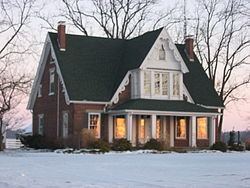
The Halderman-Van Buskirk Farmstead, Roann Covered Bridge, Roann Historic District, and Stockdale Mill are listed on the National Register of Historic Places.
Geography
According to the 2010 census, the township has a total area of 40.47 square miles (104.8 km2), of which 40.26 square miles (104.3 km2) (or 99.48%) is land and 0.21 square miles (0.54 km2) (or 0.52%) is water.
Cities, towns, villages
Unincorporated towns
(This list is based on USGS data and may include former settlements.)
Adjacent townships
Cemeteries
The township contains these seven cemeteries: Abshire, Algers, Gamble, Independent Order of Odd Fellows, Jack, Long and Reeds.
School districts
Political districts
References
Paw Paw Township, Wabash County, Indiana Wikipedia(Text) CC BY-SA