
Parent range Vindhyachal Range Last eruption 500 million years ago Elevation 800 m | Mountain type Hill Easiest route Ropeway | |
 | ||
Similar | ||
Pavagadh hill
Pavagadh Hill is situated within a plain in Panchmahal district, Gujarat, western India. At its base is the historical city of Champaner, while the hill station of Pavagadh was built upon the volcanic cone itself. A volcanic eruption occurred here approximately 500 million years ago and the etymology of its name is associated with eruption: Pavgadh means "one fourth hill" or "fire-hill", though a legend surrounding its formation is that the right foot of Sati is believed to have fallen at Pavagadh and God "sent a large hill as per the request of Rishi Vishwamitra to fill up a deep valley so that the sage's cows do not fall into it." With Champaner, Pavagadh hill forms the Champaner-Pavagadh Archaeological Park, which is spread over an area of more than 1,329 hectares (3,280 acres). The site is 50 kilometres (31 mi) east of Vadodara and 42 miles (68 km) south of Godhra.
Contents
Pavagadh hill station
Geography
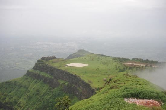
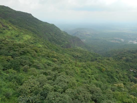
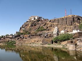
The hill is a southern Aravalli Range outlier, rising 800 metres (2,600 ft) above the surrounding plains. The Dhadhar River and Vishwamitri River originate on the hill. The Surya stream, which also rises on the hill, joins the Vishvamitri. There are five successive plateaus, Kalikamata Plateau, Mauliya Plateau, Bhadrakali Plateau, Machi Plateau and Atak Plateau. Plateau reservoirs (talaos) form a chain up the hill. Other features include dense forest, reddish-orange rhyolite boulders, and a natural cave just below the summit. Strong monsoon breezes blow winds upwards onto steep hill slopes.
The arrangement of the rock formations of Pavagadh Hill is stated as being "rhyolite, green bedded tuffs, porphyritic basalt, olivine dolerite and nonporphyritic alkaline basalt." There are steep rock exposures whose geological formation is attributed to ancient volcanic eruptions and lava flows. Pavagadh Hill has a geological setting of reddish-yellow coloured stone, and is considered to be one of the oldest rock formations in India.
The geological formation of Pavagadh Hill is thus very complex. It is interpreted as part of the Deccan Traps, which arose from the "tumultuous outpour of lava beyond 106 cubic km in volume. Eruption is deduced to have occurred 69-65 Ma age. These basaltic rocks said to be one of the largest continental flood basaltic provinces in the world." Studies carried by geologists have indicated eleven basic flows superposed by felsic volcanics. New varieties of rocks such as "rhyodycite, alkal-olivine basalt, mugearite and ankaramite" are reported. It is also recorded that except for rhyolite, all the rocks have an "alkaline-oloivine lineage." Geologists have also observed that "seventeen horizontal flows have occurred in Pavagadh and postulated that the "whole series resulted by fractionalism in two episodes."
The highest point of the hill presents an undulating forested topography in the direction of Jambughoda. The path ascending the hill passes through many old gates and cuts through natural ledges of rock like a staircase, with precipitous sides. Midway up this path is a flat ground which is strewn with boulders. The mountain above the flat ground is a very steep hill scarp.
Transportation
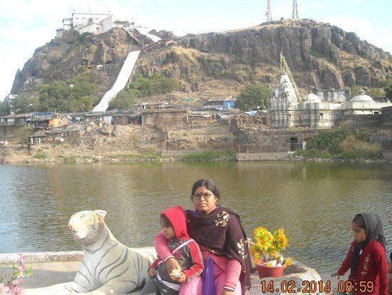
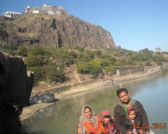
While private vehicles are not allowed, registered buses and government vehicles provide transportation up the hill. As the road ends before reaching the summit, there are only two options to reach the top, either on foot or by ropeway. The mono-cable ropeway is 740 metres (2,430 ft) in length. It can carry 1,200 people per hour. It is stated to be the country's highest ropeway, connecting the summit of the hill with the plateaus of Champaner.
History and legends
Human settlement occurred around the second century after the hill became associated with the goddess Kali. It is believed that the foot of Parvati fell on this hill, making it sacred. Legend states that the hill's formation is attributed to the sage Vishwamitra Rishi, who lived here in bygone days. He had a cow named Kamadhenu who could speak and yielded lots of milk. One day, the cow slipped while grazing and fell into the valley, which resulted in the cow attempting to scramble up the hill. Finally she produced milk, which filled the valley, and swam to higher ground. The Rishi came to know of this mishap, and in order to prevent any such incident in the future, he prayed to the gods to fill the valley. The gods fulfilled his prayers with one fourth of a hill projecting out of the plains, Pavagadh Hill.
Known for its forts, there are also dozens of heritage structures on the hill. It is part of the Champaner-Pavagadh Archaeological Park, a UNESCO World Heritage Site.
Jain temples
The temples of Jainism at Pavagadh are also noteworthy. They fall into three different groups: The first consists of the Bhavanaderi temples near the Naqqarkhana gate called the Navalakka temples, the second group is in honor of the tirthankaras Suparshvanatha and Chandraprabhu and the third group, situated on the south east of Pavagarh Hill (Mataji's cliff), is near the Pārśva temple next to the Dudhia tank. On the basis of their "stylistic and architectural features", the date of construction of these temples is deduced to be the 14th–15th centuries. The temple is made up of pure white stone with elaborately carved seated and standing images of the Jain pantheon are seen on the outer walls of the temples. The Garbabrihas are enshrined with beautiful stone images of tirthankaras in these temples. All the temples have been renovated over time. The temple also has a 30 ft. tall statue of God Bahubali stands tall in it’s vicinity.
The Greek geographer Tolemi, who journeyed to India in the year 140 A.D. regarded this temple as an ancient and holy place. In the year 1483(V.S. 1540), Mohammed Begdo, the Muslim sultan, heavily impaired this temple. In 1880(V.S. 1937) this temple was repaired. This temple is considered very holy. The entire complex houses a Dharmshala or Guest house, a Jain restaurant and gardens.