
Total length 1,300 m | Official name Patapat Viaduct Height 31 m (102 ft) Bridge type Viaduct Body of water Pasaleng Bay | |
 | ||
Maintained by Department of Public Works and Highways(DPWH) Similar Cape Bojeador Lighthouse, Kapurpurawan Rock Formation, Malacañang of the North, Paraiso Ni Anton, Paoay Church | ||
Patapat viaduct pagudpud ilocos norte philippines
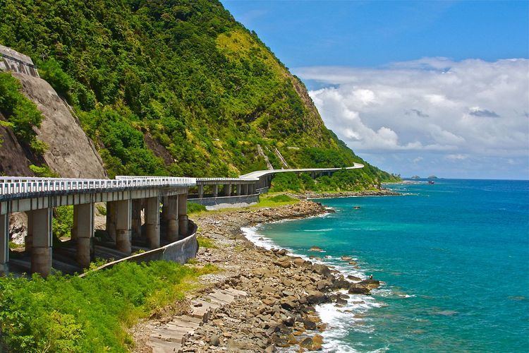
The Patapat Viaduct is a viaduct at the municipality of Pagudpud, Ilocos Norte, a coastal resort town on the northernmost tip of Luzon Island in the Philippines.
Contents
The bridge is elevated 31 meters over sea level. It is a concrete coastal bridge 1.3 km long and connects the Maharlika Highway from Laoag, Ilocos Norte to the Cagayan Valley Region. The viaduct was constructed by Hanil Development Co. Ltd. under the overall management of DPWH-PMO-PJHK and was completed and opened to traffic in October 1986. It rises along the town's coastal mountains, which is the starting point of the Cordillera Mountain Range that snakes through Northern Luzon. It is the 4th longest bridge in the Philippines.
Patapat viaduct roadtoclaveria
References
Patapat Viaduct Wikipedia(Text) CC BY-SA