
Country Area 14.60 km2 District East Siang | Language spoken State | |
 | ||
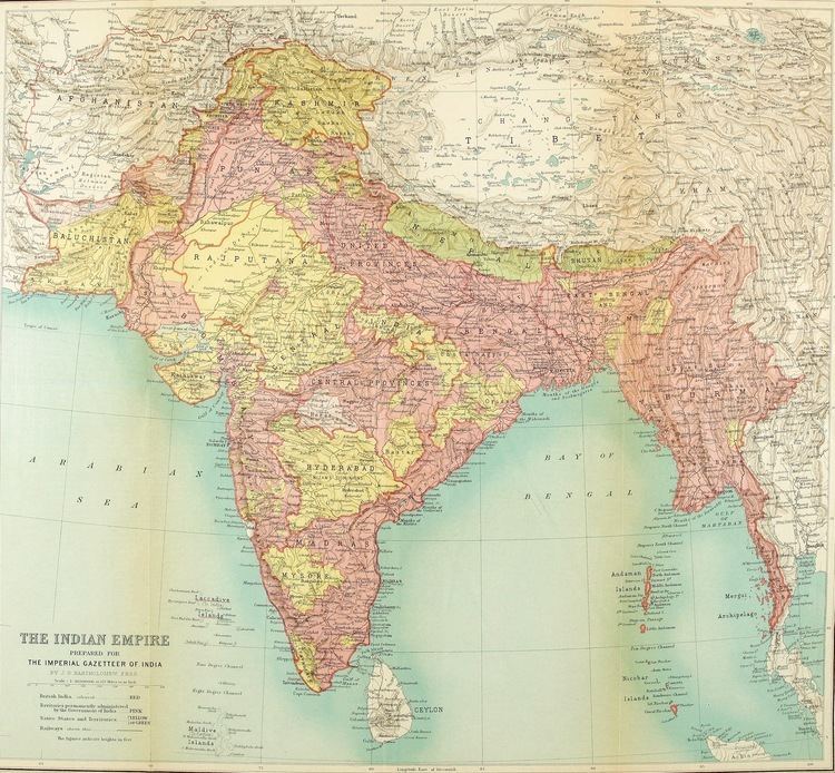
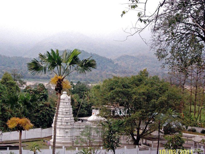
Map of Pasighat
Pasighat is the headquarter of East Siang district in the Indian state of Arunachal Pradesh. Situated at 155 meters above mean sea level, Pasighat is Arunachal's oldest town. Government of India announced to develop the town into Smart City in its 3rd list of smart cities.
Contents
- Map of Pasighat
- Shri narendra modi addresses vijay sankalp abhiyan rally in pasighat arunachal pradesh hd
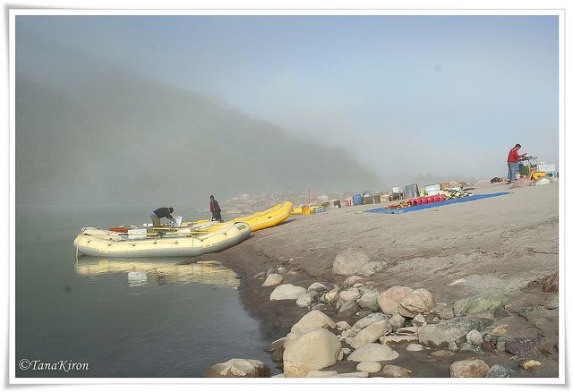
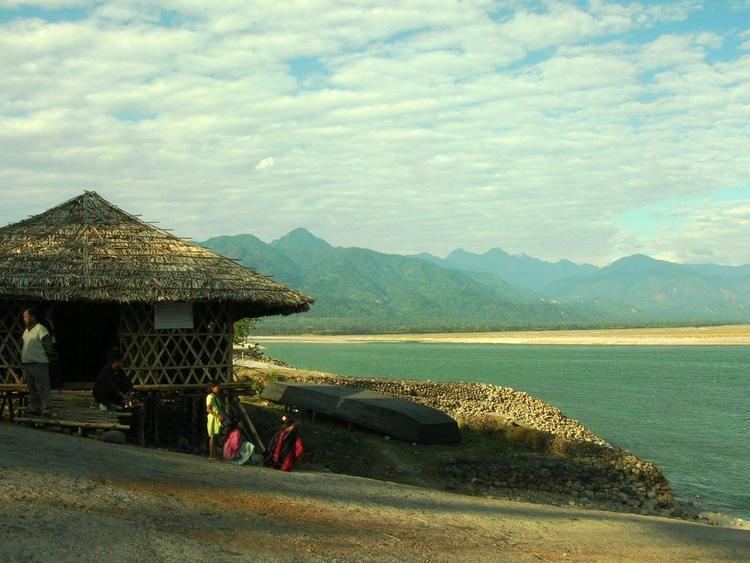
- Pasighat to roing 18
- History
- Geography
- Economy
- Demography
- Culture
- Connectivity
- Tourism
- Arunachali woman preparing food
- References
Shri narendra modi addresses vijay sankalp abhiyan rally in pasighat arunachal pradesh hd
Pasighat to roing 18
History
Pasighat was founded in 1911 A.D. by the British Raj as a gateway to administrative convenience of the greater Abor Hills and the north area in general. Primarily there were settlements of Adi tribesmen who are still living in the villages in and around Pasighat. Year 2011 (January) marked 100 years of its existence.
Cognizance of Pasighat emerged due to the last Anglo-Abor War that was fought in 1912 subsequent to fourth Anglo-Abor War in 1894. This necessitated the first ever administrative headquarters being established here with an Assistant Political Officer posted. In the post-independent Era, Pasighat is credited with the first Airfield (near Paglek, P.I. Line) established in 1946. The first Agricultural Institute in Arunachal Pradesh was also established at Pasighat in 1950. Other forms of later infrastructural development include:
Early proponents for shifting the state capital from Shillong (the then NEFA), underlined Pasighat's better infrastructure. However, the privilege was lost to the present capital Itanagar in 1974. The only significant development in Pasighat that came after that was the College Of Horticulture and Forestry Central Agriculture University established on 7 March 2001.
Geography
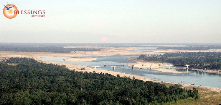
Pasighat is located at 28.07°N 95.33°E / 28.07; 95.33. It has an average elevation of 153 metres (501 ft). The area experiences tropical humid climate during summer and dry mild winter. The area receives heavy rainfall every year during the monsoon season, starting from May until September. The unique trough like features surrounded by high hills on all three sides make this place ideal for attracting rain bearing cloud which come in from the Assam plain. The rain bearing wind gets obstructed by the hills and brings heavy downpour. Winter is marked by cold dry local seasonal wind which blows throughout the winter. This factor contributes in making this place fog-free even in winter. The Brahmaputra emerges from the foothills under the name of Dihang or Siang. It enters India as Dihang, west of Sadiya town in Arunachal Pradesh. Flowing south-west, it receives its main left bank tributaries, viz. Dibang and Lohit; thereafter, it is known as the Brahmaputra. Then it crosses the Pasighat area heading for the Assam plains.
Economy
Agriculture is the main occupation of local people. Rice is the main food crop produced in the area. There are several large tea gardens in the vicinity of the town which attract workers from all over the region. Lumbering was a big sustaining industry till the Supreme Court clamped down on the industry during the nineties. There is also a bit of tourism in Pasighat, being the oldest town in Arunachal Pradesh. Agriculture, horticulture and tourism continue to be the main source of economy for the town.
Demography
As of 2001 India census, Pasighat had a population of 21,972. Males constitute 53% of the population and females 47%. Pasighat has an average literacy rate of 64%, higher than the national average of 59.5%: male literacy is 71%, and female literacy is 56%. In Pasighat, 15% of the population is under 6 years of age.
Pasighat is predominantly inhabited by the Adi people who are known for their colourful Ponung dance and war dance called Taapu. Pasighat is also ideal for adventure sports activities. The Daying Ering Wildlife Sanctuary is 13 km away and is worth visiting. The archaeological site of Malinithan (100 km) in neighbouring West Siang district is linked to the legend of Lord Krishna and his wife Rukmini. The dismembered head of Sati (Parvati) is said to have fallen at Akashiganga (100 km according to ancient Hindu myths).
Around 12 km there is a waterfall which is a tourist attraction among the teenage. A 700 m bridge is along the Siang river, where you can see the view of the mountains like never before.
Culture
The people of Pasighat celebrate a variety of festivals. Solung, Aran, Etor etc. are important festivals here. Legend has it that the festival regarded as Solung, which is the principal festival of the Adis, came into existence when the Goddess of wealth, Kiine-Naane had asked them in person to carry out this worship or 'puja'.
Solung is celebrated by the Adis for five days. The first day or the Solung Gidi Dogin is the day when they prepare for this event. Doreph Long, the second day is the day of animal slaughters. Binnyat Binam or the third day is the day of prayers. Taktor of Ekoph is the fourth day and on this day arms and ammunition are manufactured. Miri or the fifth day is the day of farewell. The songs that are sung during Solung are the lyrics of Solung Abang that show the life of humans, animals, plants, etc. Solung is celebrated in the month of September.
Connectivity
Pasighat is connected with road, NH-52 and have frequent services from Guwahati, Lakhimpur or Itanagar. Waterways crossing river Brahmaputra from Dibrugarh by ferry to Oryamghat that is situated at a distance of 32 km from Pasighat and can take a bus or taxi. Nearest rail head is at Murkongselek which is terminal station of the Rangia-Murkongselek broad gauge track, The rail head is proposed to be extended up to pasighat. The BG railway line will link North-Assam area with Pasighat town, the district headquarter of East Siang of Arunachal, located at a rail route distance of 26.5 km. About 24.5 km of the route falls in Arunachal territory. The Rangia- Murkongselek BG conversion (with extension up to Pasighat) project was one of the two major rail projects in Northeast announced by Prime Minister Manmohan Singh during 2010. This broad gauge line is supposed to be proceeding on to Roing, Parsuramkund, Rupai and other places the state. A preliminary engineering-traffic survey for the Pasighat-Tezu-Parshuram Kund was conducted by Northeast Frontier Railways at the request of the state government.Arunachal Pradesh State Transport Services (APSTS) is another means of transportation in the district which is linked with other districts and nearby villages. APSTS buses are also run from Pasighat to Itanagar, the capital of the state, from Pasighat to Shillong, Meghalaya via Guwahati on the daily basis. Bus services are available to Guwahati, Assam which are run by Network travels, Blue Hills travels etc,. Private- owned Winger and Tata Sumo services also run across the district and run in the another districts.
Tourism
Pasighat is the land of the mighty Siang and indigenous hanging bridges. A pleasant waterfall graces the mountain cliffs and chills the vicinity. The places of attraction in the town are: