
Country Population 132,867 (2001) Language spoken Area 64.36 km2 | State District East Khasi Hills | |
Colleges and Universities North Eastern Hill University, Indian Institute of Management Shillong, North Eastern Indira Gandhi Regional Institute of Health and Medical Sciences, CMJ University, St Anthonys College - Shillong | ||
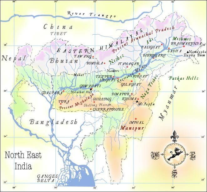
Shillong ( Khasi: Shillong) is the capital and Hill station of Meghalaya, one of the smallest states in India. It is the headquarters of the East Khasi Hills district and is situated at an average altitude of 4,908 feet (1,496 m) above sea level, with the highest point being Shillong Peak at 6,449 feet (1,966 m). Shillong is the 330th most populous city in India with population of 143,007 according to the 2011 census. It is said that the rolling hills around the town reminded the European settlers of Scotland. Hence, Shillong is known as "Scotland of the East". The population density of the state of Meghalaya in the 2000s decade is 342 people per sq mile.
Contents
- Map of Shillong
- Escape to shillong north east india tourist attractions
- Geography
- History
- Places of interest
- References
Map of Shillong
It has steadily grown in size and significance since it was made the civil station of the Khasi and Jaintia Hills in 1864 by the British. In 1874, on the formation of Assam as a Chief Commissioners Province, it was chosen as the headquarters of the new administration because of its convenient location between the Brahmaputra and Surma valleys and more so because the climate of Shillong was much cooler than tropical India. Shillong remained the capital of undivided Assam until the creation of the new state of Meghalaya on 21 January 1972, when Shillong became the capital of Meghalaya and Assam moved its capital to Dispur in Guwahati.
Escape to shillong north east india tourist attractions
Geography
Shillong is at 25.57°N 91.88°E? / 25.57; 91.88. It is on the Shillong Plateau, the only major uplifted structure in the northern Indian shield. The city lies in the centre of the plateau and is surrounded by hills, three of which are revered in Khasi tradition: Lum Sohpetbneng, Lum Diengiei and Lum Shillong.
History
As the legend goes, Shillong was named after a boy called Shyllong, who was born to a virgin mother in a village near Bisi. This boy later became a handsome youth and was made the local deity; and the place was named after him.
The Shillong Municipal Board has a long history dating back to 1878, when a proclamation was issued constituting Shillong and its suburbs, including the villages of Mawkhar and Laban, into a station under the Bengal Municipal Act of 1876. Inclusion of the villages of Mawkhar (S.E. Mawkhar, Jaiaw and part of Jhalupara and Mawprem) and Laban (Lumparing, Madan laban, Kench’s Trace and Rilbong) within the Municipality of Shillong was agreed to by Hain Manik Syiem of Mylliem under the agreement of 15 November 1878. But, there is no trace of Shillong in the British era maps dating back to 1878, up to 1900.
Shillong was also the subject of the great earthquake that occurred on June 12, 1897. The earthquake had an estimated moment magnitude of 8.1. 27 lives from Shillong town alone were lost.
Places of interest
These are locations in and around Shillong which are tourist spots. These include: