
Country South Korea Administrative divisions 5 eup, 9 myeon, 2 dong | Region Sudogwon Population 427,668 (2015) | |
 | ||
Weather 2°C, Wind W at 3 km/h, 74% Humidity Points of interest Heyri Art Valley, Imjingak, Dora Observatory, Mt Ohdu Unification Observatory, Byeokchoji culture Arboretum | ||
Korean style apartment paju city gyeonggi do south korea
Paju ([pʰa.dʑu]) is a city in Gyeonggi Province, South Korea. Paju was made a city in 1997; it had previously been a county (gun).
Contents
- Korean style apartment paju city gyeonggi do south korea
- Map of Paju si Gyeonggi do South Korea
- City symbols
- Natural environment
- Tourist attractions
- Specialties
- Education
- Administrative divisions
- Military bases
- Military cemetery
- Attractions
- Notable people
- In media
- Sister cities
- References
Map of Paju-si, Gyeonggi-do, South Korea
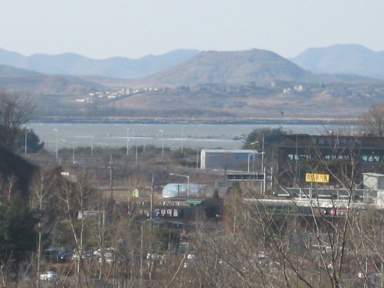
The city area is 672.78km2, and it is located just south of Panmunjeom on the 38th parallel. In 2015, the population of Paju has increased to 427,668. To defend the South Korean capital, Seoul, many U.S. and South Korean army bases are set up in the city. In 2002, the northernmost South Korean railway station, Dorasan, was opened. North Korean territory and Kaesong City can be seen from Mount Dora in the city.
City symbols
Cosmos
• Cosmos is Paju City's representative of flowers growing wild in Spring. It has very strong vitality, and symbolize unity and harmonious life as a citizen of Paju City. The flowers are neat and beautiful with different colors such as pale pink and red.
Gingko
• Ginkgos are large and beautiful trees which are usually planted as street trees. People can obtain high-quality wood from them. Also, their leaves and fruits are used as a valuable medicine. Magnificent view of the trees means prosperity and eternal peace in Paju City.
Pigeon
• Pigeons are meek and gentle with soft feathers which follow humans well. They symbolize the peace and security of mankind, and they mean to desire the unification of the Korean Peninsula and the well-being of citizens .
Badge of Paju City
• The badge brings the look of Paju implicitly. Semiconductors, which symbolize high-tech industry, high-quality culture and books, and life based on the shape of the rice industry have represented the badge with the symbol Paju logo.
Natural environment
Paju city has east and west low type of geographic trait. Many mountains are located in eastern Paju, assemble to create the border with Yangzhou. In northern Paju, mountains form the border with Goyang. Moreover, in central Paju some lower mountains spread toward south. For the major rivers in Paju, there are Imjin River and Han River. Imjin River flows between northern west and west, and Han River flows in western south of Paju. The average annual temperature of Paju is 10.5 ℃, the average January temperature is -4 ℃ and the average temperature is 25 ℃ in August. Lastly, annual precipitation of Paju is around 1,300㎜.
Tourist attractions
•Heyri Art Valley is the largest art village in South Korea. People visit the village to see Korean culture and lots of genres of art. The area includes residences, workrooms and galleries for artists, museums and performance spaces designed by lots of artistic people. It was planned from 1998 and its name Heyri is derived from a traditional farming song of Paju. Architects tried to combine the view of nature with the valley when they make plan. The valley provides lots of entertaining art performances which are diverse to all ages. The attractive theme brings people to visit every weekend, and more people visit the valley in spring and autumn because it holds art festival during the seasons.
Specialties
Jangdan bean
• Jang dan beans is one of Paju’s famous traditional specialties. From a long time ago, crops have been important for Korean people’s livelihood because their land and environment were good for agriculture. Therefore, two major crops, rice and bean, have been developed time by time. Jangdan bean is one of them which has been harvested in Paju. Its name Jangdan is from a name of a village in Paju, which existed before the Korean War. Even the village is gone, people still call the bean as Jangdan bean because the place was used to mainly provide beans. However, in nowadays, Jangdan beans are only can be seen in unification village which is located between South Korea and North Korea. It attracts people to visit because the place is usually limited for civilians.
Education
Paju English Village
• Paju English Village is a huge area which was constructed to teach children English and let them experience western culture. Hundreds of foreign teachers are hired in the village. The educational village pushes ahead various curriculum to provide several educational programs called "English Camp". To attend the programs, kids parents have to pay and send children to the village for several days. The length of the program is depending on the type of program. On the other hand, normal people also like to visit the village because of its visual and new cultural atmosphere.
Administrative divisions
Paju is divided as follows:
Military bases
Military cemetery
The Cemetery for North Korean and Chinese Soldiers was established in 1996 to hold the remains of Korean People's Army and Chinese People's Volunteer Army soldiers killed during the Korean War. In March 2014 the Chinese remains were repatriated for reburial in Shenyang, China.
Attractions
Notable people
In media
Sister cities
Paju is twinned with the following places: