
County Wapello Time zone CST (UTC-6) Local time Monday 8:00 PM Population 24,840 (2013) | Elevation 673 ft (205 m) Area code(s) 641 Zip code 52501 | |
 | ||
Weather 9°C, Wind N at 11 km/h, 87% Humidity Colleges and Universities Indian Hills Community College, Ottumwa Heights College, Iowa School of Beauty | ||
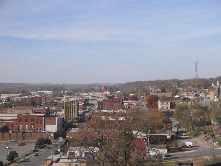
Ottumwa (/əˈtʌmwə/ ə-TUM-wə) is a city in and the county seat of Wapello County, Iowa, United States. The population was 25,023 at the 2010 census. Located in southeastern Iowa, the city is split into northern and southern halves by the Des Moines River.
Contents
- Map of Ottumwa IA 52501 USA
- History
- Presidential visits
- Geography
- 2010 census
- 2000 census
- Video Game Capital of the World
- In popular culture
- Education
- Top employers
- Media
- Radio
- Television stations
- Online
- Transportation
- Railroads
- Historic preservation
- Historic districts
- Historic structures
- Notable people
- Fictional people
- Namesake
- References
Map of Ottumwa, IA 52501, USA
History
The young town was severely damaged during the Flood of 1851.
In 1857, coal was being mined from the McCready bank, a site along Bear Creek four miles west of Ottumwa. In 1868, Brown and Godfrey opened a drift mine four miles northwest of town. By 1872, Brown and Godfrey employed 300 men and had an annual production of 77,000 tons. In 1880, the Phillips Coal and Mining Company opened a mine two miles northwest of town. In subsequent years, they opened 5 more shafts in the Phillips and Rutledge neighborhoods, just north of Ottumwa. The Phillips number 5 shaft was 140 feet deep, with a 375 horse power steam hoist. By 1889, the state mine inspector’s report listed 15 mine shafts in Ottumwa. In 1914, the Phillips Fuel Company produced over 100,000 tons of coal, ranking among the top 24 coal producers in the state.
Coal mining was so important to the local economy that, from 1890 to 1892, the Coal Palace was erected in Ottumwa as an exhibition center.
John Morrell & Company played a significant role in the development of the City of Ottumwa from 1877 to 1973. The complex typified meat packing as it developed in the midwest during the last quarter of the nineteenth century and the first half of the twentieth century.
Presidential visits
Because of the Iowa caucuses, Ottumwa is no stranger to visits by presidential hopefuls. On five occasions a sitting U.S. President has visited the Bridge City:
Geography
Ottumwa's longitude and latitude coordinates in decimal form are 41.012917, −92.414817.
According to the United States Census Bureau, the city has a total area of 16.53 square miles (42.81 km2), of which, 15.86 square miles (41.08 km2) is land and 0.67 square miles (1.74 km2) is water.
Northeastern Wapello County contains large deposits of coal, and there are also large deposits of clay in the region, which played an important role in the industrial development of Ottumwa.
2010 census
As of the census of 2010, there were 25,023 people, 10,251 households, and 6,208 families residing in the city. The population density was 1,577.7 inhabitants per square mile (609.2/km2). There were 11,257 housing units at an average density of 709.8 per square mile (274.1/km2). The racial makeup of the city was 90.2% White, 11.3% Hispanic or Latino, 1.9% African American, 0.6% Native American, 0.9% Asian, 0.2% Pacific Islander, 4.5% from other races, and 1.8% from two or more races.
There were 10,251 households of which 30.0% had children under the age of 18 living with them, 42.1% were married couples living together, 12.9% had a female householder with no husband present, 5.6% had a male householder with no wife present, and 39.4% were non-families. 32.9% of all households were made up of individuals and 14.2% had someone living alone who was 65 years of age or older. The average household size was 2.36 and the average family size was 2.97.
The median age in the city was 37.4 years. 23.3% of residents were under the age of 18; 10.8% were between the ages of 18 and 24; 24.8% were from 25 to 44; 25% were from 45 to 64; and 16% were 65 years of age or older. The gender makeup of the city was 48.4% male and 51.6% female.
2000 census
As of the census of 2000, there were 24,998 people, 10,383 households, and 6,530 families residing in the city. The population density was 1,582.2 people per square mile (610.9/km²). There were 11,038 housing units at an average density of 698.6 per square mile (269.7/km²). The racial makeup of the city was 95.33% White, 1.27% African American, 0.33% Native American, 0.78% Asian, 0.02% Pacific Islander, 1.38% from other races, and 0.89% from two or more races. Hispanic or Latino of any race were 2.76% of the population.
There were 10,383 households out of which 28.1% had children under the age of 18 living with them, 47.8% were married couples living together, 11.3% had a female householder with no husband present, and 37.1% were non-families. 31.1% of all households were made up of individuals and 14.8% had someone living alone who was 65 years of age or older. The average household size was 2.31 and the average family size was 2.88.
Age spread: 22.9% under the age of 18, 10.9% from 18 to 24, 26.1% from 25 to 44, 21.2% from 45 to 64, and 19.0% who were 65 years of age or older. The median age was 38 years. For every 100 females there were 92.8 males. For every 100 females age 18 and over, there were 88.6 males.
The median income for a household in the city was $30,174, and the median income for a family was $37,302. Males had a median income of $31,222 versus $20,934 for females. The per capita income for the city was $16,040. About 10.9% of families and 15.2% of the population were below the poverty line, including 21.3% of those under age 18 and 8.2% of those age 65 or over.
"Video Game Capital of the World"
As the home of Twin Galaxies, Ottumwa was proclaimed the "Video Game Capital of the World" by a mayoral decree issued on November 30, 1982, by Ottumwa Mayor Jerry Parker. The city's proclamation was recognized by U.S. Senator Charles Grassley. In connection with this proclamation, the city hosted the first North American Video Olympics in the fall of 1982. In 2009, the city council and chamber of commerce authorized a steering committee to plan out the International Video Game Hall of Fame museum, which, while not yet built, has inducted several video game industry professionals, developers and designers, and high-scoring players into the Hall of Fame.
In popular culture
Education
Ottumwa High School is part of the Ottumwa public school system.
Ottumwa is the home of Indian Hills Community College, a two-year community college. Between 1928 and 1980, it was also home to Ottumwa Heights College, a women's college that merged with Indian Hills in 1979 to create one institution. Indian Hills is located at the former Ottumwa Heights campus.
Top employers
According to Ottumwa's 2011 Comprehensive Annual Financial Report, the top employers in the city were:
Media
Paired with Kirksville, Missouri, Ottumwa is a media market region, ranked #199 by Nielsen.
Radio
*Some radio stations licensed to other nearby cities.
Television stations
The Ottumwa Courier is the primary daily newspaper,
Online
The Ottumwa Post http://www.ottumwapost.com
Transportation
Amtrak, the national passenger rail system, provides service to the Ottumwa Amtrak station, operating its California Zephyr daily in both directions between Chicago, Illinois, and Emeryville, California, across the San Francisco Bay from San Francisco.
Ottumwa Transit Authority operates bus services throughout the Ottumwa area. The fixed-route system includes five routes and a shopping shuttle. It also operates a para-transit service known as Ottumwa Transit Authority Lift and Job Access Reverse Commute (JARC), a dial-a-ride service geared towards employees. The five routes that operate Monday through Friday are: #1 North, #2 East West, #3 South Residential, #4 South Commercial, and #7 Airport. There are also two routes that operate on Saturday only; no routes operate on Sunday.
10–15 Regional Transit Agency provides a regional dial-a-ride service throughout Appanoose, Davis, Jefferson, Keokuk, Lee, Lucas, Mahaska, Monroe, Van Buren, Wapello and Wayne counties.
Currently, U.S. Route 34 and Iowa Highway 149 serve the town, replacing a former segment of U.S. Highway 63. Route 63 now bypasses the town as part of the Burlington to Des Moines expressway. The Jefferson Street Viaduct over the Des Moines River is listed on the National Register of Historic Places.
Railroads
The BNSF Railway has tracks through Ottumwa. This is a major corridor in the Chicago-Omaha line that is double track, and western coal makes up a large percentage of the freight carried on this line. The BNSF tracks travel under U.S. Highway 34, pass through the business district, under the U.S. Highway 63 bridge, cross the Iowa, Chicago and Eastern Railroad tracks at grade, exit Ottumwa, and later cross over the Des Moines River on their way to Albia, Iowa, and later Omaha, Nebraska.
The Iowa, Chicago & Eastern Railway was acquired by the Canadian Pacific in 2008. Ottumwa is located on the Davenport, Iowa, to Kansas City, Mo. line and is a crew change point.
The Norfolk Southern Railway has trackage rights over the BNSF through Ottumwa.
Historic preservation
Ottumwa has many historic structures as well as several historic districts that are listed on the National Register. The city has an active Historic Preservation Commission that has worked to preserve some of the most important structures in the community since 1989. The following structures and districts are listed on the National Register of Historic Places.