
Country India PIN 673582 | Time zone IST (UTC+5:30) Telephone code 91495228 | |
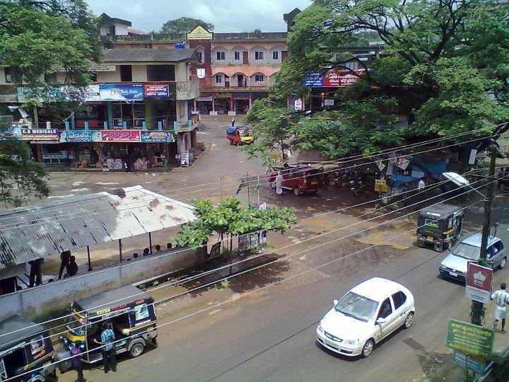 | ||
Omassery is a town in Kozhikode district, Kerala, India and it is a junction between Thiruvambady, Thamarassery, Mukkam, Koduvally, Kodencheri and Kattangal. Omassery is located 29 kilometers southeast of Kozhikode in the eastern part of Kerala; better known as Malabar (Northern Kerala). Omassery is a fast developing place and is well connected to the other parts of the state. Besides that, it is known as the gateway to the hill ranges of Western Ghats in Malabar.
Contents
- Map of Omassery Kerala 673582
- Geography
- Demographics
- Towns and suburbs of Omassery
- Landmarks
- Nonprofit Organisations
- Panchayath Wards and present members
- Transport
- How to reach by Road
- References
Map of Omassery, Kerala 673582
Geography
Omassery is located at 11°18′0″N 75°58′30″E. The total area of the Panchayath is 25.46 km².
Demographics
As of 2001 census the total population of the panchayath is 25,420 , which constitute 12511 Males and 12909 females. The population density is 998 per km² which is more than the state average. The sex ratio is 1000:1032. The people are highly literate. The literacy rate is 88.05 (Male: 93.62 and female 82.76).
Towns and suburbs of Omassery
Koduvally, Kunnamangalam, Thamarassery, Mukkam, Thiruvambady, Kodenchery, NIT (REC)
Koodathai, Venappara, Neeleswaram, Ambalakkandy, Vennakode, Malayamma,Velimanna, Kallurutty, Puthur, Nadammal Poyil & Manipuram
Landmarks
Nonprofit Organisations
Panchayath Wards and present members
Omassery Panchayath consists of 19 wards. In ward number order, with ward, member name and party indicated:
- Koodathai K.P. KUNHAMMED (INDEPENDENT)
- Kakkadakunnu SHYNI (CPIM)
- Chemmaruthai MANU E J (INC)
- Peruvilly Gracy (INC)
- Korothiri GIRIJA SUMOD KUMAR (CPIM)
- Omassery EAST BIJU AREEKKAL (INDEPENDENT)
- Omassery WEST P.V ABDU RAHIMAN MASTER (IUML)
- Ambalakkandy FATHIMA VADAKKINIKKANDY (IUML)
- Allumthara SUHARABI NECHOOLI (IUML)
- Vennakkode C.K. KHADEEJA MUHAMMED (IUML)
- NadammalPoyil M.C.RAFEENATHULUKHAN(IUML)
- Kaniyarkandam VASANTHA RAJENDRAN (INDEPENDENT)
- Kulathakkara K.T.SAKKEENA TEACHER(IUML)
- Velimanna KUNHIMOIDEEN (IUML)
- Puthur. AJITHAKUMARI(INC)
- Mangad WEST CHANDRAMATHI PUTHANPURAYIL(CPIM)
- Mangad EAST SREEBA AREEKKAL (CPIM)
- Chakkikave T.T.MANOJKUMAR (CPIM)
- Meppally K.K.RADHAKRISHNAN (CPIM)
Transport
Calicut International Airport (Karipur), the nearest airport is just 36 kilometres away from this area.
By Train
The nearest Railway station is at Kozhikode.
How to reach by Road
Omassery is on the State Highway (Koyilandy - Edavanna). The location is well connected by roads from various corners and is a main junction for surrounding various panchayaths and villages. Moreover, it gives more geographical importance to this place as this is an important gateway to the hill ranges of western Ghat of Malabar.Thiruvambady, Thamarassery, Koduvally, Mukkam and Kodencheri are near by places of Omassery. There is one bus stand and bus services available to places such as Kozhikode, Mukkam, Koduvally, Thamarassery, Thiruvambady, Kodenchery, Anakkam Poyil.
The Kilometer chart from Kozhikode to Omassery is given below.
The Kilometer chart through road from Omassery is given below.