
Existed: 1937 – present Length 32.64 km | Counties: Gallia Constructed 1937 | |
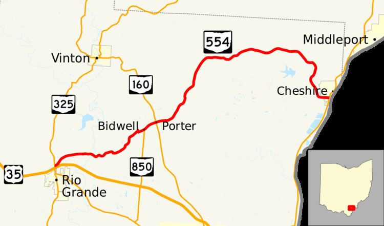 | ||
State Route 554 (SR 554) is an east–west state highway located in the southeastern corner of Ohio, a U.S. state. The western terminus of State Route 554 is at State Route 325 about 1 mile (1.6 km) north of Rio Grande, and just 1 block north of the State Route 325 interchange off of U.S. Route 35. Its eastern terminus is at a signalized intersection with State Route 7 in Cheshire a mere two blocks west of the Ohio River.
Contents
Map of OH-554, Ohio, USA
Route description
The entirety of State Route 554 is contained within Gallia County. No portion of this state highway is included as a part of the National Highway System.
History
State Route 554 was designated in 1937 along the routing through Gallia County that it currently occupies. No changes of major significance have taken place to this state highway since it was first certified.
Major intersections
The entire route is in Gallia County.