
Existed: 1929 – present Length 23.87 km | Constructed 1929 | |
 | ||
Counties | ||
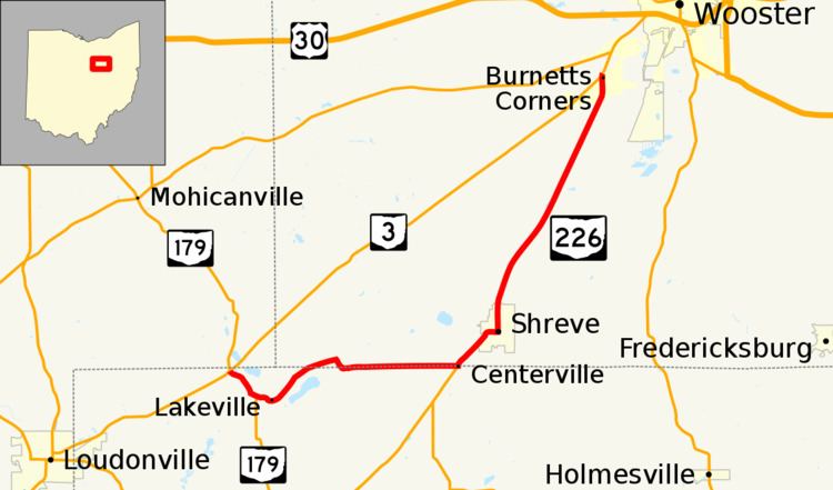
State Route 226 (SR 226) is an east–west state highway in the central part of the U.S. state of Ohio. The highway's western terminus is at the junction of State Route 3 and State Route 179 approximately 4.50 miles (7.24 km) northeast of Loudonville. Its eastern terminus is also at Ohio State Route 3, this time at an intersection nearly 1.75 miles (2.82 km) southwest of Wooster.
Contents
Map of OH-226, Ohio, USA
Route description
State Route 226 travels through the northwestern portion of Holmes County and the southwestern quadrant of Wayne County. There is no segment of State Route 226 that is incorporated within the National Highway System.
History
State Route 226 was established in 1929. It was routed along the alignment that it maintains to this day, replacing what was designated as State Route 250. This was due to the designation of U.S. Route 250 in the state of Ohio in that same year. No changes of major significance have taken place to State Route 226 since its inception.