
Existed: 1926 – present Constructed 1926 | Length 113.4 km | |
 | ||
Counties | ||
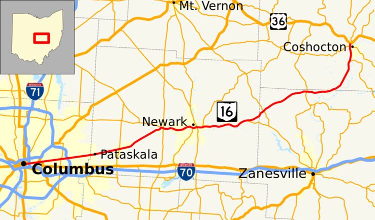
State Route 16 (SR 16) is an east–west highway running from Columbus, to Coshocton. Its western terminus is at Civic Center Drive (formerly U.S. Route 33) in Downtown Columbus, and its eastern terminus is at US 36. For much of its run through Licking County, and its entire run through Franklin County, State Route 16 follows the path of Columbus' Broad Street. West of Drexel Avenue in Bexley, the route is cosigned with U.S. Route 40 until its endpoint just east of the Scioto River.
Map of OH-16, Ohio, USA
References
Ohio State Route 16 Wikipedia(Text) CC BY-SA