
Founded March 1, 1804 Area 1,743 km² | Largest city Zanesville Population 85,231 (2013) Unemployment rate 5.8% (Apr 2015) | |
 | ||
Website www.muskingumcounty.org Colleges and Universities Points of interest The Wilds, National Road‑Zane Grey Mus, John & Annie Glenn Mu, Blue Rock State Park, Putnam Hill Park | ||
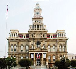
Muskingum County is a county located in the U.S. state of Ohio. As of the 2010 census, the population was 86,074. Its county seat is Zanesville. Nearly bisected by the Muskingum River, the county name is based on a Delaware American Indian word translated as "town by the river" or "elk's eye".
Contents
- Map of Muskingum County OH USA
- Geography
- Adjacent counties
- 2000 census
- 2010 census
- Culture
- City
- Census designated places
- Historical places
- References
Map of Muskingum County, OH, USA
Muskingum County comprises the Zanesville, OH Micropolitan Statistical Area, which is also included in the Columbus-Marion-Zanesville, OH Combined Statistical Area.
Geography
According to the U.S. Census Bureau, the county has a total area of 673 square miles (1,740 km2), of which 665 square miles (1,720 km2) is land and 8.0 square miles (21 km2) (1.2%) is water. It is the fourth-largest county in Ohio by land area.
Adjacent counties
2000 census
As of the census of 2000, there were 84,585 people, 32,518 households, and 22,860 families residing in the county. The population density was 127 people per square mile (49/km²). There were 35,163 housing units at an average density of 53 per square mile (20/km²). The racial makeup of the county was 93.91% White, 4.01% Black or African American, 0.21% Native American, 0.27% Asian, 0.02% Pacific Islander, 0.20% from other races, and 1.37% from two or more races. 0.52% of the population were Hispanic or Latino of any race.
There were 32,518 households out of which 33.30% had children under the age of 18 living with them, 54.30% were married couples living together, 12.00% had a female householder with no husband present, and 29.70% were non-families. 24.90% of all households were made up of individuals and 10.90% had someone living alone who was 65 years of age or older. The average household size was 2.53 and the average family size was 3.01.
In the county, the population was spread out with 25.90% under the age of 18, 9.40% from 18 to 24, 27.70% from 25 to 44, 22.60% from 45 to 64, and 14.30% who were 65 years of age or older. The median age was 36 years. For every 100 females there were 92.00 males. For every 100 females age 18 and over, there were 88.40 males.
The median income for a household in the county was $35,185, and the median income for a family was $41,938. Males had a median income of $31,537 versus $22,151 for females. The per capita income for the county was $17,533. About 9.90% of families and 12.90% of the population were below the poverty line, including 17.90% of those under age 18 and 10.00% of those age 65 or over.
2010 census
As of the 2010 United States Census, there were 86,074 people, 34,271 households, and 23,125 families residing in the county. The population density was 129.5 inhabitants per square mile (50.0/km2). There were 38,074 housing units at an average density of 57.3 per square mile (22.1/km2). The racial makeup of the county was 93.0% white, 3.8% black or African American, 0.3% Asian, 0.2% American Indian, 0.2% from other races, and 2.5% from two or more races. Those of Hispanic or Latino origin made up 0.8% of the population. In terms of ancestry, 25.2% were German, 15.5% were Irish, 11.1% were American, and 10.9% were English.
Of the 34,271 households, 32.3% had children under the age of 18 living with them, 49.1% were married couples living together, 13.2% had a female householder with no husband present, 32.5% were non-families, and 26.9% of all households were made up of individuals. The average household size was 2.46 and the average family size was 2.95. The median age was 39.5 years.
The median income for a household in the county was $39,538 and the median income for a family was $48,425. Males had a median income of $40,183 versus $28,668 for females. The per capita income for the county was $20,561. About 13.0% of families and 16.6% of the population were below the poverty line, including 24.6% of those under age 18 and 9.3% of those age 65 or over.
Culture
The Muskingum County Library System serves the communities of Muskingum County from its administrative offices in Zanesville, Ohio. This includes service to Dresden, Duncan Falls, New Concord, and Roseville. In 2005, the library loaned more than 918,000 items to its 73,000 cardholders. Total holding are over 328,000 volumes with over 190 periodical subscriptions.
The Wilds is a 9,154 acres (37.04 km2) wildlife preserve open to visitation for a fee.