Rahul Sharma (Editor)

Ohio State Route 125

Updated on
Edit
Like
Comment
Share on FacebookTweet on TwitterShare on LinkedInShare on Reddit
Existed:
  
1926 – present

Length
  
138.1 km

East end:
  
US 52 in Friendship

Constructed
  
1926

Ohio State Route 125

West end:
  
US 50 / SR 561 in Cincinnati

Counties
  
Hamilton County, Ohio, Clermont County, Ohio, Brown County, Ohio, Adams County, Ohio, Scioto County, Ohio

Time lapse ohio state route 125 west bound


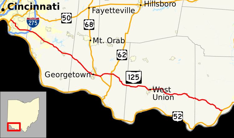
State Route 125 (SR 125) is an east–west state highway in the southwestern portion of the U.S. state of Ohio. Its western terminus is within the Cincinnati city limits, about 5 miles (8.0 km) east of downtown, at U.S. Route 50 – this is also the western terminus of State Route 32 and the southern terminus of State Route 561. The route’s eastern terminus is at U.S. Route 52 approximately 7 miles (11 km) west of Portsmouth near the village of Friendship.

Contents

Map of OH-125, Ohio, USA

Heading east from the Cincinnati neighborhoods of Mount Lookout, Linwood, and Mount Washington, State Route 125 passes through numerous subdivisions in Anderson Township as a four lane road, Beechmont Avenue. After Nordyke Road, State Route 125 becomes Ohio Pike, the old Ohio Turnpike, originally built in 1831 by E.G. Penn, not related to the modern highway of the same name. Passing under Interstate 275, State Route 125 begins to lose its suburban feel after the villages of Amelia and Hamlet as it heads into the countryside of eastern Clermont, Brown, Adams, and Scioto Counties.

Near its eastern terminus, the route passes through Shawnee State Forest, the largest in the state of Ohio, and by the Shawnee State Lodge and Park, Roosevelt Lake, and Turkey Creek Lake. This section of State Route 125 is part of the Scenic Scioto Heritage Trail.

See also National Scenic Byway, Ohio Byway, and Shawnee State Forest and Park map

History

  • 1926 – Route certified; originally routed from 7 miles (11 km) east of downtown Cincinnati to Friendship along the current U.S. Route 50 from 7 miles (11 km) to 9 miles (14 km) east of downtown Cincinnati, and along its own current alignment from 9 miles (14 km) east of downtown Cincinnati to Friendship; this entire route was State Route 25 before 1926; 7 miles (11 km) to 11 miles (18 km) east of downtown dually certified with the former State Route 74.
  • 1946 – Extended to downtown Cincinnati along U.S. Route 50, U.S. Route 52, and State Route 74.
  • 1956 – Truncated at 9 miles (14 km) east of downtown Cincinnati.
  • 1959 – From its western terminus to Amelia upgraded to 4 lanes.
  • 1962 – State Route 74 renumbered to State Route 32.
  • 1972 – Amelia to Bethel and 2 miles (3.2 km) west of Georgetown to Georgetown upgraded to divided highway.
  • 1997 – From Interstate 275 to Bethel downgraded from divided highway to 4-lane undivided highway.
  • Before 1926

  • Routed from LeSourdesville (south of Middletown to Lebanon along current State Route 63.
  • 1926 – Entire route certified as State Route 63.
  • References

    Ohio State Route 125 Wikipedia