
County Clermont FIPS code 39-01742 Elevation 267 m Zip code 45102 Population 4,897 (2013) | State Ohio Time zone Eastern (EST) (UTC-5) GNIS feature ID 1064319 Area 4.64 km² Local time Tuesday 3:00 AM Area code 513 | |
 | ||
Weather 7°C, Wind SE at 6 km/h, 76% Humidity | ||
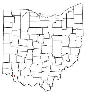
Amelia is a village in Clermont County, Ohio, United States. The population was 4,801 at the 2010 census.
Contents
Map of Amelia, OH 45102, USA
History
Amelia was not officially platted. The name Amelia was adopted in honor of Amelia Bowdoin, a well known and popular tollgate operator on the Ohio Turnpike - Main Street, today State Route 125. Her home still stands at 94 W. Main St., across the street from where it stood when it was a tollhouse. A post office called Amelia has been in operation since 1836.
In May 2009, Amelia survived an initiative on dissolving the village into Pierce and Batavia Townships.
Geography
Amelia is located at 39°1′45″N 84°13′16″W (39.029123, -84.221111).
According to the United States Census Bureau, the village has a total area of 1.79 square miles (4.64 km2), all land.
2010 census
As of the census of 2010, there were 4,801 people, 1,830 households, and 1,238 families residing in the village. The population density was 2,682.1 inhabitants per square mile (1,035.6/km2). There were 1,974 housing units at an average density of 1,102.8 per square mile (425.8/km2). The racial makeup of the village was 95.1% White, 1.6% African American, 0.3% Native American, 0.7% Asian, 0.6% from other races, and 1.6% from two or more races. Hispanic or Latino of any race were 1.9% of the population.
There were 1,830 households of which 41.5% had children under the age of 18 living with them, 49.2% were married couples living together, 13.3% had a female householder with no husband present, 5.1% had a male householder with no wife present, and 32.3% were non-families. 26.0% of all households were made up of individuals and 7.2% had someone living alone who was 65 years of age or older. The average household size was 2.62 and the average family size was 3.15.
The median age in the village was 30.5 years. 29.7% of residents were under the age of 18; 8.3% were between the ages of 18 and 24; 36.6% were from 25 to 44; 19.7% were from 45 to 64; and 5.9% were 65 years of age or older. The gender makeup of the village was 48.5% male and 51.5% female.
2000 census
As of the census of 2000, there were 2,752 people, 1,063 households, and 738 families residing in the village. The population density was 2,007.2 people per square mile (775.6/km²). There were 1,112 housing units at an average density of 811.1 per square mile (313.4/km²). The racial makeup of the village was 96.77% White, 0.58% African American, 0.07% Native American, 0.29% Asian, 0.73% from other races, and 1.56% from two or more races. Hispanic or Latino of any race were 1.27% of the population.
There were 1,063 households out of which 41.1% had children under the age of 18 living with them, 53.0% were married couples living together, 12.0% had a female householder with no husband present, and 30.5% were non-families. 24.8% of all households were made up of individuals and 10.3% had someone living alone who was 65 years of age or older. The average household size was 2.59 and the average family size was 3.10.
In the village, the population was spread out with 28.5% under the age of 18, 10.6% from 18 to 24, 39.3% from 25 to 44, 13.9% from 45 to 64, and 7.6% who were 65 years of age or older. The median age was 29 years. For every 100 females there were 89.0 males. For every 100 females age 18 and over, there were 86.9 males.
The median income for a household in the village was $44,900, and the median income for a family was $51,699. Males had a median income of $37,500 versus $26,295 for females. The per capita income for the village was $17,772. About 5.0% of families and 7.6% of the population were below the poverty line, including 5.7% of those under age 18 and 14.1% of those age 65 or over.