
Demonym(s) Nunspeter Postcode 8070–8077 Area 129.5 km² Local time Tuesday 5:17 AM | Elevation 8 m (26 ft) Time zone CET (UTC+1) Area code 0341, 0577 | |
 | ||
Weather 7°C, Wind SW at 14 km/h, 93% Humidity | ||
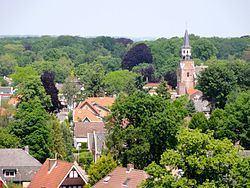
Nunspeet ( pronunciation ) is a municipality and town in the central Netherlands. It has been an agricultural site since prehistoric times. The municipality contains a number of villages, namely Hulshorst, Elspeet, and Vierhouten. Nunspeet has a vivid historical foundation, called Nuwenspete. In 1973 Nunspeet became a separate municipality after having been part of Ermelo before.
Contents
Map of Nunspeet, Netherlands
Recreation
Nunspeet is a popular tourist area because it is surrounded by woods, holiday resorts, and has a town center which is located around the main market square.
Nunspeet is situated on the shore of the Veluwemeer (Veluwe lake) which makes it popular for water leisure. There is also a small lake called "de Zandenplas" which is a popular recreational area in wooded sandy terrain.
Other tourist attractions include the weekly market and the town festival, De nacht van Nunspeet (Nunspeet Night) and the Eibertjesmarkt (Eibertjes market), as well as an annual sporting event called "de Keiler".