
Surface area 32.5 km (12.5 sq mi) Area 30 km² Outflow location IJsselmeer | Average depth 1.55 m (5 ft 1 in) Mean depth 1.55 m | |
 | ||
Primary inflows | ||
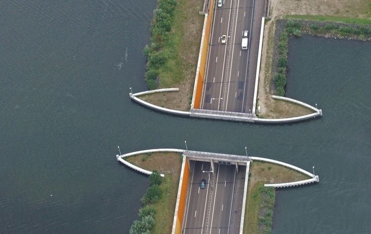
11 07 10 aquaduct veluwemeer ondergelopen na storm harderwijk
The Veluwemeer (Dutch) or Lake Veluwe is a bordering lake in the Netherlands, between the provinces of Flevoland on the west side and Gelderland on the east side. It is a narrow lake that stretches from south-west to north-east. South of Harderwijk the lake becomes het Wolderwijd and North of Elburg het Drontermeer.
Contents
- 11 07 10 aquaduct veluwemeer ondergelopen na storm harderwijk
- Map of Veluwemeer Netherlands
- 369 lk the river bridge aqueduct veluwemeer netherlands hd
- References
Map of Veluwemeer, Netherlands
The name of the lake comes from the Veluwe region in Gelderland of which the lake is on the western boundary. The lake is not natural and is one of several lakes known as the Randmeren formed in 1957 when the Flevopolder was created. It has a surface area of over 30 square kilometres and is fairly shallow with an average depth of 1.55 m. It is popular amongst tourists during the summer for recreation on the water or beach.
369 lk the river bridge aqueduct veluwemeer netherlands hd
References
Veluwemeer Wikipedia(Text) CC BY-SA