
 | ||
The Northside (Irish: Taobh Ó Thuaidh) is the part of Dublin city that lies to the north of the River Liffey.
Contents
Introduction
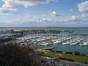
The Northside, though not an official or administrative area, is an important cultural reference and well-known colloquial geographical expression. The Northside contains some of the most scenic and well-regarded areas of the city in both cultural and social terms and major areas such as Howth, Sutton, Clontarf, Glasnevin, Drumcondra, Malahide, Coolock, Raheny, Finglas, Ballymun, Kilbarrack, Santry, Phibsborough and Castleknock are located on the Northside of the city. The definition of what constitutes the Northside can vary. Generally, it is considered to stretch as far north as Swords. Though Malahide, a close neighbour of Swords, is more often described as being in North County Dublin, despite being marginally closer to the city proper.
James Joyce set several of the Dubliners stories on the Northside, reflecting his childhood sojourns in Drumcondra and Fairview. Other best selling authors who have written extensively about the Northside include Dermot Bolger and Booker-Prize-winning author Roddy Doyle, who set several novels in the fictional Northside area of Barrytown.
The soap opera Fair City is set in Carrigstown, a fictional suburb of Northside Dublin. According to the RTÉ Guide, Carrigstown is bounded by Drumcondra to the north, the city centre to the south, East Wall to the east and Phibsboro to the west.
Areas of the Northside
The Northside includes Dublin city centre north of the Liffey, of whose many streets some are noted below, and districts such as Smithfield and Summerhill. Some older districts, such as Oxmantown, no longer exist. Beyond the centre, areas of the Northside include the below, most (at least two names were invented in the 1960s) of the names being of long heritage, though until recently many were rural townlands. Some are distinct suburbs or villages, others are parts of larger areas:
The 'area' is administered both by Dublin City Council (formerly Dublin Corporation) and Fingal County Council, responsible for 84% and 16% of the land area which lies inside the M50 motorway and north of the river Liffey respectively (excluding the Howth peninsula).
The Fingal/Dublin city boundary, when drawn up in 1985, was viewed as the edge of all Northside development from Dublin City at that time. Of course this boundary has moved significantly with the housing boom of the 1990s, with large tracts of formerly rural land being swallowed up by the city in areas such as Ashtown, Balgriffin, northern Coolock, Donaghmede and Baldoyle, and beyond Finglas.
Postcodes
In general, Dublin postal districts on the Northside are odd numbers, while Southside codes are even. One exception is the Phoenix Park, which is on the Northside but forms part of an even-numbered district (Dublin 8). The reason behind this is explained by eminent Dublin historian Pat Liddy: "Long before there were postal codes the James's St Postal Sorting Office looked after the Phoenix Park because it was considered to be closer and more convenient than Phibsborough (Dublin 7). James's St continued in this role when the postal codes were introduced so Dublin 8 it had to be."
Landmarks
Well known places and sights on the Northside include:
Major transport hubs include Connolly Station, Busáras (the national central bus station) and Dublin Airport.
Many state bodies such as the national meteorological office, Met Éireann, the Central Fisheries Board, the national enterprise and trade board, Enterprise Ireland, the National Standards Authority of Ireland, Sustainable Energy Ireland, the Department of Education and Skills, the Department of the Environment, Community and Local Government, the National Food Centre, the Irish Marine Institute in Corduff and the Department of Defence are based on the Northside.
The main shopping area in the north inner city, and busiest shopping street in Ireland, is Henry Street/Mary Street, just off O'Connell street. Four of the six city centre shopping centres are located on the Northside, these are the Jervis Centre, the Ilac Shopping Centre, Irish Life Shopping Mall and the Moore Street Mall, along with the largest out-of-town centre, at Blanchardstown, and others at Swords, Coolock, Charlestown and Donaghmede.
The Cineworld (UGC) cinema on Parnell Street is the largest cinema in Ireland with seventeen screens, the other notable north inner city cinema, the Savoy, is located on O'Connell Street and is one of Ireland's oldest cinemas.
Dublin City University, Dublin's newest university, is located between Glasnevin, Whitehall and Ballymun.
Famous Northsiders
Bram Stoker, author of Dracula, lived in the Fairview / Marino area on The Crescent, a curved terrace of houses reminiscent of the Royal Crescent in Bath. Legend has it that the terrace was built where it is deliberately to block the seaviews of the builder's rival, a rich landowner, from his estate (which included the Casino) at Marino. Perhaps the most famous contemporary Northsiders are the members of the rock group U2, which formed at Mount Temple Comprehensive School. Three of the four band members have moved to the Southside. Actor Colin Farrell is from Castleknock.
Two Taoisigh, Bertie Ahern and the late Charles Haughey, are from the Northside - Drumcondra and Donnycarney respectively.
Actress and singer Maria Doyle Kennedy is originally from the neighbourhood of Clontarf, as is Irish rugby international, Brian O'Driscoll.
Local historian and author of numerous books about Dublin, Pat Liddy, was born in Glasnevin.
All the members of Boyzone are Northsiders.
Media
[1]DublinCityNorth.com serves online news and entertainment about the local area and reports on local events.